
Wandelgids Pyrenean Haute Route - a high level trail, Pyreneeën HRP | Cicerone (9781852849818)
- ISBN / CODE: 9781852849818
- Editie: 2022
- Aantal blz.: 344
- Auteur(s): Tom Martens
- Uitgever: Cicerone
- Soort: Wandelgids
- Taal: Engels
- Uitvoering: -
- Bindwijze: -
- Beoordeling: 4,0 ★★★★★ (1 review) Schrijf een review
-
€ 24,95
Op voorraad. Voor 17.00 uur op werkdagen besteld, morgen in huis in Nederland Levertijd Belgie
Gratis verzending in Nederland vanaf €35,-
Beschrijving
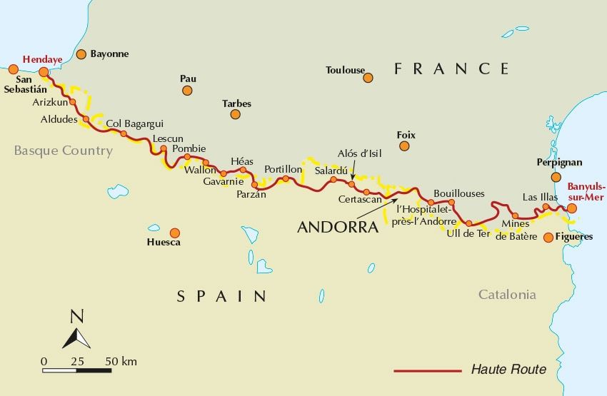
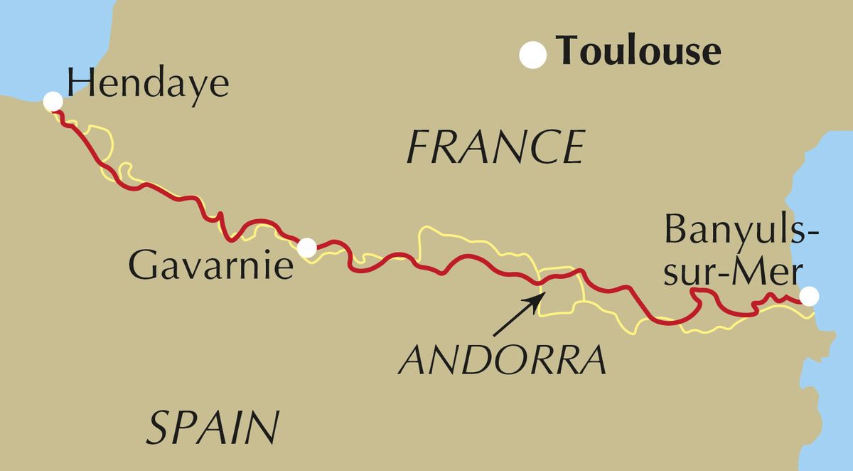
Beschrijving van de klassieke HRP, Haute Randonnee Pyreneen. Goede beschrijving van de route met hoogteprofielen en andere praktische informatie. Kaartmateriaal is voor deze zware route onvoldoende aanwezig in de gids.
Aanbevolen wandelkaarten voor de hele of een deel van de route:
Wandelkaarten van Rando Editions op Schaal 1:50.000
Reviews
Het boek geeft veel informatie over de route en heeft het opgedeeld in duidelijke dag etappes. Ook zijn er alternatieve routes omschreven als het weer bv tegen zit. Als je deze route wil lopen is dit boek zeker een aanrader!
★★★★★ door Liselot 27 april 2021 | Heeft dit artikel gekochtVond u dit een nuttige review? (login om te beoordelen)
Schrijf een review
Graag horen wij wat u van dit artikel vindt. Vindt u het goed, leuk, mooi, slecht, lelijk, onbruikbaar of erg handig: schrijf gerust alles op! Het is niet alleen leuk om te doen maar u informeert andere klanten er ook nog mee!
Ook interessant voor europa/frankrijk/pyreneeen
-

Wandelkaart 01 Pays Basque Ouest | R
€ 16,50Wandelkaarten Pyreneeën -

Wandelkaart - Topografische kaart 19
€ 16,95Topografische kaarten Pyreneeën -

Wandelkaart 13 Aneto - Posets | Rand
€ 16,50Wandelkaarten 🥾 GR-10 Trektocht -

Wandelkaart 12 Bachimala | Editorial
€ 16,95Wandelkaarten Spaanse Pyreneeën -

Wandelgids Pyrenean Haute Route - a
€ 24,95Wandelgidsen Pyreneeën