
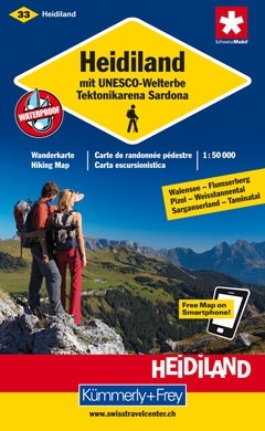
Wandelkaart 33 Heidiland mit UNESCO-Welterbe | Kümmerly & Frey (9783259008294)
- ISBN / CODE: 9783259008294
- Editie: meest recente versie
- Schaal: 1:50000
- Uitgever: Kümmerly & Frey
- Soort: Wandelkaart
- Serie: Wanderkarte 1:60.000
- Taal: Duits, Frans
- Bindwijze: -
- Uitvoering: -
- Schrijf als eerste een review
-
€ 22,50
Uitverkocht, nooit meer leverbaar
-
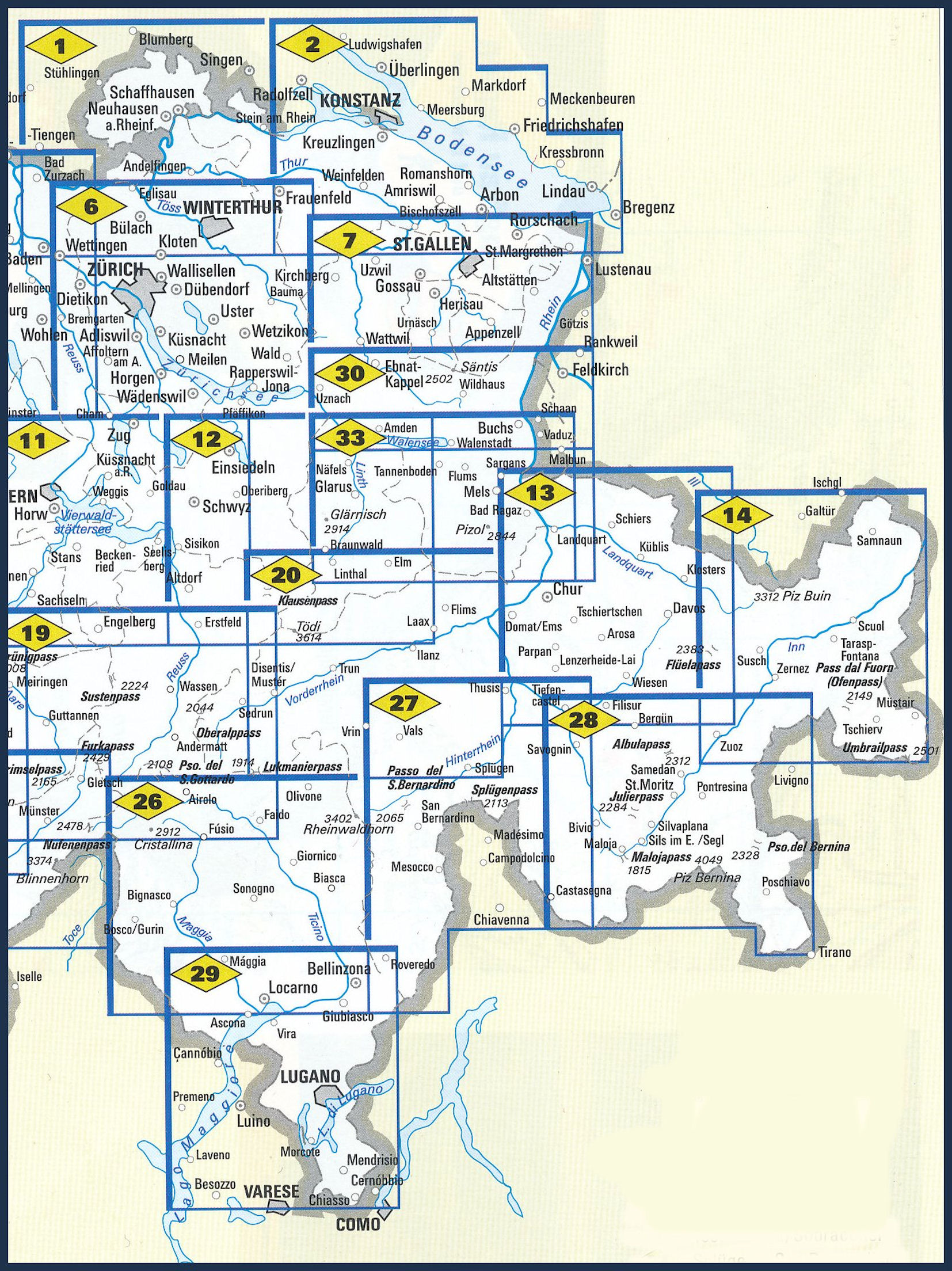
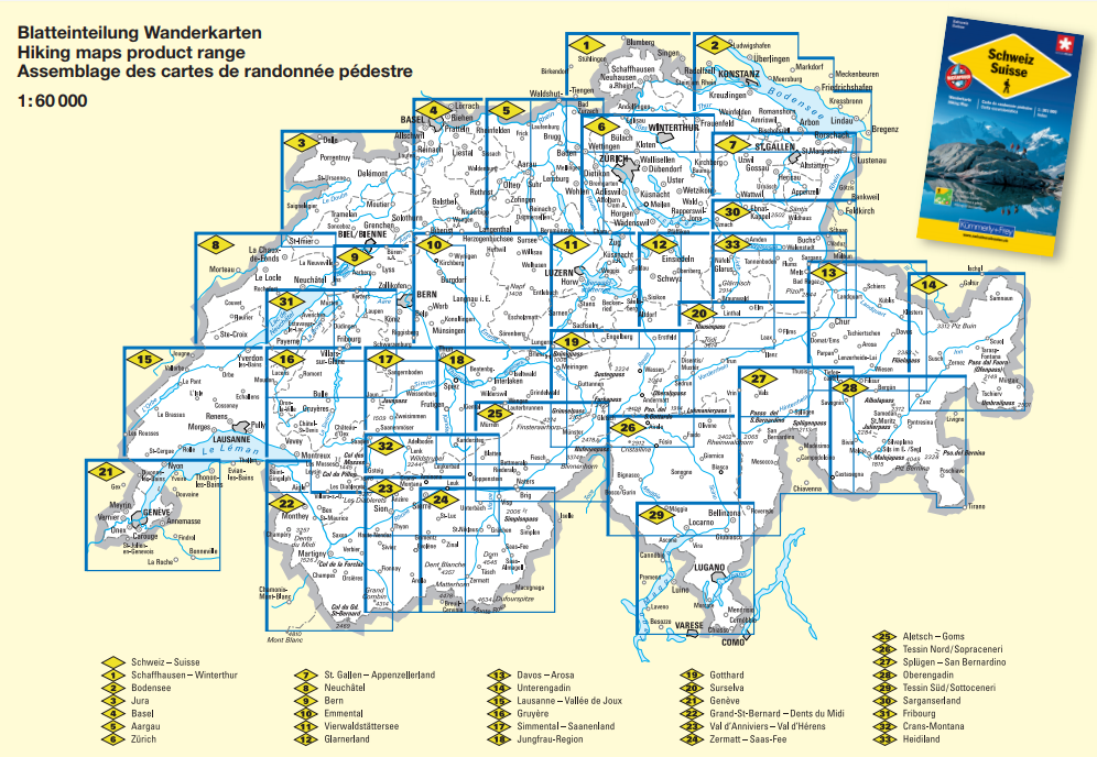
Wandelkaarten 60.000 Zwitserland (OOST) - Kümmerley Frey
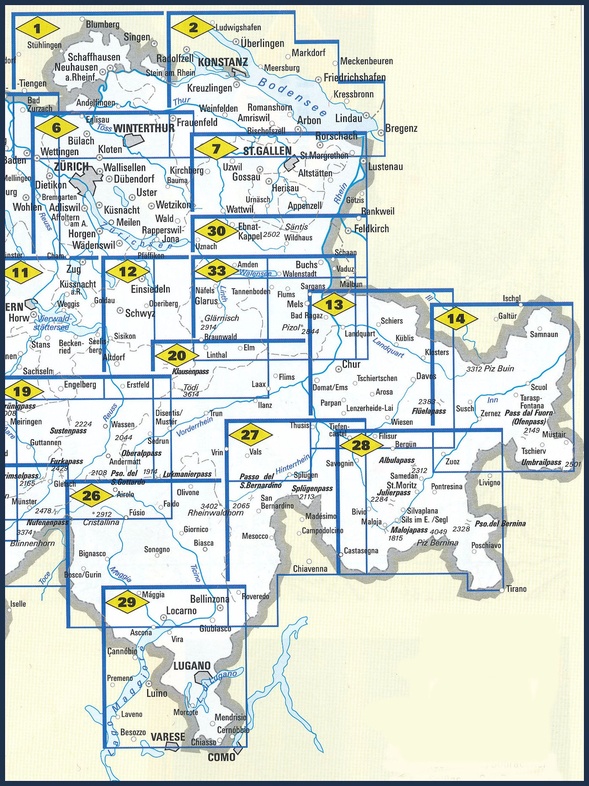
Producten op deze overzichtskaart:
Klik op een product om naar de pagina van dat product te gaan.
- Wandelkaart 01 Schaffhausen - Winterthur | Kümmerly & Frey
- Wandelkaart 02 Bodensee | Kümmerly & Frey
- Wandelkaart 06 Zürich - Zurich | Kümmerly & Frey
- Wandelkaart 07 St. Gallen - Appenzellerland | Kümmerly & Frey
- Wandelkaart 11 Vierwaldstättersee | Kümmerly & Frey
- Wandelkaart 12 Glarnerland - Muotatal - Klausenpass | Kümmerly & Frey
- Wandelkaart 13 Davos - Arosa | Kümmerly & Frey
- Wandelkaart 14 Unterengadin | Kümmerly & Frey
- Wandelkaart 19 Gotthard - Grimsel-Susten-Oberalp | Kümmerly & Frey
- Wandelkaart 20 Surselva | Kümmerly & Frey
- Wandelkaart 26 Tessin - Sopraceneri | Kümmerly & Frey
- Wandelkaart 27 Splügen - San Bernardino | Kümmerly & Frey
- Wandelkaart 28 Oberengadin | Kümmerly & Frey
- Wandelkaart 29 Tessin - Sottoceneri - Lugano - Lago Maggiore | Kümmerly & Frey
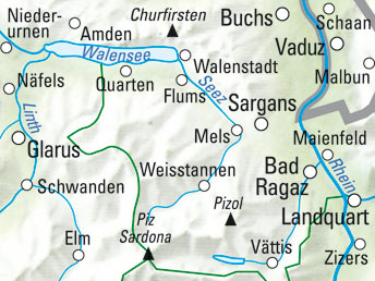
- Wandelkaart 30 Sarganserland - Liechtenstein | Kümmerly & Frey
Overzichtskaarten
Beschrijving
Zeer duidelijke wandelkaart van een deel van Zwitserland. Deze kaart - gemaakt op scheur en watervast papier - is bedoeld voor de gewone en gemiddelde bergwandelaar. Ook voor huttentochten is deze zeker geschikt. Slechts voor de gevorderde wandelaar die glesjers gaat overschrijden zijn de 25.000 topografische kaarten aan te raden.
Reviews
Geen reviews gevonden voor dit product.
Schrijf een review
Graag horen wij wat u van dit artikel vindt. Vindt u het goed, leuk, mooi, slecht, lelijk, onbruikbaar of erg handig: schrijf gerust alles op! Het is niet alleen leuk om te doen maar u informeert andere klanten er ook nog mee!
Ook interessant voor europa/zwitserland/graubunden
-

Wandelkaart - Topografische kaart 12
€ 15,95Topografische kaarten Graubunden - Oost Zwitserland -

Wandelgids Alpinwandern Südbünden |
€ 49,95Wandelgidsen Graubunden - Oost Zwitserland -

Wandelkaart - Topografische kaart 11
€ 15,95Topografische kaarten Graubunden - Oost Zwitserland -

Wandelkaart - Topografische kaart 12
€ 15,95Topografische kaarten Graubunden - Oost Zwitserland -

Wandelkaart 256T Disentis/Mustér | S
€ 26,95Wandelkaarten Graubunden - Oost Zwitserland