
Kaarten - British Columbia
 Wegenkaart - landkaart Vancouver's North Shore Hiking Trails - Fraser Valley | ITMB
Our popular map showing the recreational hiking trails in the mountains within the urban area of Metro Vancouver, but outside of its urbanized limits, continues into its most recent printing …
 Wegenatlas Travel Atlas British Columbia | ITMB
Wegenatlas in handig A5 formaat. De schaal is verschillend; het zuiden in 1:925.000 en het noorden van deze staat 1: 1.250.000. Prettig leesbaar. BC is the most visited province of …
★★★★★ Wegenkaart - landkaart 02 Canadian Rockies Banff & Jasper | Gem Trek Maps
Goede wegenkaart van Banff & Jasper met bezienswaardigheden, Overnachtingsmogelijkheden, Campings en hete bronnen. This is our most popular driving (touring) map and the map most recommended as an overview for …
★★★★★ Wegenkaart - landkaart 04 Southwest British Columbia & Northern Washington | Gem Trek Maps
Goede wegenkaart van British Columbia met Nationale Parken, Overnachtingsmogelijkheden, Ski gebieden en bezienswaardigheden. Gem Trek’s Southwest British Columbia & Northern Washington map meets the needs of visitors looking to explore …
★★★★★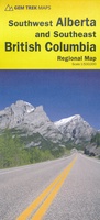 Wegenkaart - landkaart 03 Southwest Alberta & Southeast British Columbia | Gem Trek Maps
Goede wegenkaart van Southwest Alberta en Southeast British Columbia met bezienswaardigheden, overnachtingsmogelijkheden en campings. The sixth edition of this popular 1:500,000-scale map covers Edmonton and Calgary, south to the U.S. …
★★★★★★★★★★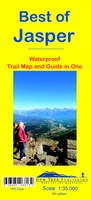 Wandelkaart 12 Best of Jasper | Gem Trek Maps
Water- en scheurvaste wandelkaart van Jasper. Met op de achterzijde een overzicht van de belangrijkste bezienswaardigheden. This map is designed for people who are only going to be in Jasper …
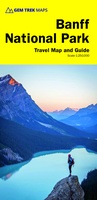 Wegenkaart - landkaart 01 Banff National Park | Gem Trek Maps
Handige uitvouwbare folder met goede kaart van schaal 1:250.000. Op de achterzijde staat heel veel info over geschiedenis, bezienswaardigheden, natuur en geologie. This user-friendly map-guide includes a 1:250,000-scale poster-quality map …
★★★★★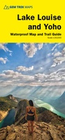 Wandelkaart 04 Lake Louise & Yoho | Gem Trek Maps
Gedetailleerde kaart van dit prachtige gebied; deze kaart is geplastificeerd, scheur- en watervast. Gem Trek’s LAKE LOUISE & YOHO MAP is designed for visitors looking to explore one of North …
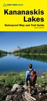 Wandelkaart 07 Kananaskis Lakes | Gem Trek Maps
This map covers what some say is the most scenic terrain in all of Kananaskis Country - the upper Smith-Dorrien-Spray Trail south of Mt. Shark, Peter Lougheed Provincial Park including …
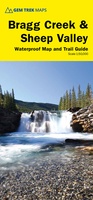 Wandelkaart 08 Bragg Creek and Sheep Valley | Gem Trek Maps
Gem Trek’s BRAGG CREEK & SHEEP VALLEY MAP is for hikers and outdoor enthusiasts looking to explore Kananaskis Country west and south of Bragg Creek. Whether you are touring along …
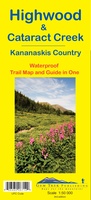 Wandelkaart 09 Highwood & Cataract Creek | Gem Trek Maps
Gedetailleerde kaart van dit prachtige gebied; deze kaart is geplastificeerd, scheur- en watervast. Gem Trek’s Highwood & Cataract Creek map meets the needs of visitors looking to explore the southern …
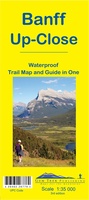 Wandelkaart 11 Banff Up-Close | Gem Trek Maps
Gem Trek Map-Guides Banff Up-Close (11) - This map-and-guide-in-one is designed for people who are only going to be in Banff for one to three days, and want to …
 Wandelkaart 06 Canmore & Kananaskis Village | Gem Trek Maps
This map covers some of the most popular terrain for hikers and mountain bikers in Kananaskis Country - Bow Valley Provincial Park, the Canmore area, the Smith-Dorrien/Spray Lakes area south …
 Wandelkaart 14 Lake O'Hara | Gem Trek Maps
Mooie, gedetailleerde kaart uit de serie van Gem Trek Hiking map-guides, van het gebied Lake O'Hara. This is a detailed map of the Lake O'Hara area. On the front …
 Wegenkaart - landkaart - Wegenatlas Pan-Americana North | ITMB
Wegenatlas - A5 formaat - verschillende schalen - voor de het Noord-Amerikaanse gedeelte van de Pan-Americana ( Pan-American Highway ) van Alaska langs the Pacific kust van British Colombia in …
★★★★★ Wegenkaart - landkaart Icefields Parkway | Gem Trek Maps
Whether you have a day or a week to spend exploring the sights along the spectacular Icefields Parkway highway, Gem Trek's ICEFIELDS PAKRWAY MAP, a combination map and guide, will …
 Wandelkaart 01 Jasper National Park & Maligne Lake | Gem Trek Maps
Scheur- en Watervast papier Gem Trek’s JASPER AND MALIGNE LAKE MAP map is designed for outdoor enthusiasts looking to explore the section of Jasper National Park near the town and …
★★★★★ Wandelkaart - Topografische kaart 254 Chilkoot Trail | National Geographic
Prachtige geplastificeerde kaart van het nationaal park. Met alle recreatieve voorzieningen als campsites, maar ook met topografische details en wandelroutes ed. Door uitgekiend kleurgebruik zeer prettig in gebruik. Scheur en …
 Wandelkaart 13 Best of Lake Louise Map and Guide | Gem Trek Maps
Mooie, gedetailleerde kaart uit de serie van Gem Trek Hiking map-guides, van het gebied Lake Louise. Helder kleurgebruik en met de beste / mooiste wandelroutes, hikes, fietsroutes, autoroutes en interessante …
★★★★★ Wandelkaart 02 Columbia Icefield | Gem Trek Maps
Waterproof and tear-resistant hiking and recreation map for the Columbia Icefield region of the Canadian Rockies. Updated with the latest satellite imagery of the icefield extent, Gem Trek's Columbia …
Laatste reviews

Boekje was niet meer voorradig, door de inzet van een medewerker toch nog via via een boekje kunnen krijgen. Ik vind dit een hele bijzondere …
★★★★★ door Thea de Weerd 17 april 2024 | Heeft dit artikel gekocht
Gebruik al jaren de ACSI gidsen. Zijn geweldig. En dan ook nog de korting in voor- en naseizoen. Prima.
★★★★★ door Loes Nagelhout-ram 17 april 2024 | Heeft dit artikel gekocht
Heel lief doosje, wij hebben hem gebruikt voor een kadopakketje te maken, met een hotelbon erbij.
★★★★★ door H vd berge 17 april 2024 | Heeft dit artikel gekocht
snel geleverd, ideaal
★★★★★ door Klaas 17 april 2024 | Heeft dit artikel gekocht