
Wandelkaart - Topografische kaart 208 Colorado National Monument | National Geographic (9781566954013)
McInnis Canyons National Conservation Area, Colorado
- ISBN / CODE: 9781566954013
- Schaal: 1:70000
- Uitgever: National Geographic
- Soort: Topografische kaart, Wandelkaart
- Taal: Engels
- Schrijf als eerste een review
-
€ 16,95
Leverbaar in 3 - 5 werkdagen in huis in Nederland Levertijd Belgie
Gratis verzending in Nederland vanaf €35,-
-
Overzicht Wandelkaarten Colorado Trails Illustrated National Geographic
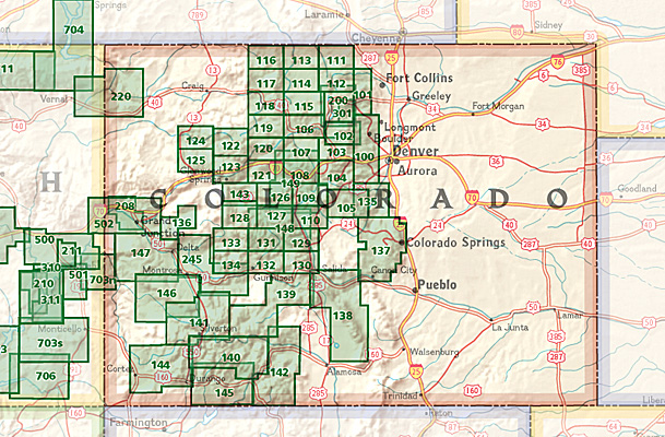
Producten op deze overzichtskaart:
Klik op een product om naar de pagina van dat product te gaan.
- Wandelkaart - Topografische kaart 110 Trails Illustrated Leadville Fairplay | National Geographic
- Wandelkaart - Topografische kaart 123 Trails Illustrated Flat Tops SE, Glenwood Canyon | National Geographic
- Wandelkaart - Topografische kaart 127 Trails Illustrated Aspen, Independence Pass | National Geographic
- Wandelkaart - Topografische kaart 139 Trails Illustrated La Garita, Cochetopa Hills | National Geographic
- Wandelkaart - Topografische kaart 141 Telluride, Silverton, Ouray, Lake City | National Geographic
- Wandelkaart - Topografische kaart 144 Durango, Cortez | National Geographic
- Wandelkaart - Topografische kaart 146 Uncompahgre Plateau South | National Geographic
- Wandelkaart - Topografische kaart 147 Uncompahgre Plateau North | National Geographic
- Wandelkaart 200 Rocky Mountain National Park | National Geographic
- Wandelkaart - Topografische kaart 208 Colorado National Monument | National Geographic
- Wandelkaart - Topografische kaart 245 Black Canyon of the Gunnison National Park | National Geographic
Overzichtskaarten
Beschrijving
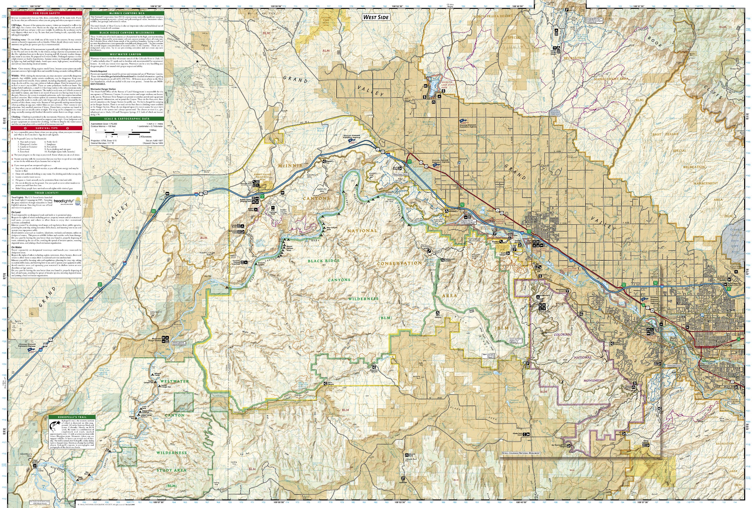
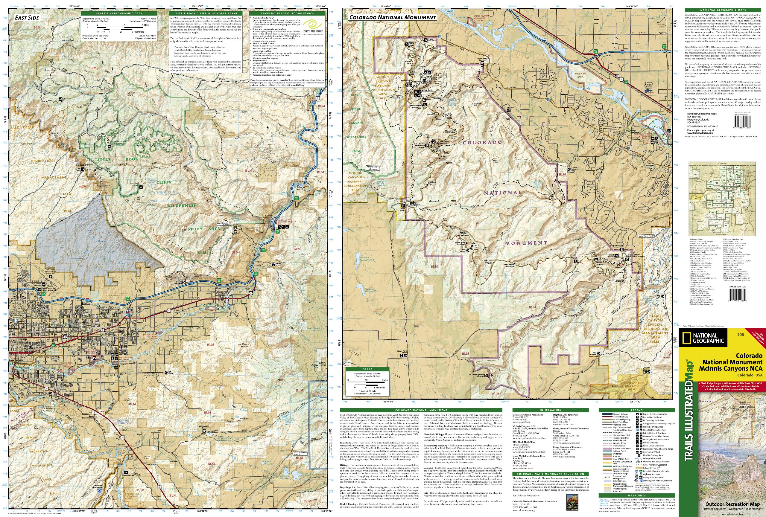
Prachtige geplastificeerde kaart van het bekende nationaal park. Met alle recreatieve voorzieningen als campsites, maar ook met topografische details en wandelroutes ed. Door uitgekiend kleurgebruik zeer prettig in gebruik. Scheur en watervast!
Reviews
Geen reviews gevonden voor dit product.
Schrijf een review
Graag horen wij wat u van dit artikel vindt. Vindt u het goed, leuk, mooi, slecht, lelijk, onbruikbaar of erg handig: schrijf gerust alles op! Het is niet alleen leuk om te doen maar u informeert andere klanten er ook nog mee!
Ook interessant voor noord-amerika/verenigde-staten-van-amerika/nationale-parken
-

Wandelkaart - Topografische kaart 70
€ 17,95Topografische kaarten Nationale Parken Verenigde Staten van Amerika -

Natuurgids Adventure Set Yellowstone
€ 18,50Natuurgidsen Nationale Parken Verenigde Staten van Amerika -

Reisgids Guide to National Parks of
€ 20,95Reisgidsen Nationale Parken Verenigde Staten van Amerika -

Reisinspiratieboek The Parklands | G
€ 55,95Reisinspiratieboeken Nationale Parken Verenigde Staten van Amerika -

Wegenkaart - landkaart Guide Map Col
€ 12,95Wegenkaarten Rocky Mountains