
Engeland
 Wegenkaart - landkaart Ancient Britain | Ordnance Survey
The Ordnance Survey Ancient Britain map is a comprehensive guide to the most important archaeological sites of early English, Welsh and Scottish history. Ordnance Survey's Ancient Britain map shows Neolithic, …
 Wegenkaart - landkaart Roman Britain | Ordnance Survey
An informative map showing the location of the most important ancient monuments of Roman Britain. The map has been produced by Ordnance Survey in collaboration with the Ancient Monument Trusts …
 Reisgids Wild Ruins B.C.: The Explorer's Guide to Britain’s Ancient Sites | Wild Things Publishing
Discover Britain's extraordinary prehistory in this handbook to its wildest and most beautiful ancient remains. The sequel to the best-selling Wild Ruins, 18,000 copies sold. Wild ruins B.C. reveals the …
★★★★★ Reisgids Islandeering: Adventures Around Britain's Hidden Islands | Wild Things Publishing
Walk, scramble, cycle, wade or even swim around the outer edge of our wildest islands. Islandeering provides all the information you need to circumnavigate 50 amazing hidden islands off the …
 Wegenkaart - landkaart Great Britain - Engeland - Schotland | ITMB
Een degelijke kaart met aanduidingen van o.a. nationale parken, vliegveld, benzinepomp, dirt-roads en kleine plattegrond van hoofdstad. Als overzichtskaart goed te gebruiken. This is the third set of …
 Campinggids The Caravan & Camping Guide Britain 2024 | AA Publishing
Uitgebreide gids met campings om met de tent of de caravan naar toe te gaan. 580 campings in Engeland, Schotland, Noord-Ierland, Wales, Kanaaleilanden, Isle of Man en de Schotse eilanden. …
★★★★★ Wandelgids the National Trails - Great British Walks - Engeland, Wales en Schotland | Cicerone
Guidebook to Britain's National Trails - 19 long-distance walking routes through England, Wales and Scotland, describing what makes each of them so special and providing the practical information to help …
 Campergids 89 Entdeckertouren mit dem Wohnmobil England | WOMO verlag
Bijzonder nuttige camperreisgids van een bepaald land of streek. Deze Duitstalige campergids beschrijft aan de hand van een aantal routes de mooiste gebieden. Naast een beschrijving van de routes zelf …
★★★★★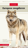 Natuurgids Veldgids Europese Zoogdieren | KNNV Uitgeverij
Een praktische natuurgids en een compleet naslagwerk. Niet eerder werden alle zoogdieren van Europa en hun sporen zo fraai en compleet in beeld gebracht. Inclusief soorten die nieuw zijn voor …
★★★★★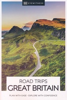 Reisgids Road Trips Great Britain | Dorling Kindersley
25 routes – uiteenlopend van een tot vijf dagen – brengen u diep het ongerepte Engelse platteland in, met onderweg charmante eethuizen en accommodatie. Bij elke route hoort een wandeling …
★★★★★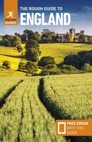 Reisgids England - Engeland | Rough Guides
Zeer goede reisgids voor zowel de georganiseerde maar vooral voor de zelfstandige reiziger. Boordevol informatie over reizen, slapen, eten, maar ook musea en cultuur. Voor Europese landen meestal completer en …
★★★★★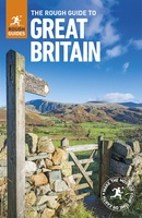 Reisgids Great Britain - Groot Britannië | Rough Guides
Zeer goede reisgids voor zowel de georganiseerde maar vooral voor de zelfstandige reiziger. Boordevol informatie over reizen, slapen, eten, maar ook musea en cultuur. Voor veel landen meestal completer en …
 Woordenboek Wat & Hoe taalgids Engels | Kosmos Uitgevers
Taalgids met woordenlijst en thematische invalshoeken voor standaard-zinnetjes. Handzaam zakformaat. Wat & Hoe Taalgids Engels is de beste tolk voor op reis. Met ruim 4.000 woorden en zinnen kom …
 Campinggids Tiny Campsites in Engeland, Schotland en Wales | AA Publishing
Eindelijk een gids voor de echte kampeerder in Engeland, Schotland en Wales: prettig kleine kampeerplekken in de middle of nowhere. We’ve all been there. You venture out into the countryside …
 Fietsgids Lands End to John O'Groats (2nd Edition) The Official Cycllist's Challenge Guide | Challenge Publications
There are numerous outdoor challenges in life around the UK. Canoeing the Caledonian Canal from one side of the country to the other, walking around Britain on the coastal footpath …
 Wandkaart Groot Brittannië en Ierland antiek, 60 x 76 cm | National Geographic
This map of Britain and Ireland shows country boundaries, thousands of place names, major roadways, airports, bodies of water, and more. Rich earth-toned colors, astounding detail and boardroom quality make …
★★★★★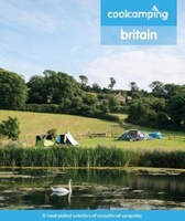 Campinggids Cool Camping Britain | Punk Publishing
Cool Camping Britain is een fantastisch idee: zowel een koffietafel boek als een campinggids. Het bewijs dat de tijd van saaie campingidsen voorbij is! Prachtig vormgegeven, maar tevens inhoudelijk belangrijk …
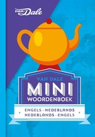 Woordenboek Miniwoordenboek Engels | van Dale
Met Van Dale kom je verder! In dit Van Dale Miniwoordenboek Engels vind je alle woorden die je nodig hebt op zakenreis of op vakantie. In twee taalrichtingen, dus je …
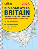 Wegenatlas Big Road Atlas Britain and Northern Ireland 2025 | A3 | Ringband | Collins
Grote wegenatlas, a3-formaat in ringband. The ultimate 3.2 miles to 1 inch scale large-format, spiral-bound road atlas of Britain, featuring Collins’ popular and well established road mapping, and designed for …
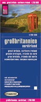 Wegenkaart - landkaart Groot Brittannie en Noord Ierland | Reise Know-How Verlag
Tweetalige kaart (Engels en Duits). Door ingetekende lengte- en breedtegraden is het gebruik van GPS mogelijk. Met hoogtelijnen en uitgebreid wegennetwerk: daarnaast worden ook de afstanden tussen belangrijke plaatsen duidelijk …
Laatste reviews

De informatie per regio ‘the guide’ is prima. De praktische informatie ‘toolkit’ is erg oppervlakkig en bevat daardoor weinig bruikbare informatie. Jammer.
★★★★★ door Astrid 01 juni 2024 | Heeft dit artikel gekocht
Tevreden
★★★★★ door Marjanne Buijs 31 mei 2024 | Heeft dit artikel gekocht
Had eerst een andere kaart besteld, maar bij deze waren beide zijde bedrukt. Vind dit niet handig en overzichtelijk. Geld snel terug gekregen.
★★★★★ door M. Steltenpool 31 mei 2024 | Heeft dit artikel gekocht
Kort maar krachtig per eiland de basale info
★★★★★ door Francien Hoving-Appeldoorn 31 mei 2024 | Heeft dit artikel gekocht