
Wandelkaarten - Canada
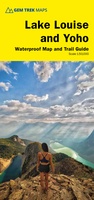 Wandelkaart 04 Lake Louise & Yoho | Gem Trek Maps
Gedetailleerde kaart van dit prachtige gebied; deze kaart is geplastificeerd, scheur- en watervast. Gem Trek’s LAKE LOUISE & YOHO MAP is designed for visitors looking to explore one of North …
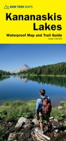 Wandelkaart 07 Kananaskis Lakes | Gem Trek Maps
This map covers what some say is the most scenic terrain in all of Kananaskis Country - the upper Smith-Dorrien-Spray Trail south of Mt. Shark, Peter Lougheed Provincial Park including …
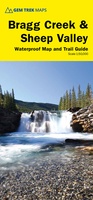 Wandelkaart 08 Bragg Creek and Sheep Valley | Gem Trek Maps
Gem Trek’s BRAGG CREEK & SHEEP VALLEY MAP is for hikers and outdoor enthusiasts looking to explore Kananaskis Country west and south of Bragg Creek. Whether you are touring along …
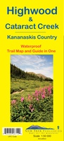 Wandelkaart 09 Highwood & Cataract Creek | Gem Trek Maps
Gedetailleerde kaart van dit prachtige gebied; deze kaart is geplastificeerd, scheur- en watervast. Gem Trek’s Highwood & Cataract Creek map meets the needs of visitors looking to explore the southern …
 Wandelkaart 11 Banff Up-Close | Gem Trek Maps
Gem Trek Map-Guides Banff Up-Close (11) - This map-and-guide-in-one is designed for people who are only going to be in Banff for one to three days, and want to …
 Wandelkaart 06 Canmore & Kananaskis Village | Gem Trek Maps
This map covers some of the most popular terrain for hikers and mountain bikers in Kananaskis Country - Bow Valley Provincial Park, the Canmore area, the Smith-Dorrien/Spray Lakes area south …
 Wandelkaart 14 Lake O'Hara | Gem Trek Maps
Mooie, gedetailleerde kaart uit de serie van Gem Trek Hiking map-guides, van het gebied Lake O'Hara. This is a detailed map of the Lake O'Hara area. On the front …
 Wandelkaart 02 Columbia Icefield | Gem Trek Maps
Waterproof and tear-resistant hiking and recreation map for the Columbia Icefield region of the Canadian Rockies. Updated with the latest satellite imagery of the icefield extent, Gem Trek's Columbia …
 Wandelkaart 03 Bow Lake and Saskatchewan Crossing | Gem Trek Maps
This map covers the trails departing from the southern section of the Icefields Parkway from Rampart Creek south to Hector Lake. A 1:100 000-scale inset map on the back of …
 Wegenkaart - landkaart - Topografische kaart - Wandelkaart Algonquin Park (Canada) | ITMB
Algonquin National Park kaart, zeer gedetailleerd (schaal 1:50,000) plus op de anderekant van de kaart staat een overzicht van de park, schaal 1:250,000. Natuurkundige overzichtskaart met veel plaatsen en wegen, spoorlijnen en …
 Wandelkaart 900 Banff South National Park | National Geographic
Prachtige geplastificeerde kaart van het bekende nationaal park. Met alle recreatieve voorzieningen als campsites, maar ook met topografische details en wandelroutes ed. Door uitgekiend kleurgebruik zeer prettig in gebruik. Scheur …
 Wandelkaart 01 Jasper National Park & Maligne Lake | Gem Trek Maps
Scheur- en Watervast papier Gem Trek’s JASPER AND MALIGNE LAKE MAP map is designed for outdoor enthusiasts looking to explore the section of Jasper National Park near the town and …
★★★★★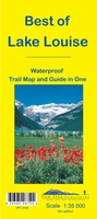 Wandelkaart 13 Best of Lake Louise Map and Guide | Gem Trek Maps
Mooie, gedetailleerde kaart uit de serie van Gem Trek Hiking map-guides, van het gebied Lake Louise. Helder kleurgebruik en met de beste / mooiste wandelroutes, hikes, fietsroutes, autoroutes en interessante …
★★★★★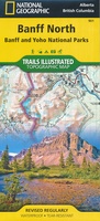 Wandelkaart 901 Banff North National Park | National Geographic
Prachtige geplastificeerde kaart van het bekende nationaal park. Met alle recreatieve voorzieningen als campsites, maar ook met topografische details en wandelroutes ed. Door uitgekiend kleurgebruik zeer prettig in gebruik. Scheur …
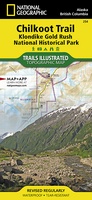 Wandelkaart - Topografische kaart 254 Chilkoot Trail | National Geographic
Prachtige geplastificeerde kaart van het nationaal park. Met alle recreatieve voorzieningen als campsites, maar ook met topografische details en wandelroutes ed. Door uitgekiend kleurgebruik zeer prettig in gebruik. Scheur en …
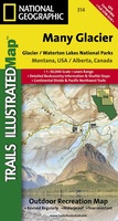 Wandelkaart - Topografische kaart 314 Many Glacier - Glacier and Waterton Lakes National Parks | National Geographic
Prachtige geplastificeerde kaart van het bekende nationaal park. Met alle recreatieve voorzieningen als campsites, maar ook met topografische details en wandelroutes ed. Door uitgekiend kleurgebruik zeer prettig in gebruik. Scheur …
 Wandelkaart West Coast Trail & Carmanah Valley | ITMB
Gedetailleerde kaart van deze prachtige meerdaagse wandeltocht. Met alle noodzakelijke informatie als campsites, afstanden en gevaarlijke river- of strandpassages. Onmisbaar voor diegenen die deze tocht gaan doen! This is actually …
 Wandelkaart - Topografische kaart 215 Glacier - Waterton Lakes National Park | National Geographic
Prachtige geplastificeerde kaart van het bekende nationaal park. Met alle recreatieve voorzieningen als campsites, maar ook met topografische details en wandelroutes ed. Door uitgekiend kleurgebruik zeer prettig in gebruik. Scheur …
 Wandelkaart 05 Banff National Park and Mt. Assiniboine | Gem Trek Maps
This map covers the most popular hiking and mountain biking terrain in Banff National Park, from Lake Louise in the north to the south end of Banff National Park, plus …
★★★★★ Wandelkaart 10 Kootenay National Park | Gem Trek Maps
This map covers all of Kootenay National Park, from Castle Mountain Junction south through Radium, to Windermere. All the official hiking and mountain biking trails in Kootenay National Park …
Laatste reviews

Snelle levering. Goede kwaliteit.
★★★★★ door Diana Faaij 20 mei 2024 | Heeft dit artikel gekocht
Prachtig boek! Zeer goede tips.
★★★★★ door Robert Arthur Watson 20 mei 2024 | Heeft dit artikel gekocht
Helaas is mijn eerste bestelling niet aangekomen. Zonder problemen is het boek nogmaals opgestuurd. Topservice!
★★★★★ door Frank Rievers 20 mei 2024 | Heeft dit artikel gekocht
Beschrijving eertse 4 stages in elk geval heel accuraat. Ter verduidelijking zou het handig zijn als er stond dat hoewel je in / langs dorpen …
★★★★★ door EH 20 mei 2024 | Heeft dit artikel gekocht