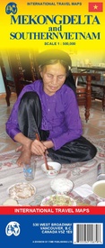
Wegenkaart - landkaart Mekong Delta & Southern Vietnam | ITMB (9781553415879)
- ISBN / CODE: 9781553415879
- Editie: 27-02-2007
- Druk: 1
- Aantal blz.: 1
- Schaal: 1:500000
- Uitgever: ITMB
- Soort: Wegenkaart
- Taal: Engels
- Hoogte: 25.0 cm
- Breedte: 10.0 cm
- Gewicht: 51.0 g
- Uitvoering: Papier
- Schrijf als eerste een review
-
€ 13,95
Op voorraad. Voor 17.00 uur op werkdagen besteld, morgen in huis in Nederland Levertijd Belgie
Gratis verzending in Nederland vanaf €35,-
Beschrijving
Een degelijke kaart met aanduidingen van o.a. nationale parken, vliegveld, benzinepomp en dirt-roads. Als overzichtskaart goed te gebruiken.
Double-sided indexed map with street plans of central Ho Chi Min City, Da Lat and Can Tho. The main map at 1:800,000 shows the area’s road and rail networks and local airports. The Ho Chi Minh Trail is highlighted, as are national parks, nature reserves, beaches, numerous places of interest, fuel supplies, etc. Provincial boundaries are marked and names of administrative regions prominently shown. Topography is indicated by altitude colouring. Latitude and longitude lines are drawn at 30’ intervals.
On the reverse, the Mekong Delta is shown in greater detail at 1:500,000 with many small waterways. The map also includes street plans of central Ho Chi Minh City, Can Tho and Da Lat, annotated with symbols showing accommodation, various facilities and places of interest. Further insets show Phu Quoc Island at 1:200,000 and, for travelers venturing further north, the environs of Hue at 1:250,000.
All place names are shown in the Roman alphabet but with scrupulous transliteration, since the map was prepared by a company with strong Vietnamese connections and a number of local cartographers.
Reviews
Geen reviews gevonden voor dit product.
Schrijf een review
Graag horen wij wat u van dit artikel vindt. Vindt u het goed, leuk, mooi, slecht, lelijk, onbruikbaar of erg handig: schrijf gerust alles op! Het is niet alleen leuk om te doen maar u informeert andere klanten er ook nog mee!


