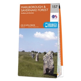
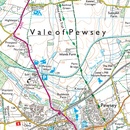
Wandelkaart - Topografische kaart 157 OS Explorer Map Marlborough, Savernake Forest | Ordnance Survey (9780319243503)
Avebury & Devizes
- ISBN / CODE: 9780319243503
- Editie: 2015
- Schaal: 1:25000
- Uitgever: Ordnance Survey
- Soort: Topografische kaart, Wandelkaart
- Serie: OS Explorer Map
- Taal: Engels
- Hoogte: 23.0 cm
- Breedte: 13.0 cm
- Dikte: 1.0 cm
- Gewicht: 150.0 g
- Uitvoering: Papier
- Bindwijze: -
- Schrijf als eerste een review
-
€ 19,50
Leverbaar in 3 - 5 werkdagen in huis in Nederland Levertijd Belgie
Gratis verzending in Nederland vanaf €35,-
-
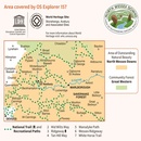
Overzichtskaart Explorer 25.000 topografische kaarten zuid Engeland

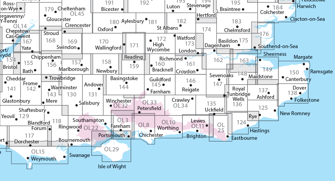
Producten op deze overzichtskaart:
Klik op een product om naar de pagina van dat product te gaan.
- Wandelkaart - Topografische kaart 117 OS Explorer Map Cerne Abbas & Bere Regis | Ordnance Survey
- Wandelkaart - Topografische kaart 118 OS Explorer Map Shaftesbury & Cranborne Chase | Ordnance Survey
- Wandelkaart - Topografische kaart 129 OS Explorer Map Yeovil & Sherborne | Ordnance Survey
- Wandelkaart - Topografische kaart 130 OS Explorer Map Salisbury & Stonehenge | Ordnance Survey
- Wandelkaart - Topografische kaart 131 OS Explorer Map Romsey, Andover & Test Valley | Ordnance Survey
- Wandelkaart - Topografische kaart 135 OS Explorer Map Ashdown Forest (greenw) | Ordnance Survey
- Wandelkaart - Topografische kaart 141 OS Explorer Map Cheddar Gorge, Mendip Hills West | Ordnance Survey
- Wandelkaart - Topografische kaart 142 OS Explorer Map Shepton Mallet , Mendip Hills East | Ordnance Survey
- Wandelkaart - Topografische kaart 143 OS Explorer Map Warminster, Trowbridge | Ordnance Survey
- Wandelkaart - Topografische kaart 144 OS Explorer Map Basingstoke, Alto, Whitchurch | Ordnance Survey
- Wandelkaart - Topografische kaart 145 OS Explorer Map Guildford, Farnham | Ordnance Survey
- Wandelkaart - Topografische kaart 146 OS Explorer Map Dorking, Box Hill, Reigate | Ordnance Survey
- Wandelkaart - Topografische kaart 147 OS Explorer Map Sevenoaks and Tonbridge | Ordnance Survey
- Wandelkaart - Topografische kaart 154 OS Explorer Map Bristol West, Portishead | Ordnance Survey
- Wandelkaart - Topografische kaart 155 OS Explorer Map Bristol, Bath | Ordnance Survey
- Wandelkaart - Topografische kaart 156 OS Explorer Map Chippenham, Bradford-on-Avon | Ordnance Survey
- Wandelkaart - Topografische kaart 157 OS Explorer Map Marlborough, Savernake Forest | Ordnance Survey
- Wandelkaart - Topografische kaart 158 OS Explorer Map Newbury, Hungerford | Ordnance Survey
- Wandelkaart - Topografische kaart 159 OS Explorer Map Reading, Wokingham & Pangbourne Map | Thames Path | Ordnance Survey
- Wandelkaart - Topografische kaart 160 OS Explorer Map Windsor, Weybridge, Bracknell | Thames Path | Ordnance Survey
- Wandelkaart - Topografische kaart 161 OS Explorer Map London South (greenw.m) | Ordnance Survey
- Wandelkaart - Topografische kaart 162 OS Explorer Map Greenwich, Gravesend | Ordnance Survey
- Wandelkaart - Topografische kaart 167 OS Explorer Map Thornbury, Dursley, Yate | Ordnance Survey
- Wandelkaart - Topografische kaart 168 OS Explorer Map Stroud, Tetbury, Malmesbury | Ordnance Survey
- Wandelkaart - Topografische kaart 169 OS Explorer Map Cirencester, Swindon | Ordnance Survey
- Wandelkaart - Topografische kaart 170 OS Explorer Map Abingdon, Wantage & Vale of White Horse | Ordnance Survey
- Wandelkaart - Topografische kaart 171 OS Explorer Map Chiltern Hills West | Ordnance Survey
- Wandelkaart - Topografische kaart 172 OS Explorer Map Chiltern Hills East | Ordnance Survey
- Wandelkaart - Topografische kaart 173 OS Explorer Map London North | Ordnance Survey
- Wandelkaart - Topografische kaart 174 OS Explorer Map Epping Forest, Lee Valley | Ordnance Survey
- Wandelkaart - Topografische kaart 179 OS Explorer Map Gloucester, Cheltenham, Stroud | Ordnance Survey
- Wandelkaart - Topografische kaart 180 OS Explorer Map Oxford | Ordnance Survey
- Wandelkaart - Topografische kaart 182 OS Explorer Map St-Albans, Hatfield | Ordnance Survey
- Wandelkaart - Topografische kaart OL03 OS Explorer Map Meon Valley - Portsmouth, Gosport & Fareham | Ordnance Survey
- Wandelkaart - Topografische kaart OL08 OS Explorer Map Chichester, South Harting & Selsey | Ordnance Survey
- Wandelkaart - Topografische kaart OL10 OS Explorer Map Arundel - Pulborough - Worthing | Ordnance Survey
- Wandelkaart - Topografische kaart OL11 OS Explorer Map Brighton & Hove, Lewes & Burgess Hill | Ordnance Survey
- Wandelkaart - Topografische kaart OL14 OS Explorer Map Wye Valley - Forest of Dean - Dyfryn Gwy | Ordnance Survey
- Wandelkaart - Topografische kaart OL15 OS Explorer Map Purbeck and South Dorset | Ordnance Survey
- Wandelkaart - Topografische kaart OL25 OS Explorer Map Eastbourne & Beachy Head | Ordnance Survey
- Wandelkaart - Topografische kaart OL29 OS Explorer Map Isle of Wight | Ordnance Survey
- Wandelkaart - Topografische kaart OL32 OS Explorer Map Winchester | Ordnance Survey
- Wandelkaart - Topografische kaart OL33 OS Explorer Map Haslemere & Petersfield | Ordnance Survey
- Wandelkaart - Topografische kaart OL34 OS Explorer Map Crawley & Horsham | Ordnance Survey
-
Overzichtskaart Explorer 25.000 topografische kaarten zuidwest Engeland - Devon - Cornwall

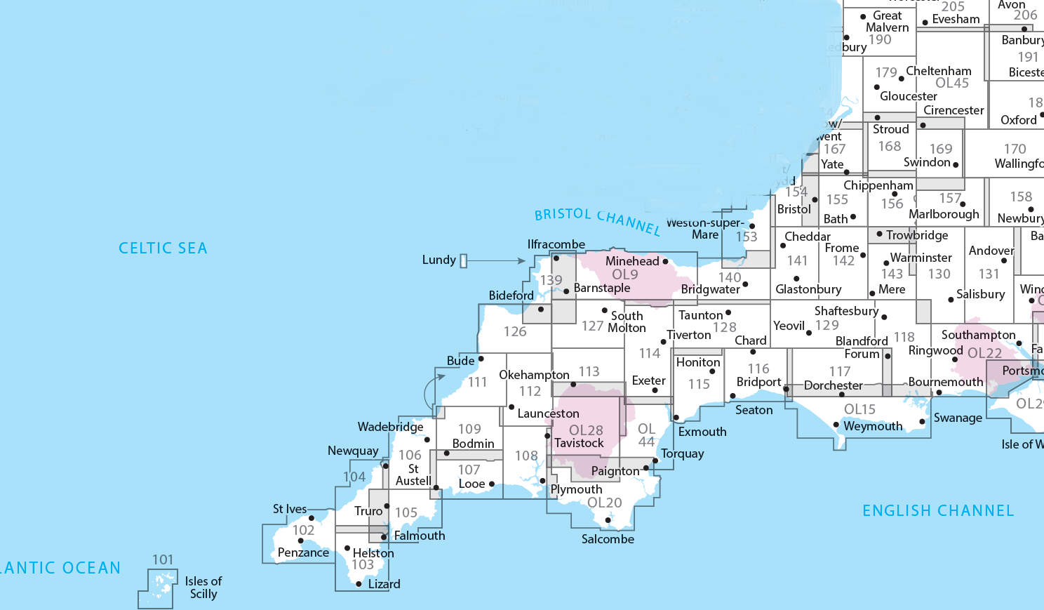
Producten op deze overzichtskaart:
Klik op een product om naar de pagina van dat product te gaan.
- Wandelkaart - Topografische kaart 101 OS Explorer Map Isles of Scilly | Ordnance Survey
- Wandelkaart - Topografische kaart 102 OS Explorer Map Land's End | Ordnance Survey
- Wandelkaart - Topografische kaart 103 OS Explorer Map The Lizard | Ordnance Survey
- Wandelkaart - Topografische kaart 104 OS Explorer Map Redruth & St Agnes | Ordnance Survey
- Wandelkaart - Topografische kaart 105 OS Explorer Map Falmouth & Mevagissey | Ordnance Survey
- Wandelkaart - Topografische kaart 106 OS Explorer Map Newquay & Padstow | Ordnance Survey
- Wandelkaart - Topografische kaart 107 OS Explorer Map St Austell & Liskeard | Ordnance Survey
- Wandelkaart - Topografische kaart 108 OS Explorer Map Lower Tamar Valley & Plymouth | Ordnance Survey
- Wandelkaart - Topografische kaart 109 OS Explorer Map Bodmin Moor | Ordnance Survey
- Wandelkaart - Topografische kaart 111 OS Explorer Map Bude, Boscastle & Tintagel | Ordnance Survey
- Wandelkaart - Topografische kaart 112 OS Explorer Map Launceston & Holsworthy | Ordnance Survey
- Wandelkaart - Topografische kaart 113 OS Explorer Map Okehampton | Ordnance Survey
- Wandelkaart - Topografische kaart 114 OS Explorer Map Exeter - Exe Valley | Ordnance Survey
- Wandelkaart - Topografische kaart 115 OS Explorer Map Exmouth & Sidmouth | Ordnance Survey
- Wandelkaart - Topografische kaart 116 OS Explorer Map Lyme Regis & Bridport | Ordnance Survey
- Wandelkaart - Topografische kaart 117 OS Explorer Map Cerne Abbas & Bere Regis | Ordnance Survey
- Wandelkaart - Topografische kaart 118 OS Explorer Map Shaftesbury & Cranborne Chase | Ordnance Survey
- Wandelkaart - Topografische kaart 126 OS Explorer Map Clovelly & Hartland | Ordnance Survey
- Wandelkaart - Topografische kaart 127 OS Explorer Map South Molton & Chulmleigh | Ordnance Survey
- Wandelkaart - Topografische kaart 128 OS Explorer Map Taunton & Blackdown Hills | Ordnance Survey
- Wandelkaart - Topografische kaart 129 OS Explorer Map Yeovil & Sherborne | Ordnance Survey
- Wandelkaart - Topografische kaart 130 OS Explorer Map Salisbury & Stonehenge | Ordnance Survey
- Wandelkaart - Topografische kaart 131 OS Explorer Map Romsey, Andover & Test Valley | Ordnance Survey
- Wandelkaart - Topografische kaart 139 OS Explorer Map Bideford & Ilfracombe & Barnstaple | Ordnance Survey
- Wandelkaart - Topografische kaart 140 OS Explorer Map Quantock Hills, Bridgewater | Ordnance Survey
- Wandelkaart - Topografische kaart 141 OS Explorer Map Cheddar Gorge, Mendip Hills West | Ordnance Survey
- Wandelkaart - Topografische kaart 142 OS Explorer Map Shepton Mallet , Mendip Hills East | Ordnance Survey
- Wandelkaart - Topografische kaart 143 OS Explorer Map Warminster, Trowbridge | Ordnance Survey
- Wandelkaart - Topografische kaart 153 OS Explorer Map Weston-super-Mare, Bleadon Hill | Ordnance Survey
- Wandelkaart - Topografische kaart 154 OS Explorer Map Bristol West, Portishead | Ordnance Survey
- Wandelkaart - Topografische kaart 155 OS Explorer Map Bristol, Bath | Ordnance Survey
- Wandelkaart - Topografische kaart 156 OS Explorer Map Chippenham, Bradford-on-Avon | Ordnance Survey
- Wandelkaart - Topografische kaart 157 OS Explorer Map Marlborough, Savernake Forest | Ordnance Survey
- Wandelkaart - Topografische kaart 158 OS Explorer Map Newbury, Hungerford | Ordnance Survey
- Wandelkaart - Topografische kaart 167 OS Explorer Map Thornbury, Dursley, Yate | Ordnance Survey
- Wandelkaart - Topografische kaart 168 OS Explorer Map Stroud, Tetbury, Malmesbury | Ordnance Survey
- Wandelkaart - Topografische kaart 169 OS Explorer Map Cirencester, Swindon | Ordnance Survey
- Wandelkaart - Topografische kaart 170 OS Explorer Map Abingdon, Wantage & Vale of White Horse | Ordnance Survey
- Wandelkaart - Topografische kaart 179 OS Explorer Map Gloucester, Cheltenham, Stroud | Ordnance Survey
- Wandelkaart - Topografische kaart OL09 OS Explorer Map Exmoor | Ordnance Survey
- Wandelkaart - Topografische kaart OL15 OS Explorer Map Purbeck and South Dorset | Ordnance Survey
- Wandelkaart - Topografische kaart OL20 OS Explorer Map South Devon | Ordnance Survey
- Wandelkaart - Topografische kaart OL22 OS Explorer Map New Forest | Ordnance Survey
- Wandelkaart - Topografische kaart OL28 OS Explorer Map Dartmoor | Ordnance Survey
- Wandelkaart - Topografische kaart OL44 OS Explorer Map Torquay & Dawlish | Ordnance Survey
- Wandelkaart - Topografische kaart OL45 OS Explorer Map The Cotswolds | Ordnance Survey
-
Overzichtskaart Explorer 25.000 wandelkaarten zuid Engeland

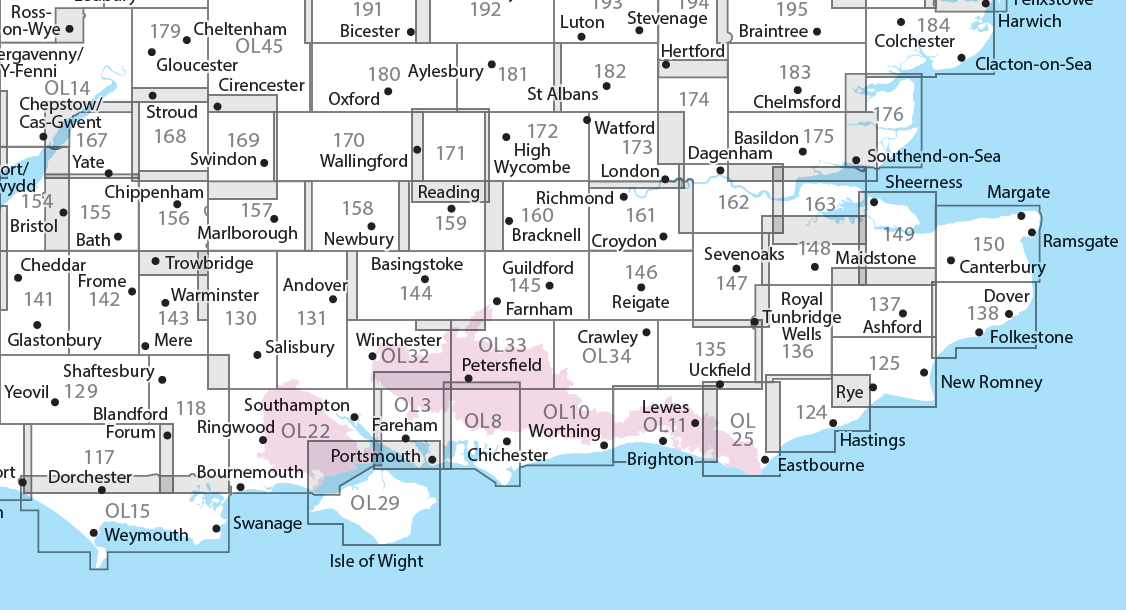
Producten op deze overzichtskaart:
Klik op een product om naar de pagina van dat product te gaan.
- Wandelkaart - Topografische kaart 117 OS Explorer Map Cerne Abbas & Bere Regis | Ordnance Survey
- Wandelkaart - Topografische kaart 118 OS Explorer Map Shaftesbury & Cranborne Chase | Ordnance Survey
- Wandelkaart - Topografische kaart 129 OS Explorer Map Yeovil & Sherborne | Ordnance Survey
- Wandelkaart - Topografische kaart 130 OS Explorer Map Salisbury & Stonehenge | Ordnance Survey
- Wandelkaart - Topografische kaart 131 OS Explorer Map Romsey, Andover & Test Valley | Ordnance Survey
- Wandelkaart - Topografische kaart 135 OS Explorer Map Ashdown Forest (greenw) | Ordnance Survey
- Wandelkaart - Topografische kaart 141 OS Explorer Map Cheddar Gorge, Mendip Hills West | Ordnance Survey
- Wandelkaart - Topografische kaart 142 OS Explorer Map Shepton Mallet , Mendip Hills East | Ordnance Survey
- Wandelkaart - Topografische kaart 143 OS Explorer Map Warminster, Trowbridge | Ordnance Survey
- Wandelkaart - Topografische kaart 144 OS Explorer Map Basingstoke, Alto, Whitchurch | Ordnance Survey
- Wandelkaart - Topografische kaart 145 OS Explorer Map Guildford, Farnham | Ordnance Survey
- Wandelkaart - Topografische kaart 146 OS Explorer Map Dorking, Box Hill, Reigate | Ordnance Survey
- Wandelkaart - Topografische kaart 147 OS Explorer Map Sevenoaks and Tonbridge | Ordnance Survey
- Wandelkaart - Topografische kaart 154 OS Explorer Map Bristol West, Portishead | Ordnance Survey
- Wandelkaart - Topografische kaart 155 OS Explorer Map Bristol, Bath | Ordnance Survey
- Wandelkaart - Topografische kaart 156 OS Explorer Map Chippenham, Bradford-on-Avon | Ordnance Survey
- Wandelkaart - Topografische kaart 157 OS Explorer Map Marlborough, Savernake Forest | Ordnance Survey
- Wandelkaart - Topografische kaart 158 OS Explorer Map Newbury, Hungerford | Ordnance Survey
- Wandelkaart - Topografische kaart 159 OS Explorer Map Reading, Wokingham & Pangbourne Map | Thames Path | Ordnance Survey
- Wandelkaart - Topografische kaart 160 OS Explorer Map Windsor, Weybridge, Bracknell | Thames Path | Ordnance Survey
- Wandelkaart - Topografische kaart 161 OS Explorer Map London South (greenw.m) | Ordnance Survey
- Wandelkaart - Topografische kaart 162 OS Explorer Map Greenwich, Gravesend | Ordnance Survey
- Wandelkaart - Topografische kaart 167 OS Explorer Map Thornbury, Dursley, Yate | Ordnance Survey
- Wandelkaart - Topografische kaart 168 OS Explorer Map Stroud, Tetbury, Malmesbury | Ordnance Survey
- Wandelkaart - Topografische kaart 169 OS Explorer Map Cirencester, Swindon | Ordnance Survey
- Wandelkaart - Topografische kaart 170 OS Explorer Map Abingdon, Wantage & Vale of White Horse | Ordnance Survey
- Wandelkaart - Topografische kaart 171 OS Explorer Map Chiltern Hills West | Ordnance Survey
- Wandelkaart - Topografische kaart 172 OS Explorer Map Chiltern Hills East | Ordnance Survey
- Wandelkaart - Topografische kaart 173 OS Explorer Map London North | Ordnance Survey
- Wandelkaart - Topografische kaart 174 OS Explorer Map Epping Forest, Lee Valley | Ordnance Survey
- Wandelkaart - Topografische kaart 179 OS Explorer Map Gloucester, Cheltenham, Stroud | Ordnance Survey
- Wandelkaart - Topografische kaart 180 OS Explorer Map Oxford | Ordnance Survey
- Wandelkaart - Topografische kaart 182 OS Explorer Map St-Albans, Hatfield | Ordnance Survey
- Wandelkaart - Topografische kaart OL03 OS Explorer Map Meon Valley - Portsmouth, Gosport & Fareham | Ordnance Survey
- Wandelkaart - Topografische kaart OL08 OS Explorer Map Chichester, South Harting & Selsey | Ordnance Survey
- Wandelkaart - Topografische kaart OL10 OS Explorer Map Arundel - Pulborough - Worthing | Ordnance Survey
- Wandelkaart - Topografische kaart OL11 OS Explorer Map Brighton & Hove, Lewes & Burgess Hill | Ordnance Survey
- Wandelkaart - Topografische kaart OL14 OS Explorer Map Wye Valley - Forest of Dean - Dyfryn Gwy | Ordnance Survey
- Wandelkaart - Topografische kaart OL15 OS Explorer Map Purbeck and South Dorset | Ordnance Survey
- Wandelkaart - Topografische kaart OL25 OS Explorer Map Eastbourne & Beachy Head | Ordnance Survey
- Wandelkaart - Topografische kaart OL29 OS Explorer Map Isle of Wight | Ordnance Survey
- Wandelkaart - Topografische kaart OL32 OS Explorer Map Winchester | Ordnance Survey
- Wandelkaart - Topografische kaart OL33 OS Explorer Map Haslemere & Petersfield | Ordnance Survey
- Wandelkaart - Topografische kaart OL34 OS Explorer Map Crawley & Horsham | Ordnance Survey
-
Overzichtskaart Explorer 25.000 wandelkaarten zuidwest Engeland - Devon - Cornwall

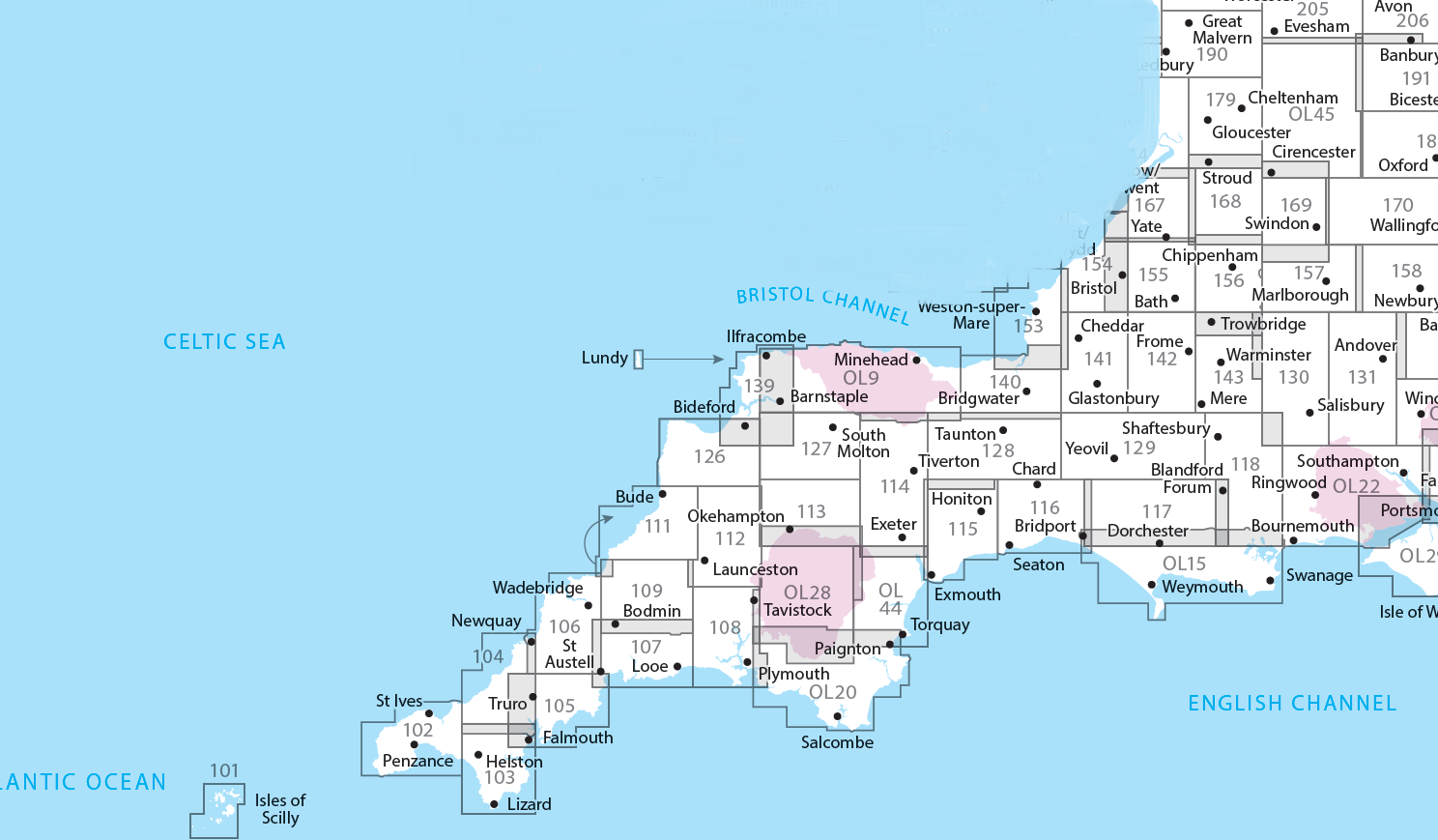
Producten op deze overzichtskaart:
Klik op een product om naar de pagina van dat product te gaan.
- Wandelkaart - Topografische kaart 101 OS Explorer Map Isles of Scilly | Ordnance Survey
- Wandelkaart - Topografische kaart 102 OS Explorer Map Land's End | Ordnance Survey
- Wandelkaart - Topografische kaart 103 OS Explorer Map The Lizard | Ordnance Survey
- Wandelkaart - Topografische kaart 104 OS Explorer Map Redruth & St Agnes | Ordnance Survey
- Wandelkaart - Topografische kaart 105 OS Explorer Map Falmouth & Mevagissey | Ordnance Survey
- Wandelkaart - Topografische kaart 106 OS Explorer Map Newquay & Padstow | Ordnance Survey
- Wandelkaart - Topografische kaart 107 OS Explorer Map St Austell & Liskeard | Ordnance Survey
- Wandelkaart - Topografische kaart 108 OS Explorer Map Lower Tamar Valley & Plymouth | Ordnance Survey
- Wandelkaart - Topografische kaart 109 OS Explorer Map Bodmin Moor | Ordnance Survey
- Wandelkaart - Topografische kaart 111 OS Explorer Map Bude, Boscastle & Tintagel | Ordnance Survey
- Wandelkaart - Topografische kaart 112 OS Explorer Map Launceston & Holsworthy | Ordnance Survey
- Wandelkaart - Topografische kaart 113 OS Explorer Map Okehampton | Ordnance Survey
- Wandelkaart - Topografische kaart 114 OS Explorer Map Exeter - Exe Valley | Ordnance Survey
- Wandelkaart - Topografische kaart 115 OS Explorer Map Exmouth & Sidmouth | Ordnance Survey
- Wandelkaart - Topografische kaart 116 OS Explorer Map Lyme Regis & Bridport | Ordnance Survey
- Wandelkaart - Topografische kaart 117 OS Explorer Map Cerne Abbas & Bere Regis | Ordnance Survey
- Wandelkaart - Topografische kaart 118 OS Explorer Map Shaftesbury & Cranborne Chase | Ordnance Survey
- Wandelkaart - Topografische kaart 126 OS Explorer Map Clovelly & Hartland | Ordnance Survey
- Wandelkaart - Topografische kaart 127 OS Explorer Map South Molton & Chulmleigh | Ordnance Survey
- Wandelkaart - Topografische kaart 128 OS Explorer Map Taunton & Blackdown Hills | Ordnance Survey
- Wandelkaart - Topografische kaart 129 OS Explorer Map Yeovil & Sherborne | Ordnance Survey
- Wandelkaart - Topografische kaart 130 OS Explorer Map Salisbury & Stonehenge | Ordnance Survey
- Wandelkaart - Topografische kaart 131 OS Explorer Map Romsey, Andover & Test Valley | Ordnance Survey
- Wandelkaart - Topografische kaart 139 OS Explorer Map Bideford & Ilfracombe & Barnstaple | Ordnance Survey
- Wandelkaart - Topografische kaart 140 OS Explorer Map Quantock Hills, Bridgewater | Ordnance Survey
- Wandelkaart - Topografische kaart 141 OS Explorer Map Cheddar Gorge, Mendip Hills West | Ordnance Survey
- Wandelkaart - Topografische kaart 142 OS Explorer Map Shepton Mallet , Mendip Hills East | Ordnance Survey
- Wandelkaart - Topografische kaart 143 OS Explorer Map Warminster, Trowbridge | Ordnance Survey
- Wandelkaart - Topografische kaart 153 OS Explorer Map Weston-super-Mare, Bleadon Hill | Ordnance Survey
- Wandelkaart - Topografische kaart 154 OS Explorer Map Bristol West, Portishead | Ordnance Survey
- Wandelkaart - Topografische kaart 155 OS Explorer Map Bristol, Bath | Ordnance Survey
- Wandelkaart - Topografische kaart 156 OS Explorer Map Chippenham, Bradford-on-Avon | Ordnance Survey
- Wandelkaart - Topografische kaart 157 OS Explorer Map Marlborough, Savernake Forest | Ordnance Survey
- Wandelkaart - Topografische kaart 158 OS Explorer Map Newbury, Hungerford | Ordnance Survey
- Wandelkaart - Topografische kaart 167 OS Explorer Map Thornbury, Dursley, Yate | Ordnance Survey
- Wandelkaart - Topografische kaart 168 OS Explorer Map Stroud, Tetbury, Malmesbury | Ordnance Survey
- Wandelkaart - Topografische kaart 169 OS Explorer Map Cirencester, Swindon | Ordnance Survey
- Wandelkaart - Topografische kaart 170 OS Explorer Map Abingdon, Wantage & Vale of White Horse | Ordnance Survey
- Wandelkaart - Topografische kaart 179 OS Explorer Map Gloucester, Cheltenham, Stroud | Ordnance Survey
- Wandelkaart - Topografische kaart OL09 OS Explorer Map Exmoor | Ordnance Survey
- Wandelkaart - Topografische kaart OL15 OS Explorer Map Purbeck and South Dorset | Ordnance Survey
- Wandelkaart - Topografische kaart OL20 OS Explorer Map South Devon | Ordnance Survey
- Wandelkaart - Topografische kaart OL22 OS Explorer Map New Forest | Ordnance Survey
- Wandelkaart - Topografische kaart OL28 OS Explorer Map Dartmoor | Ordnance Survey
- Wandelkaart - Topografische kaart OL44 OS Explorer Map Torquay & Dawlish | Ordnance Survey
- Wandelkaart - Topografische kaart OL45 OS Explorer Map The Cotswolds | Ordnance Survey
Overzichtskaarten
Beschrijving
Met zijn 4cm voor 1 km (2 ½ cm voor 1 mijl) schaal, is de OS Explorer kaartenserie de ideale en meest gedetailleerde kaartenreeks voor mensen die graag outdoor-activiteiten zoals fietsen, wandelen, paardrijden, klimmen en watersporten.
Dit product heeft meerdere varianten:


