Winkelwagen
Geen items in winkelwagen
Ga naar winkelwagen
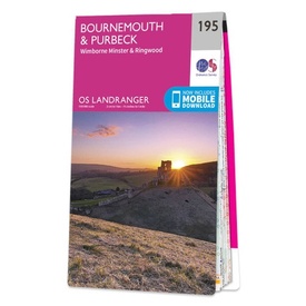
Wandelkaart - Topografische kaart 195 Landranger Bournemouth & Purbeck | Ordnance Survey (9780319262931)
Bournemouth, Purbeck, Wimborne Minster, Poole, Christchurch, Ringwood, Fordingbridge, Wareham, Swanage, Corfe Castle, Upton, Corfe Mullen, Lytchett, Spetisbury, Witchhampton, Tarrant Hilton, Gussage A
- ISBN / CODE: 9780319262931
- Editie: 2017
- Schaal: 1:50000
- Uitgever: Ordnance Survey
- Soort: Topografische kaart, Wandelkaart
- Serie: Landranger
- Taal: Engels
- Hoogte: 23.0 cm
- Breedte: 13.0 cm
- Dikte: 1.0 cm
- Gewicht: 150.0 g
- Uitvoering: Papier
- Bindwijze: -
- Schrijf als eerste een review
-
€ 19,50
Op voorraad. Voor 17.00 uur op werkdagen besteld, binnen 1 tot 2 werkdagen in huis in Nederland Levertijd Belgie
Gratis verzending in Nederland vanaf €35,-
-
Overzicht Wandelkaarten 1:50.000 Ordnance Survey

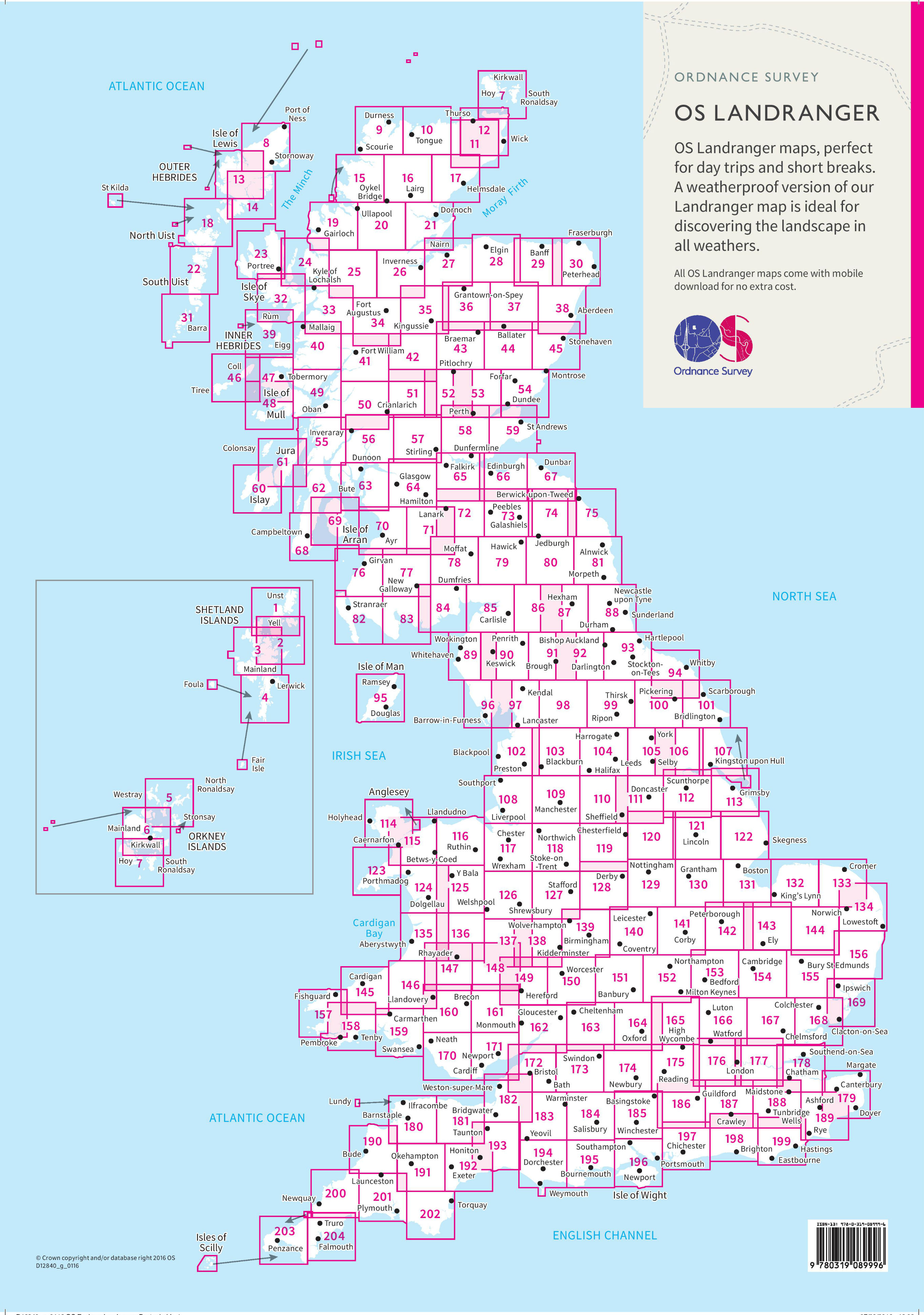
Producten op deze overzichtskaart:
Klik op een product om naar de pagina van dat product te gaan.
- Wandelkaart - Topografische kaart 001 Landranger Shetland - Yell - Unst & Fetlar | Ordnance Survey
- Wandelkaart - Topografische kaart 002 Landranger Shetland | Ordnance Survey
- Wandelkaart - Topografische kaart 003 Landranger Shetland - North Mainland | Ordnance Survey
- Wandelkaart - Topografische kaart 004 Landranger Shetland - South Mainland | Ordnance Survey
- Wandelkaart - Topografische kaart 005 Landranger Orkney - Northern Isles | Ordnance Survey
- Wandelkaart - Topografische kaart 006 Landranger Orkney - Mainland | Ordnance Survey
- Wandelkaart - Topografische kaart 007 Landranger Orkney - Southern Isles | Ordnance Survey
- Wandelkaart - Topografische kaart 008 Landranger Stornoway & North Lewis | Ordnance Survey
- Wandelkaart - Topografische kaart 009 Landranger Cape Wrath - Durness & Scourie | Ordnance Survey
- Wandelkaart - Topografische kaart 010 Landranger Strathnaver - Bettyhill & Tongue | Ordnance Survey
- Wandelkaart - Topografische kaart 011 Landranger Thurso & Dunbeath | Ordnance Survey
- Wandelkaart - Topografische kaart 012 Landranger Thurso & Wick, John O'Groats | Ordnance Survey
- Wandelkaart - Topografische kaart 013 Landranger West Lewis & North Harris | Ordnance Survey
- Wandelkaart - Topografische kaart 014 Landranger Tarbert & Loch Seaforth | Ordnance Survey
- Wandelkaart - Topografische kaart 015 Landranger Loch Assynt, Lochinver & Kylesku | Ordnance Survey
- Wandelkaart - Topografische kaart 016 Landranger Lairg & Loch Shin, Loch Naver | Ordnance Survey
- Wandelkaart - Topografische kaart 017 Landranger Helmsdale & Strath of Kildonan | Ordnance Survey
- Wandelkaart - Topografische kaart 018 Landranger Sound of Harris, North Uist, Taransay & St Kilda | Ordnance Survey
- Wandelkaart - Topografische kaart 019 Landranger Gairloch & Ullapool, Loch Maree | Ordnance Survey
- Wandelkaart - Topografische kaart 020 Landranger Beinn Dearg & Loch Broom, Ben Wyvis | Ordnance Survey
- Wandelkaart - Topografische kaart 021 Landranger Dornoch & Alness, Invergordon & Tain | Ordnance Survey
- Wandelkaart - Topografische kaart 022 Landranger Benbecula & South Uist | Ordnance Survey
- Wandelkaart - Topografische kaart 023 Landranger North Skye, Dunvegan & Portree | Ordnance Survey
- Wandelkaart - Topografische kaart 024 Landranger Raasay & Applecross, Loch Torridon & Plockton | Ordnance Survey
- Wandelkaart - Topografische kaart 025 Landranger Glen Carron & Glen Affric | Ordnance Survey
- Wandelkaart - Topografische kaart 026 Landranger Inverness & Loch Ness, Strathglass | Ordnance Survey
- Wandelkaart - Topografische kaart 027 Landranger Nairn & Forres, River Findhorn | Ordnance Survey
- Wandelkaart - Topografische kaart 028 Landranger Elgin, Dufftown & surrounding area | Ordnance Survey
- Wandelkaart - Topografische kaart 029 Landranger Banff & Huntly, Portsoy & Turriff | Ordnance Survey
- Wandelkaart - Topografische kaart 030 Landranger Fraserburgh, Peterhead & Ellon | Ordnance Survey
- Wandelkaart - Topografische kaart 031 Landranger Barra & South Uist, Vatersay & Eriskay | Ordnance Survey
- Wandelkaart - Topografische kaart 032 Landranger South Skye & Cuillin Hills | Ordnance Survey
- Wandelkaart - Topografische kaart 033 Landranger Loch Alsh, Glen Shiel & Loch Hourn | Ordnance Survey
- Wandelkaart - Topografische kaart 034 Landranger Fort Augustus, Glen Albyn & Glen Roy | Ordnance Survey
- Wandelkaart - Topografische kaart 035 Landranger Kingussie and Monadhliath Mountains | Ordnance Survey
- Wandelkaart - Topografische kaart 036 Landranger Grantown & Aviemore, Cairngorm Mountains | Ordnance Survey
- Wandelkaart - Topografische kaart 037 Landranger Strathdon & Alford | Ordnance Survey
- Wandelkaart - Topografische kaart 038 Landranger Aberdeen, Inverurie & Pitmedden | Ordnance Survey
- Wandelkaart - Topografische kaart 039 Landranger Rum, Eigg & Muck | Ordnance Survey
- Wandelkaart - Topografische kaart 040 Landranger Mallaig & Glenfinnan, Loch Shiel | Ordnance Survey
- Wandelkaart - Topografische kaart 041 Landranger Ben Nevis, Fort William & Glen Coe | Ordnance Survey
- Wandelkaart - Topografische kaart 042 Landranger Glen Garry & Loch Rannoch | Ordnance Survey
- Wandelkaart - Topografische kaart 043 Landranger Braemar & Blair Atholl | Ordnance Survey
- Wandelkaart - Topografische kaart 044 Landranger Ballater & Glen Clova | Ordnance Survey
- Wandelkaart - Topografische kaart 045 Landranger Stonehaven & Banchory | Ordnance Survey
- Wandelkaart - Topografische kaart 046 Landranger Coll & Tiree | Ordnance Survey
- Wandelkaart - Topografische kaart 047 Landranger Tobermory & North Mull | Ordnance Survey
- Wandelkaart - Topografische kaart 048 Landranger Iona & West Mull, Ulva | Ordnance Survey
- Wandelkaart - Topografische kaart 049 Landranger Oban & East Mull | Ordnance Survey
- Wandelkaart - Topografische kaart 050 Landranger Glen Orchy & Loch Etive | Ordnance Survey
- Wandelkaart - Topografische kaart 051 Landranger Loch Tay & Glen Dochart | Ordnance Survey
- Wandelkaart - Topografische kaart 052 Landranger Pitlochry & Crieff | Ordnance Survey
- Wandelkaart - Topografische kaart 053 Landranger Blairgowrie & Forest of Alyth | Ordnance Survey
- Wandelkaart - Topografische kaart 054 Landranger Dundee & Montrose, Forfar & Arbroath | Ordnance Survey
- Wandelkaart - Topografische kaart 055 Landranger Lochgilphead & Loch Awe | Ordnance Survey
- Wandelkaart - Topografische kaart 056 Landranger Loch Lomond & Inveraray | Ordnance Survey
- Wandelkaart - Topografische kaart 057 Landranger Stirling & The Trossachs | Ordnance Survey
- Wandelkaart - Topografische kaart 058 Landranger Perth to Alloa, Auchterarder | Ordnance Survey
- Wandelkaart - Topografische kaart 059 Landranger St Andrews, Kirkcaldy & Glenrothes | Ordnance Survey
- Wandelkaart - Topografische kaart 060 Landranger Islay | Ordnance Survey
- Wandelkaart - Topografische kaart 061 Landranger Jura & Colonsay | Ordnance Survey
- Wandelkaart - Topografische kaart 062 Landranger North Kintyre & Tarbert | Ordnance Survey
- Wandelkaart - Topografische kaart 063 Landranger Firth Of Clyde, Greenock & Rothesay | Ordnance Survey
- Wandelkaart - Topografische kaart 064 Landranger Glasgow, Motherwell & Airdrie | Ordnance Survey
- Wandelkaart - Topografische kaart 065 Landranger Falkirk & Linlithgow, Dunfermline | Ordnance Survey
- Wandelkaart - Topografische kaart 066 Landranger Edinburgh, Penicuik & North Berwick | Ordnance Survey
- Wandelkaart - Topografische kaart 067 Landranger Duns, Dunbar & Eyemouth area | Ordnance Survey
- Wandelkaart - Topografische kaart 068 Landranger South Kintyre & Campbeltown | Ordnance Survey
- Wandelkaart - Topografische kaart 069 Landranger Isle of Arran | Ordnance Survey
- Wandelkaart - Topografische kaart 070 Landranger Ayr, Kilmarnock & Troon | Ordnance Survey
- Wandelkaart - Topografische kaart 071 Landranger Lanark & Upper Nithsdale | Ordnance Survey
- Wandelkaart - Topografische kaart 072 Landranger Upper Clyde Valley, Biggar & Lanark | Ordnance Survey
- Wandelkaart - Topografische kaart 073 Landranger Peebles, Galashiels & Selkirk, Tweed Valley | Ordnance Survey
- Wandelkaart - Topografische kaart 074 Landranger Kelso & Coldstream, Jedburgh & Duns | Ordnance Survey
- Wandelkaart - Topografische kaart 075 Landranger Berwick-upon-Tweed, Holy Island & Wooler, Farne Islands | Ordnance Survey
- Wandelkaart - Topografische kaart 076 Landranger Girvan, Ballantrae & Barrhill | Ordnance Survey
- Wandelkaart - Topografische kaart 077 Landranger Dalmellington & New Galloway, Galloway Forest Park | Ordnance Survey
- Wandelkaart - Topografische kaart 078 Landranger Nithsdale & Annandale, Sanquhar & Moffat | Ordnance Survey
- Wandelkaart - Topografische kaart 079 Landranger Hawick & Eskdale, Langholm | Ordnance Survey
- Wandelkaart - Topografische kaart 080 Landranger Cheviot Hills & Kielder Water | Ordnance Survey
- Wandelkaart - Topografische kaart 081 Landranger Alnwick & Morpeth | Ordnance Survey
- Wandelkaart - Topografische kaart 082 Landranger Stranraer & Glenluce | Ordnance Survey
- Wandelkaart - Topografische kaart 083 Landranger Newton Stewart & Kirkcudbright, Gatehouse of Fleet | Ordnance Survey
- Wandelkaart - Topografische kaart 084 Landranger Dumfries & Castle Douglas | Ordnance Survey
- Wandelkaart - Topografische kaart 085 Landranger Carlisle & Solway Firth, Gretna Green | Ordnance Survey
- Wandelkaart - Topografische kaart 086 Landranger Haltwhistle & Brampton, Bewcastle & Alston | Ordnance Survey
- Wandelkaart - Topografische kaart 087 Landranger Hexham & Haltwhistle | Ordnance Survey
- Wandelkaart - Topografische kaart 088 Landranger Newcastle upon Tyne, Durham & Sunderland | Ordnance Survey
- Wandelkaart - Topografische kaart 089 Landranger West Cumbria, (Lake District) | Ordnance Survey
- Wandelkaart - Topografische kaart 090 Landranger Penrith & Keswick, Ambleside (Lake District) | Ordnance Survey
- Wandelkaart - Topografische kaart 091 Landranger Appleby-in-Westmorland | Ordnance Survey
- Wandelkaart - Topografische kaart 092 Landranger Barnard Castle & Richmond | Ordnance Survey
- Wandelkaart - Topografische kaart 093 Landranger Middlesbrough, Darlington & Hartlepool | Ordnance Survey
- Wandelkaart - Topografische kaart 094 Landranger Whitby & Esk Dale, Robin Hood's Bay | Ordnance Survey
- Wandelkaart - Topografische kaart 095 Landranger Isle of Man | Ordnance Survey
- Wandelkaart - Topografische kaart 096 Landranger Barrow-in-Furness & South Lakeland Lake District | Ordnance Survey
- Wandelkaart - Topografische kaart 097 Landranger Kendal & Morecambe, Windermere & Lancaster (Lake District) | Ordnance Survey
- Wandelkaart - Topografische kaart 098 Landranger Wensleydale & Upper Wharfedale | Ordnance Survey
- Wandelkaart - Topografische kaart 099 Landranger Northallerton & Ripon, Pateley Bridge & Leyburn | Ordnance Survey
- Wandelkaart - Topografische kaart 100 Landranger Malton & Pickering, Helmsley & Easingwold | Ordnance Survey
- Wandelkaart - Topografische kaart 101 Landranger Scarborough, Bridlington & Filey | Ordnance Survey
- Wandelkaart - Topografische kaart 102 Landranger Preston & Blackpool, Lytham St Annes | Ordnance Survey
- Wandelkaart - Topografische kaart 103 Landranger Blackburn & Burnley, Clitheroe & Skipton | Ordnance Survey
- Wandelkaart - Topografische kaart 104 Landranger Leeds & Bradford, Harrogate & Ilkley | Ordnance Survey
- Wandelkaart - Topografische kaart 105 Landranger York & Selby | Ordnance Survey
- Wandelkaart - Topografische kaart 106 Landranger Market Weighton, Goole & Stamford Bridge | Ordnance Survey
- Wandelkaart - Topografische kaart 107 Landranger Kingston upon Hull, Beverley & Driffield | Ordnance Survey
- Wandelkaart - Topografische kaart 108 Landranger Liverpool, Southport & Wigan | Ordnance Survey
- Wandelkaart - Topografische kaart 109 Landranger Manchester, Bolton & Warrington | Ordnance Survey
- Wandelkaart - Topografische kaart 110 Landranger Sheffield & Huddersfield, Glossop & Holmfirth | Ordnance Survey
- Wandelkaart - Topografische kaart 111 Landranger Sheffield & Doncaster, Rotherham, Barnsley & Thorne | Ordnance Survey
- Wandelkaart - Topografische kaart 112 Landranger Scunthorpe & Gainsborough | Ordnance Survey
- Wandelkaart - Topografische kaart 113 Landranger Grimsby, Louth & Market Rasen | Ordnance Survey
- Wandelkaart - Topografische kaart 114 Landranger Anglesey | Ordnance Survey
- Wandelkaart - Topografische kaart 115 Landranger Snowdon & Caernarfon - Wales | Ordnance Survey
- Wandelkaart - Topografische kaart 116 Landranger Denbigh & Colwyn Bay | Ordnance Survey
- Wandelkaart - Topografische kaart 117 Landranger Chester & Wrexham, Ellesmere Port | Ordnance Survey
- Wandelkaart - Topografische kaart 118 Landranger Stoke-on-Trent & Macclesfield | Ordnance Survey
- Wandelkaart - Topografische kaart 119 Landranger Buxton & Matlock, Bakewell & Dove Dale | Ordnance Survey
- Wandelkaart - Topografische kaart 120 Landranger Mansfield & Worksop, Sherwood Forest | Ordnance Survey
- Wandelkaart - Topografische kaart 121 Landranger Lincoln & Newark-on-Trent | Ordnance Survey
- Wandelkaart - Topografische kaart 122 Landranger Skegness & Horncastle | Ordnance Survey
- Wandelkaart - Topografische kaart 123 Landranger Lleyn Peninsula - Wales | Ordnance Survey
- Wandelkaart - Topografische kaart 124 Landranger Dolgellau & Porthmadog - Wales | Ordnance Survey
- Wandelkaart - Topografische kaart 125 Landranger Bala & Lake Vyrnwy, Berwyn - Wales | Ordnance Survey
- Wandelkaart - Topografische kaart 126 Landranger Shrewsbury & Oswestry - Wales | Ordnance Survey
- Wandelkaart - Topografische kaart 127 Landranger Stafford & Telford, Ironbridge | Ordnance Survey
- Wandelkaart - Topografische kaart 128 Landranger Derby & Burton upon Trent | Ordnance Survey
- Wandelkaart - Topografische kaart 129 Landranger Nottingham & Loughborough, Melton Mowbray | Ordnance Survey
- Wandelkaart - Topografische kaart 130 Landranger Grantham, Sleaford & Bourne | Ordnance Survey
- Wandelkaart - Topografische kaart 131 Landranger Boston & Spalding | Ordnance Survey
- Wandelkaart - Topografische kaart 132 Landranger North West Norfolk, King's Lynn & Fakenham | Ordnance Survey
- Wandelkaart - Topografische kaart 133 Landranger North East Norfolk, Cromer & Wroxham | Ordnance Survey
- Wandelkaart - Topografische kaart 134 Landranger Norwich & The Broads, Great Yarmouth | Ordnance Survey
- Wandelkaart - Topografische kaart 135 Landranger Aberystwyth & Machynlleth | Ordnance Survey
- Wandelkaart - Topografische kaart 136 Landranger Wales - Newtown, Llanidloes | Ordnance Survey
- Wandelkaart - Topografische kaart 137 Landranger Ludlow & Church Stretton, Wenlock Edge | Ordnance Survey
- Wandelkaart - Topografische kaart 138 Landranger Kidderminster & Wyre Forest | Ordnance Survey
- Wandelkaart - Topografische kaart 139 Landranger Birmingham & Wolverhampton | Ordnance Survey
- Wandelkaart - Topografische kaart 140 Landranger Leicester, Coventry & Rugby | Ordnance Survey
- Wandelkaart - Topografische kaart 141 Landranger Kettering and Corby | Ordnance Survey
- Wandelkaart - Topografische kaart 142 Landranger Peterborough, Market Deeping & Chatteris | Ordnance Survey
- Wandelkaart - Topografische kaart 143 Landranger Ely & Wisbech, Downham Market | Ordnance Survey
- Wandelkaart - Topografische kaart 144 Landranger Thetford & Diss, Breckland & Wymondham | Ordnance Survey
- Wandelkaart - Topografische kaart 145 Landranger Cardigan & Mynydd Preseli - Wales | Ordnance Survey
- Wandelkaart - Topografische kaart 146 Landranger Lampeter & Llandovery - Wales | Ordnance Survey
- Wandelkaart - Topografische kaart 147 Landranger Elan Valley & Builth Wells - Wales | Ordnance Survey
- Wandelkaart - Topografische kaart 148 Landranger Presteigne & Hay-on-Wye, Llanandras a'r Gelli Gandryll - Wales | Ordnance Survey
- Wandelkaart - Topografische kaart 149 Landranger Hereford & Leominster, Bromyard & Ledbury | Ordnance Survey
- Wandelkaart - Topografische kaart 150 Landranger Worcester & The Malverns, Evesham & Tewkesbury | Ordnance Survey
- Wandelkaart - Topografische kaart 151 Landranger Stratford-upon-Avon, Warwick & Banbury | Ordnance Survey
- Wandelkaart - Topografische kaart 152 Landranger Northampton & Milton Keynes, Buckingham & Daventry | Ordnance Survey
- Wandelkaart - Topografische kaart 153 Landranger Bedford & Huntingdon, St Neots & Biggleswade | Ordnance Survey
- Wandelkaart - Topografische kaart 154 Landranger Cambridge & Newmarket, Saffron Walden | Ordnance Survey
- Wandelkaart - Topografische kaart 155 Landranger Bury St Edmunds, Sudbury & Stowmarket | Ordnance Survey
- Wandelkaart - Topografische kaart 156 Landranger Saxmundham, Aldeburgh & Southwold | Ordnance Survey
- Wandelkaart - Topografische kaart 157 Landranger St David's & Haverfordwest | Ordnance Survey
- Wandelkaart - Topografische kaart 158 Landranger Tenby & Pembroke - Wales | Ordnance Survey
- Wandelkaart - Topografische kaart 159 Landranger Swansea & Gower, Carmarthen - Wales | Ordnance Survey
- Wandelkaart - Topografische kaart 160 Landranger Brecon Beacons - Wales | Ordnance Survey
- Wandelkaart - Topografische kaart 161 Landranger Abergavenny & The Black Mountains/Y Mynyddoedd Duon - Brecon Beacons / Wales | Ordnance Survey
- Wandelkaart - Topografische kaart 162 Landranger Gloucester & Forest of Dean - Wales | Ordnance Survey
- Wandelkaart - Topografische kaart 163 Landranger Cheltenham & Cirencester, Stow-on-the-Wold - Cotswolds | Ordnance Survey
- Wandelkaart - Topografische kaart 164 Landranger Oxford, Chipping Norton & Bicester | Ordnance Survey
- Wandelkaart - Topografische kaart 165 Landranger Aylesbury & Leighton Buzzard | Ordnance Survey
- Wandelkaart - Topografische kaart 166 Landranger Luton & Hertford, Hitchin & St Albans | Ordnance Survey
- Wandelkaart - Topografische kaart 167 Landranger Chelmsford, Harlow & Bishop's Stortford | Ordnance Survey
- Wandelkaart - Topografische kaart 168 Landranger Colchester, Halstead & Maldon | Ordnance Survey
- Wandelkaart - Topografische kaart 169 Landranger Ipswich & The Naze, Clacton-on-sea | Ordnance Survey
- Wandelkaart - Topografische kaart 171 Landranger Cardiff & Newport, Pontypool Wales | Ordnance Survey
- Wandelkaart - Topografische kaart 172 Landranger Bristol & Bath, Thornbury & Chew Magna | Ordnance Survey
- Wandelkaart - Topografische kaart 173 Landranger Swindon & Devizes, Marlborough & Trowbridge | Ordnance Survey
- Wandelkaart - Topografische kaart 174 Landranger Newbury & Wantage, Hungerford & Didcot | Ordnance Survey
- Wandelkaart - Topografische kaart 175 Landranger Reading & Windsor, Henley-on-Thames & Bracknell | Ordnance Survey
- Wandelkaart - Topografische kaart 176 Landranger West London, Rickmansworth & Staines | Ordnance Survey
- Wandelkaart - Topografische kaart 177 Landranger East London, Billericay & Gravesend | Ordnance Survey
- Wandelkaart - Topografische kaart 178 Landranger Thames Estuary, Rochester & Southend-on-Sea | Ordnance Survey
- Wandelkaart - Topografische kaart 179 Landranger Canterbury & East Kent, Dover & Margate | Ordnance Survey
- Wandelkaart - Topografische kaart 180 Landranger Barnstaple & Ilfracombe, Lynton & Bideford | Ordnance Survey
- Wandelkaart - Topografische kaart 181 Landranger Minehead & Brendon Hills, Dulverton & Tiverton | Ordnance Survey
- Wandelkaart - Topografische kaart 182 Landranger Weston-super-Mare, Bridgwater & Wells | Ordnance Survey
- Wandelkaart - Topografische kaart 183 Landranger Yeovil & Frome, Shaftesbury & Shepton Mallet | Ordnance Survey
- Wandelkaart - Topografische kaart 184 Landranger Salisbury & The Plain, Amesbury | Ordnance Survey
- Wandelkaart - Topografische kaart 186 Landranger Aldershot & Guildford | Ordnance Survey
- Wandelkaart - Topografische kaart 187 Landranger Dorking, Reigate & Crawley area | Ordnance Survey
- Wandelkaart - Topografische kaart 188 Landranger Maidstone & Royal Tunbridge Wells | Ordnance Survey
- Wandelkaart - Topografische kaart 189 Landranger Ashford & Romney Marsh | Ordnance Survey
- Wandelkaart - Topografische kaart 190 Landranger Bude and Clovelly | Ordnance Survey
- Wandelkaart - Topografische kaart 191 Landranger Okehampton & North Dartmoor | Ordnance Survey
- Wandelkaart - Topografische kaart 192 Landranger Exeter & Sidmouth, Exmouth & Teignmouth | Ordnance Survey
- Wandelkaart - Topografische kaart 193 Landranger Taunton & Lyme Regis, Chard & Bridport | Ordnance Survey
- Wandelkaart - Topografische kaart 194 Landranger Dorchester & Weymouth, Cerne Abbas & Bere Regis | Ordnance Survey
- Wandelkaart - Topografische kaart 195 Landranger Bournemouth & Purbeck | Ordnance Survey
- Wandelkaart - Topografische kaart 196 Landranger The Solent & The Isle of Wight | Ordnance Survey
- Wandelkaart - Topografische kaart 197 Landranger Chichester & The South Downs, Bognor Regis & Arundel | Ordnance Survey
- Wandelkaart - Topografische kaart 198 Landranger Brighton & Lewes, Haywards Heath | Ordnance Survey
- Wandelkaart - Topografische kaart 199 Landranger Eastbourne & Hastings, Battle & Heathfield | Ordnance Survey
- Wandelkaart - Topografische kaart 200 Landranger Newquay & Bodmin, Camelford & St Austell | Ordnance Survey
- Wandelkaart - Topografische kaart 201 Landranger Plymouth & Launceston, Tavistock & Looe | Ordnance Survey
- Wandelkaart - Topografische kaart 202 Landranger Torbay & South Dartmoor, Totnes & Salcombe | Ordnance Survey
- Wandelkaart - Topografische kaart 203 Landranger Land's End & Isles of Scilly, St Ives & Lizard Point | Ordnance Survey
- Wandelkaart - Topografische kaart 204 Landranger Truro & Falmouth, Roseland Peninsula | Ordnance Survey
- Wandelkaart 48 Landranger Active Schotland Iona & West Mull, Ulva | Ordnance Survey
Overzichtskaarten
Beschrijving
Take a walk on the sunny side of life in beautiful south Dorset. Relax on Bournemouth’s sandy beaches or explore the Jurassic Coast peninsula of the Isle of Purbeck, home to the world-famous beaches of Swanage and Lulworth Cove.
- Visit the charming riverside town of Wimborne Minster set amidst the Cranborne Chase Area of Outstanding Natural Beauty
- From the market town of Ringwood, explore the New Forest National Park
- Walk, hike and cycle along the South West Coast Path through the Dorset and East Devon Coast World Heritage Site
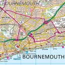
Zeer goede detailkaart met topografische ondergrond. Kleurgebruik is goed over nagedacht: bijzonder goed leesbaar en helder kaartbeeld. Hierop zijn toeristische symbolen van bezienswaardigheden ingetekend, daarnaast staan bijvoorbeeld campings en jeugdherbergen vermeld en - voor wandelaars het belangrijkst - alle right of way paden en Lange afstands Wandelpaden zijn er op te vinden. De ideale kaart voor het wandelen in Engeland, Wales of Schotland. De kaarten zijn te gebruiken met GPS (UTM OSGB36), de legenda is in het Engels, Frans en Duits.
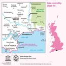
Plaatsen op deze kaart: Bournemouth, Purbeck, Wimborne Minster, Poole, Christchurch, Ringwood, Fordingbridge, Wareham, Swanage, Corfe Castle, Upton, Corfe Mullen, Lytchett, Spetisbury, Witchhampton, Tarrant Hilton, Gussage All Saints, Three Legged Cross, Longham, Hurn, Bransgore, Ferndown, Cranborne, Alderholt, Verwood, North Gorley, Burley, Sway, New Milton, and Milford on Sea
Ingetekende Langeafstandswandelroute
South west coast Path
Dit product heeft meerdere varianten:


