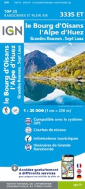
Wandelkaart - Topografische kaart 3335ET le Bourg d'Oisans - l'Alpe d'Huez | IGN - Institut Géographique National (9782758551607)
Grandes Rousses, Sept Laux
- ISBN / CODE: 9782758551607
- Editie: 31-05-2021
- Druk: 6
- Aantal blz.: 1
- Schaal: 1:25000
- Uitgever: IGN - Institut Géographique National
- Soort: Topografische kaart, Wandelkaart
- Serie: Top 25
- Taal: Frans
- Hoogte: 24.0 cm
- Breedte: 11.0 cm
- Gewicht: 88.0 g
- Uitvoering: Papier
- Bindwijze: -
- Beoordeling: 4,0 ★★★★★ (4 reviews) Schrijf een review
-
€ 16,95
Op voorraad. Voor 17.00 uur op werkdagen besteld, binnen 1 tot 2 werkdagen in huis in Nederland Levertijd Belgie
Gratis verzending in Nederland vanaf €35,-
-
Topografische kaarten IGN 25.000 Savoie - Vanoise
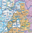
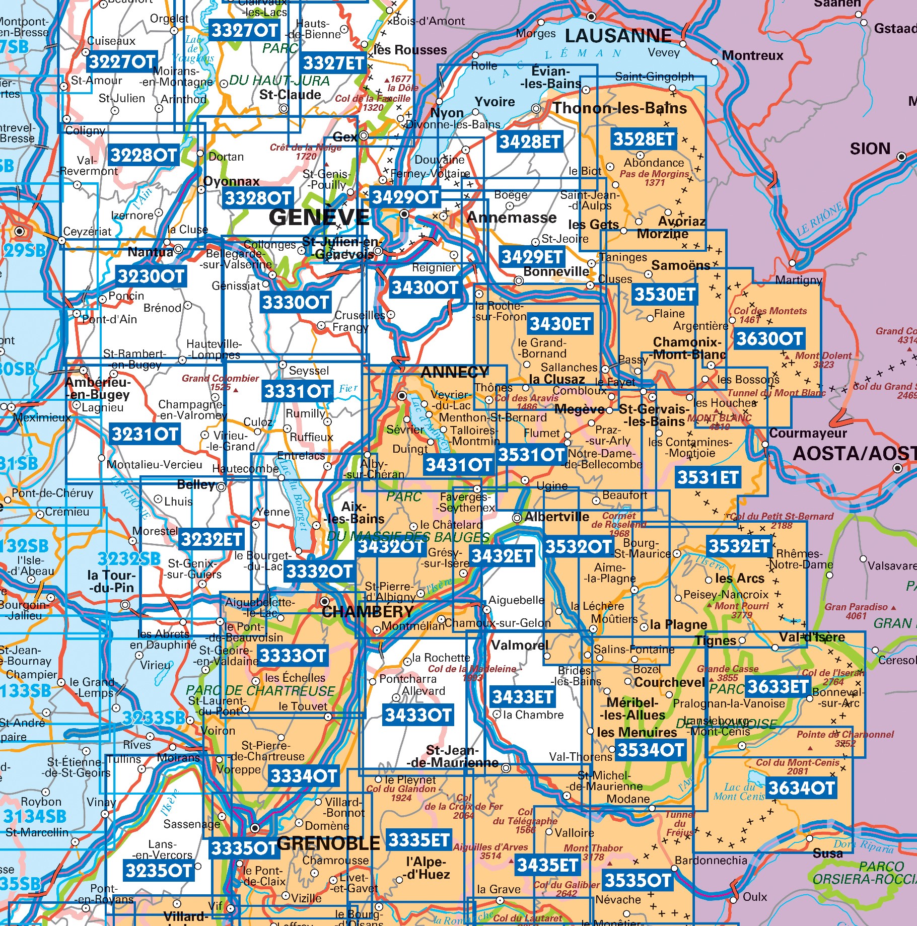
Producten op deze overzichtskaart:
Klik op een product om naar de pagina van dat product te gaan.
- Topografische kaart - Wandelkaart 3233 Le Grand-Lemps, Lac de Paladru, Voiron, Tullins | IGN - Institut Géographique National
- Wandelkaart - Topografische kaart 3333OT Massif de la Chartreuse Nord | IGN - Institut Géographique National
- Wandelkaart - Topografische kaart 3334OT Massif de la Chartreuse Sud | IGN - Institut Géographique National
- Wandelkaart - Topografische kaart 3335ET le Bourg d'Oisans - l'Alpe d'Huez | IGN - Institut Géographique National
- Wandelkaart - Topografische kaart 3335OT Grenoble | IGN - Institut Géographique National
- Wandelkaart - Topografische kaart 3335OTR Grenoble | IGN - Institut Géographique National
- Wandelkaart - Topografische kaart 3432ET Albertville | IGN - Institut Géographique National
- Wandelkaart - Topografische kaart 3432OT Massif des Bauges | IGN - Institut Géographique National
- Wandelkaart - Topografische kaart 3432OTR Massif des Bauges | IGN - Institut Géographique National
- Wandelkaart - Topografische kaart 3433ET Saint-Jean-de-Maurienne | IGN - Institut Géographique National
- Wandelkaart - Topografische kaart 3433OT Allevard | IGN - Institut Géographique National
- Wandelkaart - Topografische kaart 3435ET Valloire | IGN - Institut Géographique National
- Wandelkaart - Topografische kaart 3532ET les Arcs - la Plagne | IGN - Institut Géographique National
- Wandelkaart - Topografische kaart 3532OT Massif du Beaufortain | IGN - Institut Géographique National
- Wandelkaart - Topografische kaart 3534OT Les Trois Vallées | IGN - Institut Géographique National
- Wandelkaart - Topografische kaart 3535OT Névache - Mont Thabor | IGN - Institut Géographique National
- Wandelkaart - Topografische kaart 3633ET Tignes - Val d'Isère | IGN - Institut Géographique National
- Wandelkaart - Topografische kaart 3634OT Val Cenis | IGN - Institut Géographique National
-
Wandelkaarten IGN 25.000 Savoie - Vanoise
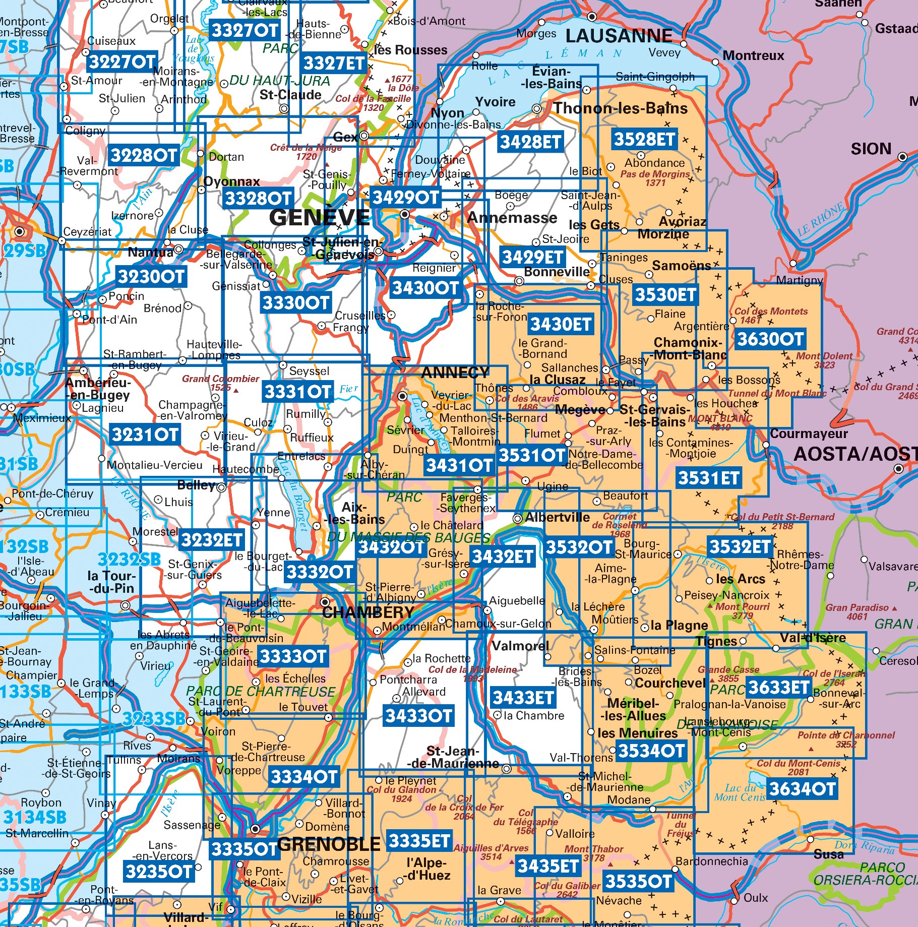
Producten op deze overzichtskaart:
Klik op een product om naar de pagina van dat product te gaan.
- Topografische kaart - Wandelkaart 3233 Le Grand-Lemps, Lac de Paladru, Voiron, Tullins | IGN - Institut Géographique National
- Wandelkaart - Topografische kaart 3333OT Massif de la Chartreuse Nord | IGN - Institut Géographique National
- Wandelkaart - Topografische kaart 3334OT Massif de la Chartreuse Sud | IGN - Institut Géographique National
- Wandelkaart - Topografische kaart 3335ET le Bourg d'Oisans - l'Alpe d'Huez | IGN - Institut Géographique National
- Wandelkaart - Topografische kaart 3335OT Grenoble | IGN - Institut Géographique National
- Wandelkaart - Topografische kaart 3335OTR Grenoble | IGN - Institut Géographique National
- Wandelkaart - Topografische kaart 3432ET Albertville | IGN - Institut Géographique National
- Wandelkaart - Topografische kaart 3432OT Massif des Bauges | IGN - Institut Géographique National
- Wandelkaart - Topografische kaart 3432OTR Massif des Bauges | IGN - Institut Géographique National
- Wandelkaart - Topografische kaart 3433ET Saint-Jean-de-Maurienne | IGN - Institut Géographique National
- Wandelkaart - Topografische kaart 3433OT Allevard | IGN - Institut Géographique National
- Wandelkaart - Topografische kaart 3435ET Valloire | IGN - Institut Géographique National
- Wandelkaart - Topografische kaart 3532ET les Arcs - la Plagne | IGN - Institut Géographique National
- Wandelkaart - Topografische kaart 3532OT Massif du Beaufortain | IGN - Institut Géographique National
- Wandelkaart - Topografische kaart 3534OT Les Trois Vallées | IGN - Institut Géographique National
- Wandelkaart - Topografische kaart 3535OT Névache - Mont Thabor | IGN - Institut Géographique National
- Wandelkaart - Topografische kaart 3633ET Tignes - Val d'Isère | IGN - Institut Géographique National
- Wandelkaart - Topografische kaart 3634OT Val Cenis | IGN - Institut Géographique National
Overzichtskaarten
Beschrijving
Dit product heeft meerdere varianten:
Reviews
Het is een enorme kaart en zeer gedetailleerd, maar toch ongeschikt als wandelkaart in die berggebieden. Te groot om tijdens wandelen en eigenlijk ook thuis om op te kijken. En er staan geen routes op. Bij plaatselijke touristinfo wel een goede wandelkaart met boekje kunnen kopen. Die had ik graag voor de vakantie bij jullie ook te koop gezien.
★★★★★ door Johanna Scholten 14 augustus 2023 | Heeft dit artikel gekochtVond u dit een nuttige review? (login om te beoordelen)
Snelle levering en mooie duidelijke kaart waardoor de voorpret op de vakantie al snel kon beginnen. Heerlijk om zo alvast de omgeving te "verkennen"!
★★★★★ door Marja Pappot 3 september 2018Vond u dit een nuttige review? (login om te beoordelen)
Erg gemakkelijk om kort voor de vakantie de juiste wandelkaart nog in huis te kunnen krijgen. Hierdoor hebben we ons vast kunnen voorbereiden.
★★★★★ door Wouter 17 augustus 2016Vond u dit een nuttige review? (login om te beoordelen)
Schrijf een review
Graag horen wij wat u van dit artikel vindt. Vindt u het goed, leuk, mooi, slecht, lelijk, onbruikbaar of erg handig: schrijf gerust alles op! Het is niet alleen leuk om te doen maar u informeert andere klanten er ook nog mee!


