Mandje Tel: +31503126950 Menu
Winkelwagen
Geen items in winkelwagen
Ga naar winkelwagen

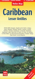
Wegenkaart - landkaart Lesser Antilles - Caraibisch gebied - Antillen | Nelles Verlag (9783865743268)

  • ISBN / CODE: 9783865743268
  • Editie: 10-04-2018
  • Aantal blz.: 1
  • Schaal: 1:2500000
  • Uitgever: Nelles Verlag
  • Soort: Wegenkaart
  • Taal: Engels, Duits
  • Hoogte: 25.0 cm
  • Breedte: 12.0 cm
  • Gewicht: 63.0 g
  • Uitvoering: Scheur- en watervast
  • Schrijf als eerste een review
  • 11,95

    Op voorraad. Binnen 2 - 3 werkdagen in huis in Belgie Levertijd Nederland Voor 17.00 uur op werkdagen besteld, binnen 1 tot 2 werkdagen in huis in Nederland Levertijd Belgie

    Gratis verzending in Nederland vanaf €35,-

Beschrijving

Goede wegenkaart van van een groot aantal eilanden. Aan beide kanten bedrukt. Met veel toeristische aanduidingen als nationale parken en culturele bezienswaardigheden. Prima leesbare kaart en zeker als overzichtskaart goed te gebruiken.

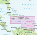
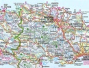
Folded road and tourist map of the Lesser Antilles Caribbean island chain at 1:2 500 000 scale. Places of interest, national parks, and beaches are all highlighted and shaded-relief colouring clearly depicts the topography.
 
The map includes insets showing Trinidad and Tobago at 1:500 000, the Virgin Islands at 1:250 000, Anegada at 1:250 000, St. Croix at 1:300 000, Anguilla and St. Martin at 1:300 000, St. Kitts and Nevis at 1:300 000, St. Barts at 1:300 000, Saba at 1:300 000, St. Eustatius at 1:300 000, Montserrat at 1:300 000, Aruba at 1:150 000, Curacao at 1:300 000, Bonaire at 1:300 000, Barbados at 1:300 000, The Grenadines at 1:300 000, Grenada at 1:300 000, St. Vincent and The Grenadines at 1:300 000, Canouan at 1:300 000, Barbuda at 1:300 000, Antigua at 1:300 000, Saint Lucia at 1:300 000, Guadeloupe at 1:325 000, La Desirade at 1:325 000, Martinique at 1:325 000, and Dominica at 1:300 000. The legend is in three languages, including English.
 
For over 20 years Nelles maps have been renowned throughout the world for their quality, faithfulness to detail and up-to-dateness. 
 
So that streets, ferry links, railway lines, etc are always up to date, Nelles are continuously upgrading their maps - with the help of their international team of correspondents. Roads are provided with an exact kilometerage. Sights are highlighted extra clearly so that you don't miss any tourist attractions.
 
A good map must be hard-wearing and allow itself to be folded up simply and quickly. Nelles Maps are a handy pocket size with the reliable, practical concertina fold. In addition they use an extra high-quality speciality paper resulting in considerably increased fold strength.


Reviews

Geen reviews gevonden voor dit product.

Schrijf een review

Graag horen wij wat u van dit artikel vindt. Vindt u het goed, leuk, mooi, slecht, lelijk, onbruikbaar of erg handig: schrijf gerust alles op! Het is niet alleen leuk om te doen maar u informeert andere klanten er ook nog mee!