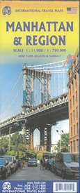
Stadsplattegrond - Wegenkaart - landkaart Manhattan & regio | ITMB (9781771294942)
- ISBN / CODE: 9781771294942
- Editie: 01-12-2024
- Druk: 5
- Aantal blz.: 1
- Schaal: 1:11000
- Uitgever: ITMB
- Soort: Stadsplattegrond, Wegenkaart
- Taal: Engels
- Hoogte: 25.0 cm
- Breedte: 10.0 cm
- Gewicht: 109.0 g
- Uitvoering: Scheur- en watervast
- Bindwijze: -
- Beoordeling: 5,0 ★★★★★ (1 review) Schrijf een review
-
€ 12,95
Op voorraad. Voor 17.00 uur op werkdagen besteld, binnen 1 tot 2 werkdagen in huis in Nederland Levertijd Belgie
Gratis verzending in Nederland vanaf €35,-
Beschrijving
Van de uitgever
Stadsplan Manhattan & wegenkaart New York regio en Metro - Boston tot Washington
On one side you will find a detailed map of the streets of Manhattan, with a map of the city, a map of the subway, an index of streets. Some tourist information is identified with symbols: attractions, shopping streets, museums, religious buildings, theaters, department stores, pedestrian streets.
On the other side you will find a road map of New York region, subway, Boston to Washington corridor.
Reviews
De plattegrond geeft ons een duidelijk overzicht van dit stuk van New York waar wij in het najaar 2013 naar toe gaan. De plattegrond voldoet volledig aan mijn verwachtingen.
★★★★★ door Paul Blikslager 7 januari 2013Vond u dit een nuttige review? (login om te beoordelen)
Schrijf een review
Graag horen wij wat u van dit artikel vindt. Vindt u het goed, leuk, mooi, slecht, lelijk, onbruikbaar of erg handig: schrijf gerust alles op! Het is niet alleen leuk om te doen maar u informeert andere klanten er ook nog mee!


