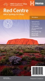
Wegenkaart - landkaart Iconic Map The Red Centre - Alice Spring to Uluru - Australië | Hema Maps (9781925625745)
- ISBN / CODE: 9781925625745
- Editie: 01-05-2019
- Druk: 7
- Aantal blz.: 1
- Schaal: 1:550000
- Uitgever: Hema Maps
- Soort: Wegenkaart
- Serie: Iconic Map
- Taal: Engels
- Hoogte: 25.0 cm
- Breedte: 14.0 cm
- Gewicht: 89.0 g
- Uitvoering: Papier
- Bindwijze: -
- Schrijf als eerste een review
-
€ 15,95
Op voorraad. Voor 17.00 uur op werkdagen besteld, morgen in huis in Nederland Levertijd Belgie
Gratis verzending in Nederland vanaf €35,-
Beschrijving
Detailkaart van een deel van Australië. Zeer goed leesbaar, met naast de topografische details veel symbolen waarmee allerhande toeristische zaken worden aangeduid als campsites, nationale parken, attracties, wandelmogelijkheden etc.
Reviews
Geen reviews gevonden voor dit product.
Schrijf een review
Graag horen wij wat u van dit artikel vindt. Vindt u het goed, leuk, mooi, slecht, lelijk, onbruikbaar of erg handig: schrijf gerust alles op! Het is niet alleen leuk om te doen maar u informeert andere klanten er ook nog mee!


