
Kaarten
De beste wegenkaarten, routekaarten, fiets- of wandelkaarten en topografische kaarten vindt u hier!
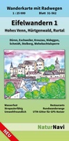 Wandelkaart 31-562 Eifelwandern 1 - Hohes Venn, Hürtgenwald, Rurtal | NaturNavi
Uitstekende geplastificeerde wandelkaart van de Eifel • Sehr genaue und aktuelle topografische Kartographie im Ideal-Maßstab 1 : 25 000 • Detaillierte Wander- und Radwege inkl. Rund- und Fernwege • …
★★★★★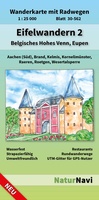 Wandelkaart 30-562 Eifelwandern 2 - Belgisches Hohes Venn - Hoge Venen, Eupen | NaturNavi
Uitstekende geplastificeerde wandelkaart van de Eifel • Sehr genaue und aktuelle topografische Kartographie im Ideal-Maßstab 1 : 25 000 • Detaillierte Wander- und Radwege inkl. Rund- und Fernwege • …
★★★★★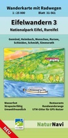 Wandelkaart 31-561 Eifelwandern 3 - Nationalpark Eifel, Rureifel | NaturNavi
Uitstekende geplastificeerde wandelkaart van de Eifel • Sehr genaue und aktuelle topografische Kartographie im Ideal-Maßstab 1 : 25 000 • Detaillierte Wander- und Radwege inkl. Rund- und Fernwege • …
★★★★★★★★★★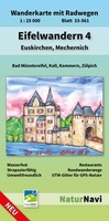 Wandelkaart 33-561 Eifelwandern 4 - Euskirchen, Mechernich | NaturNavi
Uitstekende geplastificeerde wandelkaart van de Eifel • Sehr genaue und aktuelle topografische Kartographie im Ideal-Maßstab 1 : 25 000 • Detaillierte Wander- und Radwege inkl. Rund- und Fernwege • …
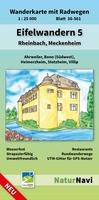 Wandelkaart 36-561 Eifelwandern 5 - Rheinbach, Meckenheim | NaturNavi
Uitstekende geplastificeerde wandelkaart van de Eifel • Sehr genaue und aktuelle topografische Kartographie im Ideal-Maßstab 1 : 25 000 • Detaillierte Wander- und Radwege inkl. Rund- und Fernwege • …
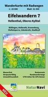 Wandelkaart 31-559 Eifelwandern 7 - Hellenthal, Oberes Kylltal | NaturNavi
Uitstekende geplastificeerde wandelkaart van de Eifel • Sehr genaue und aktuelle topografische Kartographie im Ideal-Maßstab 1 : 25 000 • Detaillierte Wander- und Radwege inkl. Rund- und Fernwege • …
★★★★★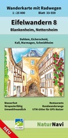 Wandelkaart 33-559 Eifelwandern 8 - Blankenheim, Nettersheim | NaturNavi
Uitstekende geplastificeerde wandelkaart van de Eifel • Sehr genaue und aktuelle topografische Kartographie im Ideal-Maßstab 1 : 25 000 • Detaillierte Wander- und Radwege inkl. Rund- und Fernwege • …
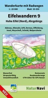 Wandelkaart 35-559 Eifelwandern 9 - Hohe Eifel (Nord), Ahrgebirge | NaturNavi
Uitstekende geplastificeerde wandelkaart van de Eifel • Sehr genaue und aktuelle topografische Kartographie im Ideal-Maßstab 1 : 25 000 • Detaillierte Wander- und Radwege inkl. Rund- und Fernwege • …
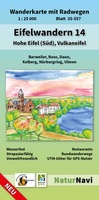 Wandelkaart 35-557 Eifelwandern 14 - Hohe Eifel (Süd), Vulkaneifel | NaturNavi
Uitstekende geplastificeerde wandelkaart van de Eifel • Sehr genaue und aktuelle topografische Kartographie im Ideal-Maßstab 1 : 25 000 • Detaillierte Wander- und Radwege inkl. Rund- und Fernwege • …
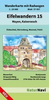 Wandelkaart 37-557 Eifelwandern 15 - Mayen, Kaisersesch | NaturNavi
Uitstekende geplastificeerde wandelkaart van de Eifel • Sehr genaue und aktuelle topografische Kartographie im Ideal-Maßstab 1 : 25 000 • Detaillierte Wander- und Radwege inkl. Rund- und Fernwege • …
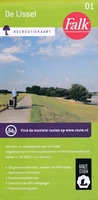 Wandelkaart - Fietskaart 01 Recreatiekaart De IJssel | Falk
Alle fiets en wandelpaden aan de IJssel. Uitgebreid met het fietsroutenetwerk met fietsknooppunten en het Hanzestedenpad/ 18 gemarkeerde fiets-, wandel- en MTB-routes Toeristische informatie Evenementenkalender Overzicht van VVV verstigingen Plaatsnamenregister
★★★★★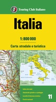 Wegenkaart - landkaart 11 Italia - Italië | Touring Club Italiano
Duidelijke tweezijdige wegenkaart van heel Italië op een schaal van1:800.000. Mooie wegen zijn net als bijvoorbeeld bij Michelin met groen aangegeven. Met een register en meertalig, ook Engels en Frans. …
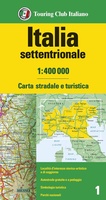 Wegenkaart - landkaart 1 Italia Nord settentrionale - Noord Italië | Touring Club Italiano
Duidelijke wegenkaart van noord Italië. gedrukt op een soort scheur- en watervast papier. Meertalig, ook Frans en Engels. Met aanduiding van toeristische hoogtepunten en mooie wegen worden met groen extra …
★★★★★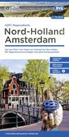 Fietskaart ADFC Regionalkarte Noord Holland - Amsterdam | BVA BikeMedia
Zeer goede heldere, betrouwbare kaart met ingetekend alle bewegwijzerde routes en de fietsknooppunten * Zeer gedetailleerde kaart * Vermelding van verkeersdrukte * Vermelding van type wegdek * Hellingen worden …
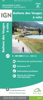 Fietskaart 09 Velo Ballons des Vosges a Velo | IGN - Institut Géographique National
Dit is een duidelijke fietskaart van een bepaald gebied in Frankrijk. Bedenk wel dat er nauwelijks aparte fietspaden bestaan, het is dan ook vooral een gedetailleerde kaart waarop route-suggesties staan …
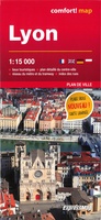 Stadsplattegrond Comfortmap Lyon | ExpressMap
Heel handige stadsplattegrond van Lyon met naast het centrum ook een groot gedeelte van de buitenwijken. De kracht zit hem in het feit dat deze kaart in delen is geplastificeerd …
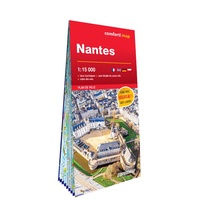 Stadsplattegrond Comfortmap Nantes | ExpressMap
Heel handige stadsplattegrond van Nantes met naast het centrum ook een groot gedeelte van de buitenwijken. De kracht zit hem in het feit dat deze kaart in delen is geplastificeerd …
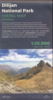 Wandelkaart Dilijan National Park – Hiking Topo Map Armenia | Cartisan
Detailed topographical map of Dilijan National Park and the surrounding area, highlighting available hiking routes including the long-distance Transcaucasian Trail and Janapar Trail, as well as the official national park …
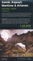 Wandelkaart Gomk, Kapuyt, Martiros & Artavan - Vayots Dzor | Cartisan
Detailed topographical map of the trail network connecting the villages of Gomk, Kapuyt, Martiros and Artavan in the Vayots Dzor province, central Armenia. The map includes the long-distance Transcaucasian Trail, …
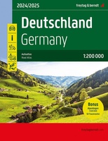 Wegenatlas Deutschland - Germany - Duitsland 2024-2025 | Freytag & Berndt
Der Straßenatlas "Deutschland 1:200.000" ist der ideale Wegbegleiter für alle die in Deutschland mit dem Auto unterwegs sind und dabei nicht nur Autobahnen und Schnellstraßen nutzen möchten.Mit dem detailreichen Kartenbild …
★★★★★
Laatste reviews

Prima koop
★★★★★ door Paul van Schelt 26 november 2024 | Heeft dit artikel gekocht
Het product wat ik van u heb ontvangen is prima !! maar voldoet niet geheel aan mijn verwachtingen want ik had een iets overzichtelijkere plattegrond …
★★★★★ door W. Breeschoten 26 november 2024 | Heeft dit artikel gekocht
De kaart NEPAL is netjes uitgevoerd en voldoet bijna aan mijn wensen : De plattegrond van KATHMANDU had ik liever iets uitvoeriger gezien en voorzien …
★★★★★ door Wout Breeschoten 26 november 2024 | Heeft dit artikel gekocht
Het is een mooi boekje, super handig. Beter dan de volwassen versie.
★★★★★ door Petra 26 november 2024 | Heeft dit artikel gekocht