
Kaarten
De beste wegenkaarten, routekaarten, fiets- of wandelkaarten en topografische kaarten vindt u hier!
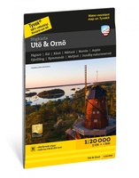 Wandelkaart Stikart Utö & Ornö stigkarta | Zweden | Calazo
Deze kaart beschrijft wandelpaden en natuurpaden op de eilanden Utö en Ornö. Hier vind je onder andere pareltjes zoals Utö Runt en Ålö Runt op Utö, en de Lervassastigen en …
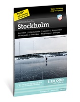 Wandelkaart Stockholm | Zweden | Calazo
De schaatskaart van Stockholm is de meest geavanceerde kaart ooit gemaakt met de behoeften van de schaatser in het middelpunt. De kaart is ontwikkeld in nauwe samenwerking met Mårten …
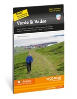 Wandelkaart Turkart Vardø & Vadsø | Noorwegen | Calazo
Buitenactiviteiten, fysieke activiteit, natuurbeleving en goede gezondheid zijn belangrijk voor de Finnmark Friluftsraad (Finnmark Outdoor Council). Hier zijn mogelijkheden voor gevarieerde tochten in alle seizoenen. Ons doel is dat steeds …
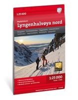 Wandelkaart Hoyfjellskart Lyngenhalvøya nord | Noorwegen | Calazo
Dit is een deel van de moderne kaartenserie van Calazo met een detailniveau dat nooit eerder is getoond over Lyngen. De terreininformatie op de kaart is gebaseerd op nieuwe gegevens …
 Wandelkaart Hoyfjellskart Lyngenhalvøya Sud | Noorwegen | Calazo
Dit is een deel van de moderne kaartenserie van Calazo met een detailniveau dat nooit eerder is getoond over Lyngen. De terreininformatie op de kaart is gebaseerd op nieuwe gegevens …
 Wandelkaart Hoyfjellskart Røldalsfjell | Noorwegen | Calazo
Dit is een deel van de moderne kaartenserie van Calazo met een detailniveau dat nooit eerder is getoond over de Røldalsfjell. De terreininformatie op de kaart is gebaseerd op nieuwe …
 Wandelkaart Hoyfjellskart Haukelifjell | Noorwegen | Calazo
Dit is een deel van de moderne kaartenserie van Calazo met een detailniveau dat nooit eerder is getoond over Haukelifjell. De terreininformatie op de kaart is gebaseerd op nieuwe gegevens …
 Wegenkaart - landkaart Kanada - Canada | Marco Polo
Marco Polo Canada Map: the ideal map for your trip Let the Marco Polo Canada Map guide you around this incredible country. Plan your great Canadian road trip with …
 Wegenkaart - landkaart Canada East Coast | ITMB
Canada is a vast country in area; inconceivably enormous in European terms. It is best mapped as a series of regional maps and this is the first of two maps …
 Wandelkaart Terrängkartor Södertälje Gnesta Åkers styckebruk | Zweden | Calazo
Calazo heeft drie kaartbladen ontwikkeld die het grootste deel van de provincie Södermanland bestrijken, met een focus op wandelen. Naast bijgewerkte informatie over de route van de Sörmlandsleden, hebben we …
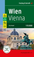 Stadsplattegrond City Pocket Wenen | Freytag & Berndt
Der City Pocket Stadtplan Wien 1:15.000 zeigt die Innenstadt von Wien und bietet auf der Rückseite zahlreiche Zusatzinformationen und mehrsprachige Tipps zu den Themen: Einkaufen, Kulinarik, Kultur, Nachtleben und Sehenswürdigkeiten. …
 Wegenkaart - landkaart Antarctic Explorer | Ocean Explorer Maps
An excellent foldout map of Antarctica. On one side there is a map of the Antarctic continent, around which succinct biographies of Antarctic explorers from William Spiers Bruce to Edward …
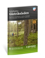 Wandelatlas Friluftsatlas Gästrikeleden | Zweden | Calazo
Voor de eerste keer zijn de etappekaarten van de hele Gästrikeleden verzameld op één plek. Speciaal ontwikkelde terreinkaarten op schaal 1:50.000 worden gepresenteerd in een handig boekformaat. Etappestarts, parkeerplaatsen, accommodaties, …
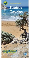 Wandelkaart 11.20 Gavdos | Anavasi
Wandelkaart op schaal 1:20.000 voor Gavdos. De wandelkaart van Gavdos, met de volledige topografische achtergrond van het eiland, omvat het gehele wegen- en wandelnetwerk. Op de achterkant van de kaart …
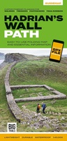 Wandelkaart Hadrian's Wall Path | Vertebrate Publishing
The 138-kilometre Hadrian's Wall Path traces a grey line along Great Whin Sill, the dolerite ridge chosen by the Romans for their historic wall. The route, one of Britain's most …
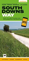 Wandelkaart South Downs Way | Vertebrate Publishing
The 162-kilometre South Downs Way begins in Winchester and traces a ridgeline along the rolling, green South Downs to the coast at Eastbourne. It is rightly regarded as one of …
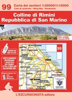 Wandelkaart 99 Colline di Rimini, Repubblica di San Marino | L'Escursionista editore
Wandel- en mountainbikekaart van de heuvels van Rimini (1:25.000) en de Republiek San Marino (1:15.000) met kilometerraster. Paden in het gebied onderzocht met GPS-satellietapparatuur. Gedrukt op milieuvriendelijke, scheurvaste en waterdichte …
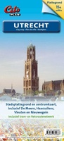 Stadsplattegrond Citoplan Utrecht | Buijten & Schipperheijn
– praktisch voor wandelaar, fietser en automobilist – overzichtskaartje van de regio met hoofdverkeersstructuur, afrit- en wijknaamgeving – vergrote centrumkaart van Utrecht 1 : 10.000 – alle straatnamen, belangrijke en …
★★★★★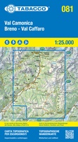 Wandelkaart 081 Val Camonica - Breno - Val Caffaro | Tabacco Editrice
De beste wandelkaarten voor de Dolomieten. Zeer veel topografische details met secure hoogtelijnen (25 meter interval), helder kleurgebruik en bijna alle Tabacco kaarten hebben een UTM grid (voor GPS toepasbaar). …
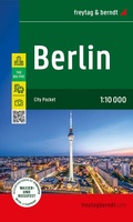 Stadsplattegrond City Pocket Berlin | Berlijn | Freytag & Berndt
De City Pocket stadskaart Berlijn 1:10.000 toont het stadscentrum van Berlijn en biedt op de achterkant talloze aanvullende informatie en meertalige tips over de onderwerpen: winkelen, gastronomie, cultuur, nachtleven en …
Laatste reviews

Ik heb deze kaart gebruikt bij het wandelen van Zuid naar Noord Lanzarote. De kaart blijft zelfs goed bij vouwen en buigen.
★★★★★ door saar 25 november 2024 | Heeft dit artikel gekocht
Goede kaart, waterbestendig
★★★★★ door Bas 25 november 2024 | Heeft dit artikel gekocht
Was een hele goede keuze geweest. Enorm tevreden.
★★★★★ door Annet kriesels-Potters 25 november 2024 | Heeft dit artikel gekocht
zie boven
★★★★★ door Sabine Cohen 25 november 2024 | Heeft dit artikel gekocht