Cicerone
Fijne wandelgidsen en fietsgidsen van Cicerone voor wandelaars, hikers & fietsers
 Wandelgids - Fietsgids Hiking and Cycling the California Missions Trail - Californie | Cicerone
Guidebook to hiking or cycling the 800 mile (1289km) California Missions Trail between San Francisco Bay and San Diego. The pilgrimage trail takes in 21 historic Spanish missions and can …
 Wandelgids Beieren - Walking in the Bavarian Alps | Cicerone
Wandelgids met dagtochten: goed beschreven met veel praktische informatie om de route te kunnen lopen, inclusief redelijke kaarten. Enorm veel keus in een groot gebied! This guidebook of walks explores …
 Wandelgids 15 Short Walks Cornwall: Land's End and Penzance | Cicerone
 Wandelgids Japan's Kumano Kodo Pilgrimage | Cicerone
Guidebook to Japan's Kumano Kodo, a series of UNESCO-listed pilgrimage routes that crisscross the mountainous Kii peninsula, south of Osaka. Centred on three Shinto-Buddhist shrines known as the Kumano Sanzan, …
 Wandelgids Norway - North hiking | Cicerone
 Wandelgids Trekking in the Stubaier Alps | Cicerone
Uitstekende wandelgids van Cicerone over de Stubaier Alpen, waarbij de nadruk ligt op een tweetal meerdaagse routes: Huttentochten voor een gemiddelde en wat meer gevorderde wandelaar. Goede praktische informatie, kaartmateriaal …
★★★★★ Wandelgids The Skye Trail | Cicerone
Guidebook to the Skye Trail, a challenging 80-mile (128km) trek that snakes its way north–south across the largest island in Scotland’s Inner Hebrides. This unofficial, week-long route is ideal for …
 Wandelgids The Cape Wrath Trail | Cicerone
Uitstekende wandelgids die in etappes de route nauwkeurig beschijft. A guidebook to the Cape Wrath Trail, a long-distance trek through the Scottish Highlands from Fort William to Cape Wrath. The …
★★★★★ Wandelatlas The Great Glen Way | Cicerone
Handzaam gidsje met alleen de topografische routekaarten van 1:25000. De uitgebreide wandelgids (inclusief dit gidsje) is hier te bestellen. This booklet of Ordnance Survey 1:25,000 Explorer maps has been designed …
★★★★★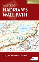 Wandelatlas Hadrian's Wall Path Map Booklet | Cicerone
All the mapping you need to walk the 84 mile (135km) Hadrian's Wall Path from Bowness-on-Solway in Cumbria to Wallsend, Newcastle. This booklet of Ordnance Survey 1:25,000 Explorer maps has …
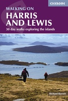 Wandelgids Harris and Lewis – Outer Hebrides, Hebriden Schotland | Cicerone
Uitstekende wandelgids van dit geweldige gebied. goed beschreven met veel praktische informatie om de route te kunnen lopen, inclusief goede kaarten. This guidebook describes 30 day walks all over the …
★★★★★ Wandelgids Trekking The Kungsleden | Cicerone
Sweden's most famous long-distance trail, the Kungsleden (King's Trail) traverses the land of the Sámi people and the midnight sun, stretching 460km between Abisko and Hemavan. Around half the route …
★★★★★ Wandelgids Tour of the Jungfrau Region - Berner Oberland | Cicerone
Trekkinggids met de gedetailleerde beschrijving van de klassieke Jungfrau-trek, maar ook varianten. Goede etappe-beschrijvingen met veel praktische info. The Tour of the Jungfrau Region is described as a clockwise hut-to-hut …
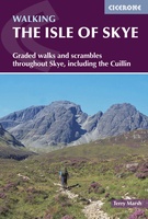 Wandelgids The Isle of Skye | Cicerone
Uitstekende wandelgids, sommige meerdaags, voor dit uitdagende wandelgebied in Schotland. This third edition of Terry Marsh’s walking and scrambling guide to Skye, the Hebrides, northwest Scotland, updated using digital mapping …
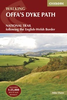 Wandelgids The Offa's Dyke Path - Wales | Cicerone
Engelstalige beschrijving van de mooiste wandeltocht in Wales. De gids voldoet aan alle verwachtingen die je kunt hebben, het enige dat je mist is een overzichtskaart. Inclusief gidsje met routekaarten …
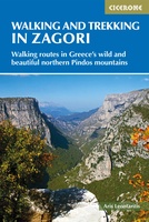 Wandelgids Walking and Trekking in the Zagori | Cicerone
Uitstekende wandelgids van Zagori. Goed beschreven met veel praktische informatie om de routes te kunnen lopen, inclusief redelijke kaarten. Zagori in Greece's Northern Pindos National Park is among the last …
★★★★★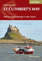 Wandelgids St Cuthbert's Way | Cicerone
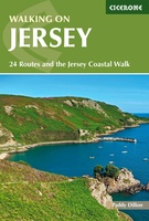 Wandelgids Walking on Jersey | Cicerone
This guidebook to Walking on Jersey describes 24 coastal and inland walks, ranging from 2 to 8 miles in length, visiting St Helier, St Aubin, St John, St Ouen and …
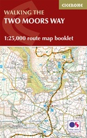 Wandelkaart Two Moors Way map Booklet | Cicerone
 Wandelgids The Two Moors Way | Cicerone
Uitstekende wandelgids van de Two Moors Way, waarbij naast alle noodzakelijke informatie ook gebruik gemaakt wordt van de echte topografische kaart. inclusief gidsje met routekaarten van 1:25000 This guidebook to …
Laatste reviews

Deze kaarten gebruik ik om mooie wandelingen uit te zetten, die ik dan met mijn liefste meisje beloop. Dank u wel voor de snelle adequate …
★★★★★ door Jacques Marks 03 december 2024 | Heeft dit artikel gekocht
Ook ik ben een zwerver, maar gelukkig niet dakloos. Deze kaarten gebruik ik om mooie wandelingen uit te zetten, die ik dan met mijn liefste …
★★★★★ door Jacques Marks 03 december 2024 | Heeft dit artikel gekocht
Perfect👍
★★★★★ door Wilma & Mari 03 december 2024 | Heeft dit artikel gekocht
Vooralsnog ben ik tevreden met de kaart. Hij werd vlot bezorgd en ik kan hem goed lezen. De echte proof of the pudding vindt echter …
★★★★★ door Jan Piebe Tjepkema 03 december 2024 | Heeft dit artikel gekocht


