
National Geographic
Dit bekende tv-kanaal heeft naast prachtige natuurdocumontaires en magazines ook zijn eigen reisgidsen en wegenkaarten uitgegeven. De landkaarten zijn gedrukt op scheurvast en waterbestendig papier wat een vergrootte levensduur betekent. De kaarten zijn helder en bevatten een schat aan informatie voor zowel de 'gewone' toerist als de avonturier. De hoofdwegen zijn duidelijk aangegeven, maar ook de secundaire wegen en tracks staan er op. Met de nationale parken duidelijk en mooie zwemplekken of attracties aangegeven onderscheidt deze kaartenserie zich van de andere wegenkaarten. De kaarten heten dan ook niet voor niets Adventure Maps! Het avontuur wacht!
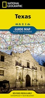 Wegenkaart - landkaart State Guide Map Texas | National Geographic
Makkelijk leesbare kaart aan 2 zijden bedrukt. De ene kan met informatie en beperkte stadsplattegronden, de andere met de daadwerkelijke kaart. De kaart is geplastificeerd en dus watervast! Expertly researched …
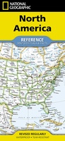 Wegenkaart - landkaart North America - Noord Amerika | National Geographic
• Waterproof • Tear-Resistant • Reference Map Expertly researched and designed, National Geographic's North America Flags & Facts Map is the authoritative map of North America by which other …
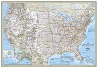 Wandkaart USA - Verenigde Staten Political, 178 x 124 cm | National Geographic
Het klassieke kaartbeeld van National Geographic, de grenzen van de staten van Amerika zijn apart gekleurd. De wandkaart is heel gedetailleerd met veel plaatsen, wegen, rivieren en nationale parken, het …
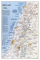 Wandkaart Holy Land – Israël, 53 x 80 cm | National Geographic
National Geographic Wall Maps offer a special glimpse into current and historical events, and they inform about the world and environment. Offered in a variety of styles and formats, these …
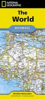 Wegenkaart - landkaart Wereld + vlaggen + info per land | National Geographic
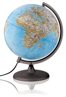
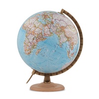 Wereldbol - Globe Gold Classic Blauw ø 30 cm | Engelstalig | Met Verlichting | National Geographic
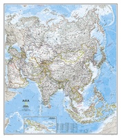 Wandkaart Azië, politiek, 84 x 96 cm | National Geographic
Mooie wandkaart van Azië, staatkundig, met rustig kleurgebruik en helder kaartbeeld, Ondanks het wat kleiner formaat staan er toch heel wat topografische details op vermeld. The map presents Asia …
 Wereldbol - Globe Classic Ø30 Nederlands met Verlichting | National Geographic
Deze verlichte wereldbol/globe van National Geographic (30 cm) met blauwe oceaan bevat meer dan 3800 plaatsnamen in het Nederlands. De tekst is duidelijk en elk land is afgebeeld in een …
★★★★★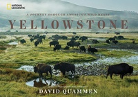 Fotoboek Yellowstone | National Geographic
Best-selling author David Quammen takes readers on a breathtaking journey through America's most inspiring and imperiled ecosystem--Yellowstone National Park--in this monumental book on America's first national park. Yellowstone's storied past, …
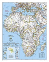 Wandkaart Afrika, politiek, 91 x 118 cm | National Geographic
Mooie wandkaart van Afrika, staatkundig, met rustig kleurgebruik en helder kaartbeeld, Ondanks het wat kleiner formaat staan er toch heel wat topografische details op vermeld. The map presents Africa …
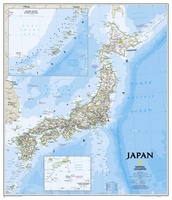 Wandkaart Japan, 63 x 74 cm | National Geographic
This classic-style map of Japan shows political boundaries, major highways and roads, cities and towns, airports, and other geographic details. Thousands of place-names and exact borders are carefully researched by …
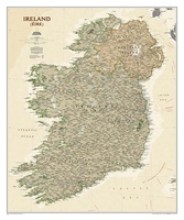 Wandkaart Ierland, antiek, 76 x 92 cm | National Geographic
National Geographic Maps' new Ireland wall map is one of the most authoritative maps yet published of the Emerald Isle. Of the nearly 1,000 place-names shown on this map, all …
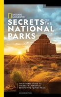 Reisgids National Geographic Secrets of the National Parks, 2nd Edition | National Geographic
Discover a side of America's national parks that you've never seen before with more than 500 tips and tricks for getting away from the crowds, exploring little-known hikes, and finding …
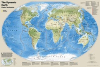 Wereldkaart Dynamic earth plate tectonics, 92 x 61 cm | National Geographic
The new Dynamic Earth wall map illustrates plate tectonics and features new bathymetry and naturally colored relief, as well as current volcano and earthquake data. Notable earthquakes and eruptions lists …
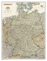 Wandkaart Duitsland, antiek, 60 x 77 cm | National Geographic
Complete political actual detail of Germany - country boundaries, roads and cities, airports, bodies of water, and other geographic details in antique style.
 Fotoboek America the Beautiful | National Geographic
"America the Beautiful' showcases the stunning spaces closest to our nation's heart--from the woods in the Great Appalachian Valley that Davy Crockett once called home to the breathtaking sweep of …
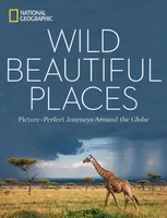 Fotoboek Wild, Beautiful Places | National Geographic
National Geographic photography captures the world's most remote, exotic places in this visually stunning travel book full of scenic wonders to experience. Highlighting 50 of Earth's most pristine, scenic locales, …
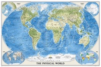 Wereldkaart Natuurkundig, oceaanbodem, 116 x 77 cm | National Geographic
Bijzonder fraaie natuurkundige kaart van National Geographic waarbij het accent ligt op de fysische aspecten van de aarde met veel details van de oceanen. Een schoonheid aan de muur! …
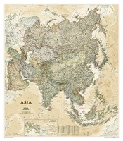 Wandkaart Azië, politiek & antiek, 84 x 96 cm | National Geographic
Mooie wandkaart van Azië, staatkundig, met rustig kleurgebruik en helder kaartbeeld; deze kaart heeft een antieke uitstraling door gebruik van aarde-kleuren. Ondanks het wat kleine formaat staan er toch heel …
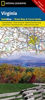 Wegenkaart - landkaart State Guide Map Virginia | National Geographic
Makkelijk leesbare kaart aan 2 zijden bedrukt. De ene kan met informatie en beperkte stadsplattegronden, de andere met de daadwerkelijke kaart. De kaart is geplastificeerd en dus watervast! The front …
★★★★★
Laatste reviews

Klein en handig compact boekje, perfect om mee te nemen voor op vakantie!!!👍🏼
★★★★★ door Mathias 11 december 2024 | Heeft dit artikel gekocht
Duidelijk, makkelijk in gebruik en mijn man (het was een kadootje voor hem)stippelt allerlei interessante tochtjes uit met jullie fijne kaarten!
★★★★★ door Joke Erkens 10 december 2024 | Heeft dit artikel gekocht
Met het arriveren van deze prachtige en overzichtelijke wegenkaart is de voorpret van het plannen van de vakantie begonnen. Ik vind het heerlijk om gebogen …
★★★★★ door Carl 10 december 2024 | Heeft dit artikel gekocht
prima kaart - goede schaal om op te lopen - veel toeristische info
★★★★★ door herman de swart 09 december 2024 | Heeft dit artikel gekocht