
Wandkaarten van landen - Europa
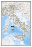 Wandkaart Italy – Italië, 59 x 87 cm | National Geographic
Decoratieve wandkaart van Italië. Naast de mooie kleuren staan er bijzonder veel plaatsen op vermeld. This Italy Wall Map by National Geographic contains extensive political information with political boundaries clearly …
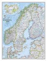
★★★★★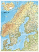 Wandkaart Scandinavië en IJsland, 75 x 100 cm | Norstedts
Prachtige wandkaart van Scandinavië met een inzet van IJsland. Hele duidelijke kaart waar door het kleurgebruik de natuurkundige aspecten als hoogte, bergen en fjorden heel goed uitkomt. Daarnaast zjin er …
★★★★★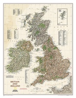 Wandkaart Groot Brittannië en Ierland antiek, 60 x 76 cm | National Geographic
This map of Britain and Ireland shows country boundaries, thousands of place names, major roadways, airports, bodies of water, and more. Rich earth-toned colors, astounding detail and boardroom quality make …
★★★★★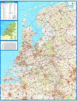 Wandkaart 34 Nederland Basic, 100 x 130 cm | Falk
Wandkaart - Falk Nederland met een formaat van 130 (h) X 100 (b) cm. Het is een zeer gedetailleerde en duidelijke wandkaart, met veel plaatsen, wegen met wegnummers, afritten. Deze …
★★★★★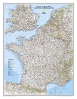 Wandkaart Frankrijk, België en Nederland, 60 x 77 cm | National Geographic
>Our classic wall map of France, Belgium, and the Netherlands shows political boundaries, major highways and roads, cities and towns, and a wealth of other incredibly accurate geographic detail. …
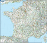 Wandkaart Frankrijk – France, 111 x 100 cm | Michelin
Dubbelzijdig geplastificeerde wandkaart van de klassieke overzichtskaart van Michelin Frankrijk. Als altijd zeer overzichtelijk en voorzien van een mooie heldere kleurstelling. Prachtig aan de muur! Op deze kaart is het wegennet identiek …
★★★★★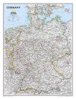 Wandkaart Germany – Duitsland, 58 x 76 cm | National Geographic
Decoratieve wandkaart van Duitsland. Naast de mooie kleuren staan er bijzonder veel plaatsen op vermeld. National Geographic's political map of Germany includes everything from country boundaries, major roads, towns …
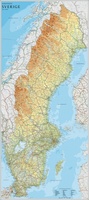 Wandkaart Zweden, 79 x 177 cm | Norstedts
Een grote kaart van Zweden voor aan de muur. Decoratieve kleuren tonen verschillende hoogten en Zweedse bergketens. Belangrijke wegen, spoorwegen en steden zijn duidelijk herkenbaar. Wordt geleverd op rol …
★★★★★ Wandkaart Scandinavië en Ijsland, 60 x 77 cm | National Geographic
National Geographic Wall Maps offer a special glimpse into current and historical events, and they inform about the world and environment. Offered in a variety of styles and formats, these …
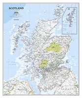 Wandkaart Schotland, 76 x 91 cm | National Geographic
This new map of Scotland, features our rich, antique-inspired Executive style. This beautiful map includes thousands of place names, accurate political boundaries, national parks, archeological sites, and major infrastructure networks …
★★★★★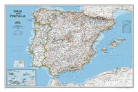 Wandkaart Spain - Spanje & Portugal 83 x 55 cm | National Geographic
This classic-style map of Spain and Portugal shows political boundaries, major highways and roads, cities and towns, airports and other geographic details. Thousands of place-names and exact borders are carefully …
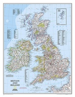 Wandkaart Britain and Ireland - Groot Brittannië en Ierland, 60 x 76 cm | National Geographic
This classic-style map of England and Wales shows political boundaries, major highways and roads, cities and towns, airports, and other geographic details. Thousands of place-names and exact borders are carefully …
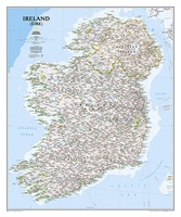 Wandkaart Ireland – Ierland, 76 x 91 cm | National Geographic
National Geographic Maps' new Ireland wall map is one of the most authoritative maps yet published of the Emerald Isle. Of the nearly 1,000 place-names shown on this map, all …
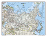 Wandkaart Russia – Rusland, 77 x 60 cm | National Geographic
Our classic wall map of Russia and the independent states of the former Soviet Union shows thousands of place names, roadways, political boundaries, bodies of water, airports, and many other …
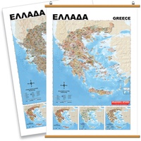 Wandkaart Griekenland Natuurkundig, 70 x 100 cm | Orama
Mooie natuurkundige kaart van Griekenland met namen in het Grieks.
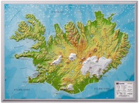 Wandkaart - Reliëfkaart IJsland met voelbaar 3D reliëf 42 x 30 cm | GeoRelief
Prachtig vormgegeven wandkaart van IIsland met reliëf. Uitgevoerd in stevig kunststof is IJsland vanzelfsprekend een land dat zich bij uitstek leent voor een 3D kaart: zo komen de bergmassieven, maar …
★★★★★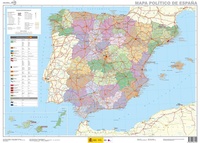 Wandkaart Spanje, 70 x 50 cm | CNIG - Instituto Geográfico Nacional
Administrative provinces of Spain shown in bright colours on a wall map at 1:2,250,000, size 70 x 50cm (27.5" x 20" approx), from IGN/CNIG - the country’s civilian survey organization, …
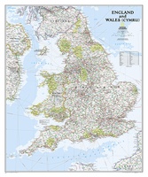 Wandkaart Engeland en Wales, 76 x 92 cm | National Geographic
This classic-style map of England and Wales shows political boundaries, major highways and roads, cities and towns, airports, and other geographic details. Thousands of place-names and exact borders are carefully …
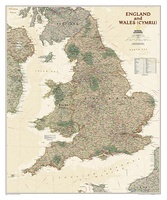 Wandkaart Engeland en Wales, antiek, 76 x 91 cm | National Geographic
This earth-toned, executive-style map of England and Wales shows political boundaries, major highways and roads, cities and towns, airports, and other geographic details. Thousands of place-names and exact borders are …
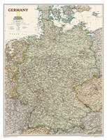 Wandkaart Duitsland, antiek, 60 x 77 cm | National Geographic
Complete political actual detail of Germany - country boundaries, roads and cities, airports, bodies of water, and other geographic details in antique style.
Laatste reviews

Op de hoogte gehouden van de vertraging. Zodra binnen, snel verstuurd. Hartelijk dank!
★★★★★ door Els van Blokland 24 april 2024 | Heeft dit artikel gekocht
Wij zijn erg blij met deze wandelkaart, alles staat zeer duidelijk aangegeven, voordeel is dat de kaart geplastificeerd is, deze kaart is het geld zeker …
★★★★★ door Rene van den Driesche 24 april 2024 | Heeft dit artikel gekocht
Uit het ruime aanbod kaarten een kaart met veel details gekozen, waarmee de voorbereiding van reis leuk wordt
★★★★★ door Ad 24 april 2024 | Heeft dit artikel gekocht
Handige informatieve kaart van de kust van Normandie van D Day.Wij gebruiken de kaart voor het voorbereiden van de Herdenking 80 jaar.
★★★★★ door Mary 24 april 2024 | Heeft dit artikel gekocht