
North East England
 Wandelkaart The Coast to Coast Map Booklet | Cicerone
All the mapping you need to complete the 185-mile (296km) unwaymarked Coast to Coast Walk from St Bees in Cumbria to Robin Hood's Bay, North Yorkshire. This booklet of …
 Wandelkaart Dales Way | Harvey Maps
Mooie, duidelijke kaart van de Dales Way in Noord-Engeland. Geplastificeerd met veel extra informatie en uitsnedes van de route. A leap forward in technical excellence: Tough, durable and 100% …
 Wandelkaart Northumberland Coast Path and Berwickshire Coastal Path | Harvey Maps
Mooie, duidelijke kaart van de Northumberland Coast Path en het vervolg daarop de Berwickshire Coastal Path in Noord-Engeland en Schotland. Geplastificeerd met veel extra informatie en uitsnedes van de route. …
 Wandelkaart Settle to Carlisle Way | Harvey Maps
Mooie, duidelijke kaart van de Settle to Carlisle Way in Noord-Engeland. Geplastificeerd met veel extra informatie en uitsnedes van de route. Settle Carlisle Way is a walking route linking the …
 Wandelkaart St Oswald's Way | Harvey Maps
Mooie, duidelijke kaart van de St Oswald's Way Noord-Engeland. Geplastificeerd met veel extra informatie en uitsnedes van de route. From Holy Island to Heavenfield, the 97 mile St Oswald's …
 Fietsgids Lost Lanes North | Wild Things Publishing
Jack Thurston, best-selling author of the Lost Lanes series (50,000 sold) and presenter of the Bike Show, takes you on a freewheeling tour of the lost lanes and forgotten byways …
 Fietsgids Hadrian's Cycleway | Cicerone
Hadrian's Cycleway is a 174 mile route from Ravenglass in Cumbria to South Shields. Also known as Route 72, this coast-to-coast route heads north up the Cumbrian coast to reach …
★★★★★ Campergids 96 nach England, der Norden | WOMO verlag
Tourenkarten Auf rund 4400 km in 11 Touren zu allen großen Attraktionen und weniger bekannten Orten in Nordengland reisen. Genaue Markierung freier Stell-, Bade-, Picknick-, Wander-, Pub- und Campingplätze incl. …
 Wegenkaart - landkaart Nord- und Mittelengland / Northern England & the Midlands | Reise Know-How Verlag
Hochreißfeste und 100% wasserfeste Landkarte "Nord- und Mittelengland" aus der Serie world mapping project, erschienen im Reise Know-How Verlag. Reise Know-How Landkarten zeichnen sich durch besonders stabiles Kunststoffpapier aus, …
 Reisgids British Breaks Newcastle and Northumbria | Rough Guides
Discover the best of Newcastle & Northumbria with this compact, practical, entertaining Pocket Rough Guide with a free eBook. This slim, trim treasure trove of trustworthy travel information is ideal …
★★★★★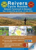 Fietskaart Reivers Cycle Routes | Northern Heritage Services
The long-distance Reivers Cycle Routes are two intertwining signed / waymarked bi-directional ‘coast to coast’ cycle routes between the North Sea and the Irish Sea. The original Reivers Cycle …
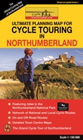 Fietskaart Cycle Touring Map of Northumberland | Northern Heritage Services
The official planner for recreational cycling and cycle touring in Northumberland and beyond. Version 3 printed 2020. Comprehensive list of promoted long distance cycle routes including: Coast and Castles …
★★★★★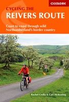 Fietsgids Cycling the Reivers Route | Cicerone
Guidebook to the Reivers Route, a 173 mile (280km) coast-to-coast cycle route across northern England and into Scotland from Tynemouth to Whitehaven. Exploring the rich history of traditional border territory, …
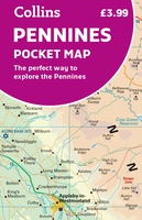 Wegenkaart - landkaart Pocket Map Pennines | Collins
Handy little full colour map of the Pennines. Main features of this map include: • Clear mapping • Main tourist attractions located and described • Ideal for touring with …
 Fietskaart 10 Cycling guides North York Moors | Goldeneye
Scheur- en watervast foetskaart van de North York Moors met ingetekende fietsroutes. Our maps are double-sided, printed on an A2 sheet with a concertina fold. This allows for easy …
 Wandelgids 087 Pathfinder Guides Northumberland | Ordnance Survey
Pathfinder® Guide to Northumberland, featuring 28 outstanding walks designed for a range of abilities covering 180 miles of walking. Features: 28 guided walks for a range of abilities …
 Wandelgids Park Rangers Favourite Walks Northumberland | Collins
The perfect companions for exploring the National Parks. Walking guide to the Northumberland National Park, with 20 best routes chosen by the park rangers. Each walk varies in length from …
 Fietskaart The C2C Cycle Route - Coast to Coast | Footprint maps
- Britains most popular loing distance route. - New clear mapping, based on OS data,ata a scale of 1:90 000 - Waterproof paper and compact size - Excellent value for …
 Wandelkaart Adventure Atlas Hadrian's Wall Path | A-Z Map Company
AZ heeft de meest gedetailleerde wandelkaarten van het Hadrian's Wall Path gebundeld in een atlasje. Daardoor is het heel handig qua formaat. De kaarten zelf zijn perfect voor het wandelen. …
 Wandelgids Walking in the Yorkshire Dales: South and West | Cicerone
Veelzijdige wandelgids van een deel van de Yorkshire Dales, goede kaarten en beschrijvingen en veel keuze uit een behoorlijk aantal wandelingen. Part of a two-book set, this guidebook describes 44 …
Laatste reviews

Kan de huidige ontstuimige ontwikkelingen wereldwijd, nu ook geografisch plaatsen en daarmee beter volgen.
★★★★★ door Leo Janssen 20 december 2024 | Heeft dit artikel gekocht
We hadden Piëmonte al eens bezocht en voor onze komende reis werd ons door kennissen deze gids aanbevolen. Inderdaad is dit een heel goede gids. …
★★★★★ door DWKdB 19 december 2024 | Heeft dit artikel gekocht
Mijn bestellingen zijn altijd goed en worden altijd op tijd geleverd. Komen afspraken goed na. Erg tevreden.
★★★★★ door Ben Wegdam 19 december 2024 | Heeft dit artikel gekocht
Zeer gedetailleerde kaart van het zuidelijke deel van het douaniers pad
★★★★★ door Marian 18 december 2024 | Heeft dit artikel gekocht