
🥾 South West Coast Path
 Wandelgids 11 The South West Coast Path | Aurum Press
Goede beschrijving van een deel van het beroemde South West Coast path in Cornwall. Men heeft gebruik gemaakt van zeer gedetailleerde kaarten van Ordnance Survey. The South West Coast Path …
★★★★★ Wandelgids Cornwall Coast Path | Trailblazer Guides
Wandelgids met uitgebreide beschrijvingen wandelingen en praktische informatie met eenvoudige kaarten van de wandelroutes. Practical, complete hiking route guide, with maps and accommodation for the 288-mile footpath that runs around …
★★★★★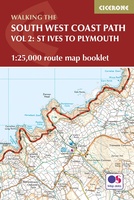 Wandelatlas South West Coast Path - Vol 2: St Ives to Plymouth | Cicerone
Heel handig bedacht van uitgever Cicerone: een boekje dat dienst doet als atlas met alle topografische kaarten die je nodig hebt voor het lopen van een gedeelte van de South …
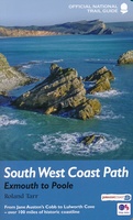
 Reisgids The South West Coast Path | Bloomsbury
Often featuring in lists of the world's best walks, the South West Coast Path is 630 miles long, and passes through two World Heritage Sites. This guide to the path …
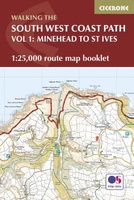 Wandelgids South West Coast Path Map Booklet | Cicerone
This booklet of Ordnance Survey 1:25,000 Explorer maps shows the northern part of the route between Minehead and St Ives, providing all the mapping you need to walk the trail …
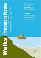 Wandelgids Ilfracombe to Padstow | Hallewell Publications
Walks Ilfracombe to Padstow features a selection of the best short walks from the section of South West Coast Path which runs between the towns of Ilfracombe in the north …
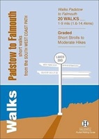 Wandelgids Padstow to Falmouth | Hallewell Publications
Walks Padstow to Falmouth features a selection of the best short walks from the section of South West Coast Path which runs between the towns of Padstow in the north …
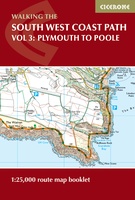 Wandelatlas South West Coast Path Map Booklet - Vol 3 | Cicerone
This booklet of Ordnance Survey 1:25,000 Explorer maps shows the full line of the section of the National Trail between Plymouth and Poole, providing all the mapping you need to …
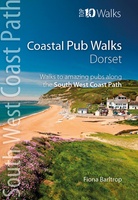 Wandelgids Coastal Pub Walks: Dorset | Northern Eye Books
Dorset’s best coastal pub walks The excellent pubs along the Dorset coast complement the walking on this superlative stretch of the South West Coast Path. Each walk incorporates a stretch …
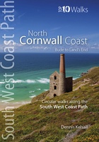 Wandelgids North Cornwall Coast | Northern Eye Books
Bude to Land’s End The ten walking routes featured here highlight the best short circular walks along the North Cornwall Coast section of the popular, 630-mile long South West Coast …
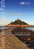 Wandelgids South Cornwall Coast | Northern Eye Books
Land’s End to Plymouth The ten walking routes featured here highlight the best short circular walks along the South Cornwall Coast section of the popular, 630-mile long South West Coast …
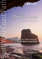 Wandelgids South Devon Coast | Northern Eye Books
Plymouth to Lyme Regis The ten walking routes featured here highlight the best short circular walks along the South Devon Coast section of the popular, 630-mile long South West Coast …
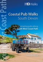 Wandelgids Coastal Pub Walks: South Devon | Northern Eye Books
South Devon’s best coastal pub walks The lovely pubs along the South Devon coast complement the walking on this superlative stretch of the South West Coast Path. Each walk incorporates …
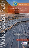 Wandelgids Wales Coast Path | Northern Eye Books
One of seven Official Guides to the Wales Coast Path The 115 mile/185km long South Wales Coast section of the Wales Coast Path runs through unexpectedly varied and dramatic …
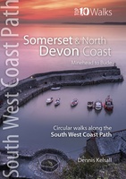 Wandelgids South West Coast Path: Somerset & North Devon | Northern Eye Books
Handzame wandelgids met 10 rondwandelingen rond het South West Coast Path. The ten walking routes featured here highlight the best short circular walks along the Somerset and North Devon …
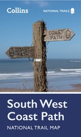 Wandelkaart National Trail Map South West Coast Path | Collins
Overzichtskaart op vrij grove schaal van deze LAW Lange Afstands Wandeling in Engeland. Let op: je kunt er niet op lopen. Wel met veel informatie op de kaart, goed ingetekend, …
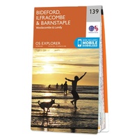 Wandelkaart - Topografische kaart 139 OS Explorer Map Bideford & Ilfracombe & Barnstaple | Ordnance Survey
Met zijn 4cm voor 1 km (2 ½ cm voor 1 mijl) schaal, is de OS Explorer kaartenserie de ideale en meest gedetailleerde kaartenreeks voor mensen die graag outdoor-activiteiten zoals …
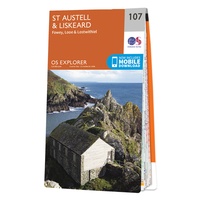 Wandelkaart - Topografische kaart 107 OS Explorer Map St Austell & Liskeard | Ordnance Survey
Met zijn 4cm voor 1 km (2 ½ cm voor 1 mijl) schaal, is de OS Explorer kaartenserie de ideale en meest gedetailleerde kaartenreeks voor mensen die graag outdoor-activiteiten zoals …
★★★★★ Wandelkaart - Topografische kaart OL09 OS Explorer Map Exmoor | Ordnance Survey
Een van de beste detailkaarten die er op de wereld gemaakt worden: zeer gedetailleerd, prachtig helder kleurgebruik, veel topografische aspecten en - zeer belangrijk - allerlei toeristische en recreatieve aspecten …
★★★★★★★★★★
Laatste reviews

Duidelijke kaart, ook met kleinere wegen. Snelle levering
★★★★★ door Ger Sulkers 02 mei 2024 | Heeft dit artikel gekocht
Ja wij zijn tevreden, alleen is mijn vriendin het boekje al kwijtgeraakt bij onze eerste wandeling.🙁
★★★★★ door Mark 02 mei 2024 | Heeft dit artikel gekocht
Ja ik ben dik tevreden over de wegenkaart van Kazachstan. Stond alles op wat ik wou dus heel erg tevreden daarover.
★★★★★ door Sjoerd Westra 02 mei 2024 | Heeft dit artikel gekocht
Zoals altijd mooie verzorgde kaarten die tijdens de reis van pas komen en achteraf mooie herinneringen oproepen.
★★★★★ door Klaas Wijnberg 02 mei 2024 | Heeft dit artikel gekocht