
Wandelkaarten - Pyreneeën
Overzichtskaarten
-
Wandelkaarten IGN 25.000 Midi - Pyreneeën : West
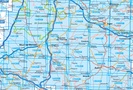
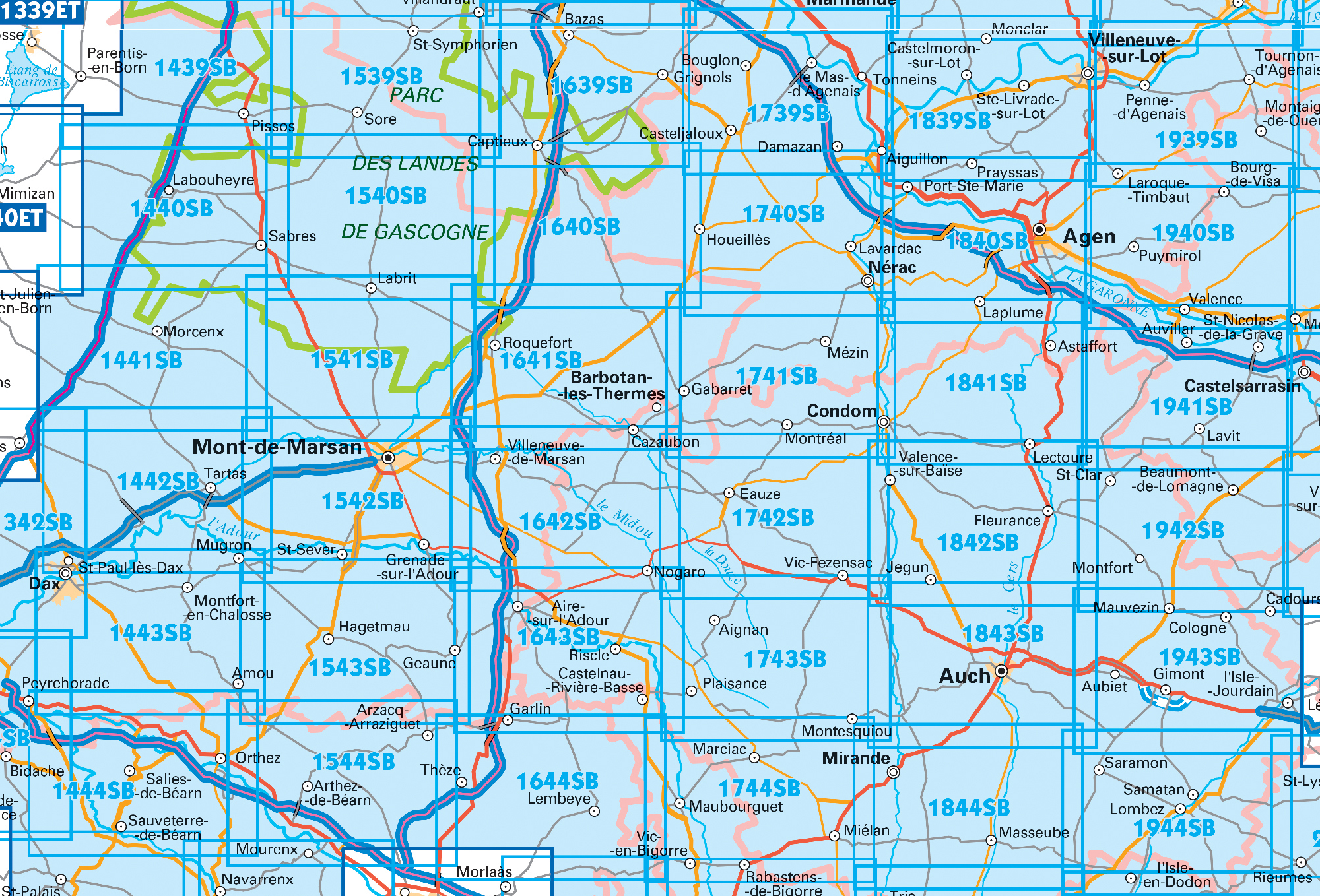
Producten op deze overzichtskaart:
Klik op een product om naar de pagina van dat product te gaan.
- Wandelkaart - Topografische kaart 1443 SB - Serie Bleue Dax | IGN - Institut Géographique National
- Wandelkaart - Topografische kaart 1541 SB - Serie Bleue Ygos-Saint-Saturnin | IGN - Institut Géographique National
- Wandelkaart - Topografische kaart 1542 SB - Serie Bleue Mont-de-Marsan | IGN - Institut Géographique National
- Wandelkaart - Topografische kaart 1543 SB - Serie Bleue Hagetmau | IGN - Institut Géographique National
- Wandelkaart - Topografische kaart 1544 SB - Serie Bleue Arthez-de-Béarn | IGN - Institut Géographique National
- Wandelkaart - Topografische kaart 1641 SB - Serie Bleue Roquefort | IGN - Institut Géographique National
- Wandelkaart - Topografische kaart 1642 SB - Serie Bleue Villeneuve-de-Marsan | IGN - Institut Géographique National
- Wandelkaart - Topografische kaart 1643 SB - Serie Bleue Aire-sur-l'Adour | IGN - Institut Géographique National
- Wandelkaart - Topografische kaart 1644 SB - Serie Bleue Lembeye | IGN - Institut Géographique National
- Topografische kaart - Wandelkaart 1739 SB - Serie Bleue Tonneins - Casteljaloux | IGN - Institut Géographique National
- Wandelkaart - Topografische kaart 1740 SB - Serie Bleue Nérac | IGN - Institut Géographique National
- Wandelkaart - Topografische kaart 1741 SB - Serie Bleue Mézin | IGN - Institut Géographique National
- Wandelkaart - Topografische kaart 1742 SB - Serie Bleue Eauze, Vic-Fezensac | IGN - Institut Géographique National
- Wandelkaart - Topografische kaart 1743 SB - Serie Bleue Plaisance - Montesquiou | IGN - Institut Géographique National
- Wandelkaart - Topografische kaart 1744 SB - Serie Bleue Miélan - Vic en Bigorre | IGN - Institut Géographique National
- Wandelkaart - Topografische kaart 1839 SB - Serie Bleue Villeneuve sur Lot - Castelmoron sur Lot | IGN - Institut Géographique National
- Topografische kaart - Wandelkaart 1840 SB - Serie Bleue Agen | IGN - Institut Géographique National
- Topografische kaart - Wandelkaart 1841 SB - Serie Bleue Condom | IGN - Institut Géographique National
- Wandelkaart - Topografische kaart 1842 SB - Serie Bleue Fleurance | IGN - Institut Géographique National
- Topografische kaart - Wandelkaart 1843 SB - Serie Bleue Auch | IGN - Institut Géographique National
- Wandelkaart - Topografische kaart 1844 SB - Serie Bleue Mirande - Masseube | IGN - Institut Géographique National
- Wandelkaart - Topografische kaart 1939 SB - Serie Bleue Penne-d'Agenais | IGN - Institut Géographique National
- Wandelkaart - Topografische kaart 1941 SB - Serie Bleue Saint-Nicolas-de-la-Grave | IGN - Institut Géographique National
-
Wandelkaarten IGN 25.000 Midi - Pyreneeën : Oost
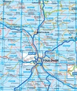
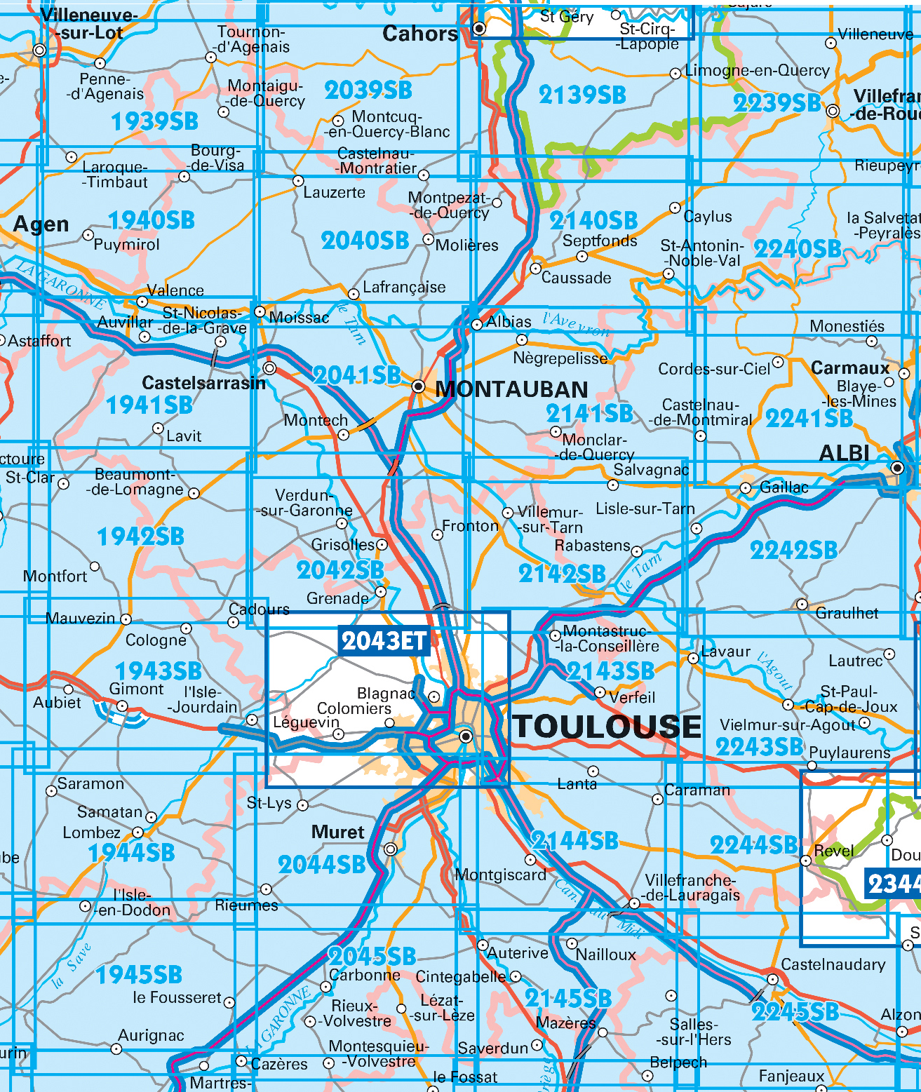
Producten op deze overzichtskaart:
Klik op een product om naar de pagina van dat product te gaan.
- Wandelkaart - Topografische kaart 1940 SB - Serie Bleue Valence | IGN - Institut Géographique National
- Wandelkaart - Topografische kaart 1942 SB - Serie Bleue Beaumont-de-Lomagne | IGN - Institut Géographique National
- Wandelkaart - Topografische kaart 1943 SB - Serie Bleue L'Isle-Jourdain | IGN - Institut Géographique National
- Wandelkaart - Topografische kaart 1944 SB - Serie Bleue Samatan | IGN - Institut Géographique National
- Wandelkaart - Topografische kaart 1945 SB - Serie Bleue Le Fousseret - Aurignac | IGN - Institut Géographique National
- Wandelkaart - Topografische kaart 2039 SB - Serie Bleue Montcuq-en-Quercy-Blanc, Labastide-Marnhac | IGN - Institut Géographique National
- Wandelkaart - Topografische kaart 2040 SB - Serie Bleue Moissac | IGN - Institut Géographique National
- Wandelkaart - Topografische kaart 2041 SB - Serie Bleue Montauban (Tarn-et-Garonne) - Castelsarrasin | IGN - Institut Géographique National
- Wandelkaart - Topografische kaart 2042SB SB - Serie Bleue Grenade | IGN - Institut Géographique National
- Wandelkaart - Topografische kaart 2043ET Toulouse | IGN - Institut Géographique National
- Wandelkaart - Topografische kaart 2044 SB - Serie Bleue Muret, Saint Lys | IGN - Institut Géographique National
- Wandelkaart - Topografische kaart 2045 SB - Serie Bleue Lézat-sur-Lèze, Cazeres | IGN - Institut Géographique National
- Wandelkaart - Topografische kaart 2139 SB - Serie Bleue Cahors | IGN - Institut Géographique National
- Wandelkaart - Topografische kaart 2140 SB - Serie Bleue Caussade | IGN - Institut Géographique National
- Wandelkaart - Topografische kaart 2141 SB - Serie Bleue Nègrepelisse | IGN - Institut Géographique National
- Wandelkaart - Topografische kaart 2142 SB - Serie Bleue Villemur-sur-Tarn | IGN - Institut Géographique National
- Wandelkaart - Topografische kaart 2143 SB - Serie Bleue Montastruc-la-Conseillère, Lavaur | IGN - Institut Géographique National
- Wandelkaart - Topografische kaart 2144 SB - Serie Bleue Ramonville-Saint-Agne | IGN - Institut Géographique National
- Wandelkaart - Topografische kaart 2145 SB - Serie Bleue Auterive - Mazères - Saverdun | IGN - Institut Géographique National
- Wandelkaart - Topografische kaart 2239 SB - Serie Bleue Villefranche-de-Rouergue, Martiel | IGN - Institut Géographique National
- Wandelkaart - Topografische kaart 2240 SB - Serie Bleue Varen, Laguépie, Najac | IGN - Institut Géographique National
- Wandelkaart - Topografische kaart 2241 SB - Serie Bleue Albi, Cordes-sur-Ciel | IGN - Institut Géographique National
- Wandelkaart - Topografische kaart 2242 SB - Serie Bleue Gaillac, Graulhet | IGN - Institut Géographique National
- Wandelkaart - Topografische kaart 2244 SB - Serie Bleue Revel, St-Félix-Lauragais, Sorèze | IGN - Institut Géographique National
- Wandelkaart - Topografische kaart 2245 SB - Serie Bleue Bram - Castelnaudary | IGN - Institut Géographique National
- Wandelkaart - Topografische kaart 2340 SB - Serie Bleue Naucelle, La Salvetat, Peyrales | IGN - Institut Géographique National
- Wandelkaart - Topografische kaart 2341 SB - Serie Bleue Carmaux, Valence-d'Albigeoi | IGN - Institut Géographique National
-
Wandelkaarten IGN 25.000 Pyreneeën : West
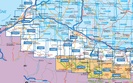

Producten op deze overzichtskaart:
Klik op een product om naar de pagina van dat product te gaan.
- Wandelkaart - Topografische kaart 1245OT Hendaye - St.Jean de Luz - Cote d'Argent | IGN - Institut Géographique National
- Wandelkaart - Topografische kaart 1343E SB - Serie Bleue Saint-Geours-de-Maremne | IGN - Institut Géographique National
- Wandelkaart - Topografische kaart 1344 SB - Serie Bleue Peyrehorade | IGN - Institut Géographique National
- Wandelkaart - Topografische kaart 1344OT Bayonne | IGN - Institut Géographique National
- Wandelkaart - Topografische kaart 1345OT Cambo-les-Bains – Hasparren | IGN - Institut Géographique National
- Topografische kaart - Wandelkaart 1346ET Forêt d'Iraty - Pic d'Orly | IGN - Institut Géographique National
- Topografische kaart - Wandelkaart 1346OT St.-Jean-Pied-de-Port | IGN - Institut Géographique National
- Wandelkaart - Topografische kaart 1444 SB - Serie Bleue Orthez | IGN - Institut Géographique National
- Wandelkaart - Topografische kaart 1445 SB - Serie Bleue Mauléon-Licharre – St-Palais | IGN - Institut Géographique National
- Wandelkaart - Topografische kaart 1446ET Tardets-Sorholus, Arette | IGN - Institut Géographique National
- Wandelkaart - Topografische kaart 1545 SB - Serie Bleue Oloron – Sainte-Marie | IGN - Institut Géographique National
- Wandelkaart - Topografische kaart 1545ET Pau | IGN - Institut Géographique National
- Wandelkaart - Topografische kaart 1546ET Laruns, Gourette | IGN - Institut Géographique National
- Wandelkaart - Topografische kaart 1546OT Oloron-Sainte.Marie, Vallee d'Aspe | IGN - Institut Géographique National
- Wandelkaart - Topografische kaart 1547OT Ossau - Vallée D'Aspe | IGN - Institut Géographique National
- Topografische kaart - Wandelkaart 1645 Pontacq - Ossun - Ger | IGN - Institut Géographique National
- Wandelkaart - Topografische kaart 1647ET Lourdes, Argeles-Gazost, Le Lavedan, Pierrefitte-Nestalas, Aucun | IGN - Institut Géographique National
- Wandelkaart - Topografische kaart 1647OT Vignemale, Ossau, Cauterets, Gourette | IGN - Institut Géographique National
- Wandelkaart - Topografische kaart 1745 SB - Serie Bleue Tarbes | IGN - Institut Géographique National
- Wandelkaart - Topografische kaart 1746 SB - Serie Bleue Bagnères-de-Bigorre | IGN - Institut Géographique National
- Wandelkaart - Topografische kaart 1747ET Bagnères-de-Bigorre | IGN - Institut Géographique National
- Wandelkaart - Topografische kaart 1748ET Neouvielle | IGN - Institut Géographique National
- Wandelkaart - Topografische kaart 1748OT Gavarnie | IGN - Institut Géographique National
- Wandelkaart - Topografische kaart 1845 SB - Serie Bleue Boulogne-sur-Gesse | IGN - Institut Géographique National
- Wandelkaart - Topografische kaart 1846 SB - Serie Bleue Lannemezan | IGN - Institut Géographique National
- Wandelkaart - Topografische kaart 1847OT Saint Bertrand de Comminges, Arreau | IGN - Institut Géographique National
- Wandelkaart - Topografische kaart 1848OT Bagnères de Luchon, | IGN - Institut Géographique National
- Wandelkaart - Topografische kaart 1848OTR Bagnères-de-Luchon | IGN - Institut Géographique National
-
Wandelkaarten IGN 25.000 Pyreneeën : Oost
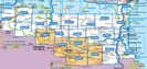
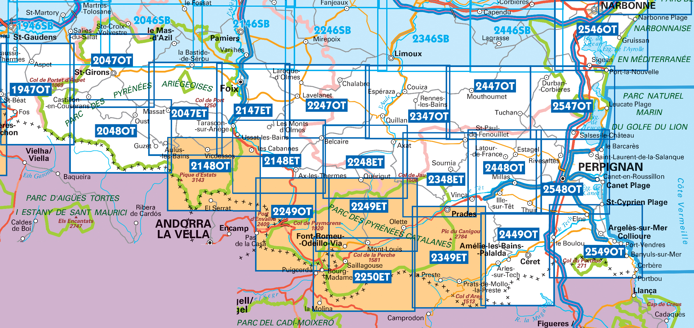
Producten op deze overzichtskaart:
Klik op een product om naar de pagina van dat product te gaan.
- Wandelkaart - Topografische kaart 1946 SB - Serie Bleue St-Gaudens, Salies-du-Salat | IGN - Institut Géographique National
- Wandelkaart - Topografische kaart 1947OT Aspet, Pic de Mauberme | IGN - Institut Géographique National
- Wandelkaart - Topografische kaart 2046 SB - Serie Bleue Le Mas-d'Azil, Ste-Croix-Volvestre | IGN - Institut Géographique National
- Wandelkaart - Topografische kaart 2047ET Massat - Pic des Trois Seigneurs - PNR Pyr. Ariégeoises | IGN - Institut Géographique National
- Wandelkaart - Topografische kaart 2047OT St.-Girons, Castillons-en-Couserans | IGN - Institut Géographique National
- Wandelkaart - Topografische kaart 2048OT Aulus-les-Bains, Mont Valier | IGN - Institut Géographique National
- Wandelkaart - Topografische kaart 2146 SB - Serie Bleue Varilhes - Pamiers | IGN - Institut Géographique National
- Wandelkaart - Topografische kaart 2147ET Foix - Tarascon sur Ariege, Ussat, les Monts-d'Olmes | IGN - Institut Géographique National
- Wandelkaart 2148ET Ax-les-Thermes, Ussat, Les Cabannes, Ax-Bonascre | IGN - Institut Géographique National
- Wandelkaart - Topografische kaart 2148OT Vicdessos, Pic d'Estats et de Montcalm, Pyrenees-Ariegeoises | IGN - Institut Géographique National
- Wandelkaart - Topografische kaart 2246 SB - Serie Bleue Mirepoix | IGN - Institut Géographique National
- Wandelkaart - Topografische kaart 2247OT Lavelanet, Chalabre, Montségur, Laroque-d'Olmes | IGN - Institut Géographique National
- Wandelkaart - Topografische kaart 2248ET Axat, Querigut | IGN - Institut Géographique National
- Wandelkaart - Topografische kaart 2249ET Font Romeu, Capcir, Olette | IGN - Institut Géographique National
- Wandelkaart - Topografische kaart 2249OT Bourg-Madame, Pic Carlit, Col de Puymorens, Port d'Envalira | IGN - Institut Géographique National
- Wandelkaart - Topografische kaart 2250ET Bourg-Madame - Mont-Louis | IGN - Institut Géographique National
- Wandelkaart - Topografische kaart 2347OT Quillan, Alet-les-Bains, Couiza, Rennes-les-Bains, Esperaza | IGN - Institut Géographique National
- Wandelkaart - Topografische kaart 2348ET Prades, Sournia, Vinca, St.Paul-de-Fenouillet | IGN - Institut Géographique National
- Wandelkaart - Topografische kaart 2349ET Massif du Canigou, La Preste, Prats-de-Mollo, Vernet-les-Bains | IGN - Institut Géographique National
- Wandelkaart - Topografische kaart 2447OT Tuchan | IGN - Institut Géographique National
- Wandelkaart - Topografische kaart 2448OT Thuir, Ille-sur-Tet, Latour-de-France, Estagel, Millas | IGN - Institut Géographique National
- Wandelkaart - Topografische kaart 2449OT Céret, Amélie-les-Bains-Palalda, Vallée du Tech | IGN - Institut Géographique National
- Wandelkaart - Topografische kaart 2548OT Perpignan, Plages du Roussillon | IGN - Institut Géographique National
- Wandelkaart - Topografische kaart 2549OT Banyuls-sur-Mer | IGN - Institut Géographique National
 Wandelkaart - Topografische kaart 1545ET Pau | IGN - Institut Géographique National
De wandelkaart die de perfectie benadert! Werkelijk alle topografische details zijn er op te vinden; van hoogtelijnen tot aan bruggetjes en allerlei wandelpaden. Daarnaast hebben de makers een flinke dosis …
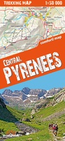 Wandelkaart Trekking map Central Pyrenees - Pyreneeën | TerraQuest
Uitstekende wandelkaart van een deel van de Pyreneën. Alle noodzakelijke gegevens staan er op, de kaart is gebaseerd op topografische kaarten en voorzien van ingetekende wandelroutes. De kaart is geplastificeerd. …
★★★★★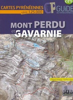 Wandelkaart Mont Perdu - Gavarnie | Sua edizioak
Mooie bijzonder gedetailleerde wandelkaart van een klein deel van de Pyreneeen. De wandelroutes zijn ingetekend, ook zijn met symbolen veel praktische zaken weergegeven als campings, hutten maar ook opvallende aspecten …
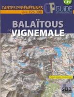 Wandelkaart Balaïtous - Vignemale | Sua edizioak
Mooie bijzonder gedetailleerde wandelkaart van een klein deel van de Pyreneeen. De wandelroutes zijn ingetekend, ook zijn met symbolen veel praktische zaken weergegeven als campings, hutten maar ook opvallende aspecten …
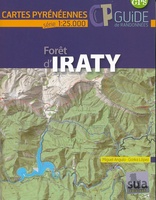 Wandelkaart Foret d'Iraty | Sua edizioak
Mooie bijzonder gedetailleerde wandelkaart van een klein deel van de Pyreneeen. De wandelroutes zijn ingetekend, ook zijn met symbolen veel praktische zaken weergegeven als campings, hutten maar ook opvallende aspecten …
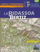 Wandelkaart La Bidassoa - Bertiz | Sua edizioak
Mooie bijzonder gedetailleerde wandelkaart van een klein deel van de Pyreneeen. De wandelroutes zijn ingetekend, ook zijn met symbolen veel praktische zaken weergegeven als campings, hutten maar ook opvallende aspecten …
★★★★★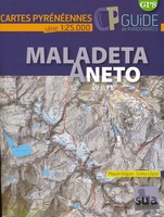 Wandelkaart Maladeta Aneto | Sua edizioak
Mooie bijzonder gedetailleerde wandelkaart van een klein deel van de Pyreneeen. De wandelroutes zijn ingetekend, ook zijn met symbolen veel praktische zaken weergegeven als campings, hutten maar ook opvallende aspecten …
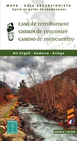 Wandelkaart Cami de Retrobament - Alt Urgell - Andorra - Ariège | Editorial Alpina
Wandelkaart van een lange afstandswandeling in Frankrijk - Spanje: Chemin de Rencontre - Alt Urgell, Andorra, Ariège. Gedetailleerde wandelkaart. Met hoogtelijnen, wandelroutes, campings en berghutten. Deze kaart bestrijkt de langeafstandswandelroute van Auzat …
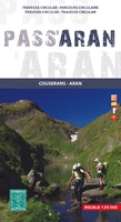 Wandelkaart Pass'Aran - Couserans - Aran | Editorial Alpina
Gedetailleerde wandelkaart van een meerdaagse rondwandeling (ca. 6 dagen) in een bekend berggebied van de Spaanse en Franse Pyreneeen: op goede schaal - 1:25.000 met ingetekende route en veel goede …
★★★★★
Laatste reviews

Mooie landkaart en snel bezorgd
★★★★★ door Rene van Paasen 16 december 2024 | Heeft dit artikel gekocht
Als er één ding is waardoor de Blue Guides bekendheid genieten, dan is het wel de vele aandacht voor cultuur. Zo ook deze. Ik krijg …
★★★★★ door Christine Grit 13 december 2024 | Heeft dit artikel gekocht
De coördinaten op de kaart zijn onbruikbaar. Je kan deze niet gebruiken met een kaarthoekmeter. Er is geen getekende grid voor de coördinaten. Kaart is …
★★★★★ door Robin 13 december 2024 | Heeft dit artikel gekocht
De coördinaten op de kaart zijn onbruikbaar. Je kan deze niet gebruiken met een kaarthoekmeter. Er is geen getekende grid voor de coördinaten. Kaart is …
★★★★★ door Robin 13 december 2024 | Heeft dit artikel gekocht