
Boeken - Lowlands | Schotse Laaglanden en grenzen
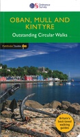 Wandelgids 031 Pathfinder Guides Oban, Mull & Kintyre | Ordnance Survey
Wandelgids van een deel van Schotland. Deze gids bevat 28 dagwandelingen, variërend van korte tochten tot pittige dagtochten. De bijbehorende kaarten zijn uitstekend: men heeft de topografische kaarten van Ordnance …
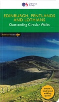 Wandelgids 047 Pathfinder Guides Edinburgh, Pentlands & the Lothians | Ordnance Survey
Wandelgids van een deel van Engeland, Schotland of Wales. Deze gids bevat 28 dagwandelingen, variërend van korte tochten tot pittige dagtochten. De bijbehorende kaarten zijn uitstekend: men heeft de topografische …
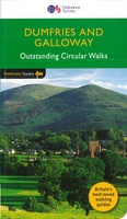 Wandelgids 019 Pathfinder Guides Dumfries & Galloway | Ordnance Survey
Wandelgids van het zuidwestenl van Schotland. Deze gids bevat 28 dagwandelingen, variërend van korte tochten tot pittige dagtochten. De bijbehorende kaarten zijn uitstekend: men heeft de topografische kaarten van Ordnance …
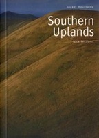 Wandelgids Southern Uplands | Pocket Mountains
Mooi uitgevoerde wandelgids in een handzaam formaat: 15 x 10 cm. De wandelingen zijn duidelijk beschreven, soms een beetje summier. This Pocket Mountains guide to the Southern Uplands of Scotland …
 Wandelgids Walking on Arran | Cicerone
Uitstekende wandelgids voor dit uitdagende wandelgebied in Schotland. Dagtochten. The 45 walking routes in this Isle of Arran guidebook range from easy 3km (2 miles) nature trails to long arduous …
 Wandelgids Ayrshire and Arran Coastal Paths | Cicerone
A guide to walking or backpacking along the Ayrshire and Arran Coastal Paths, which stretch for over 150 miles along the stunning west coast of Scotland, within easy reach of …
 Wandelgids The Arran Coastal Way | Rucksack Readers
The Arran Coastal Way is perhaps Scotland's finest circular long-distance trail, running 65 miles (105 km) around the Isle of Arran in a memorable week-long hike from Brodick. It's accessible …
★★★★★★★★★★ Wandelgids The Southern Upland Way | Cicerone
Uitstekende wandelgids van de Southern Upland Way, waarbij naast alle noodzakelijke informatie ook gebruik gemaakt wordt van de echte topografische kaart. The Southern Upland Way is Scotland's coast-to-coast walk …
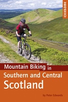 Fietsgids - Mountainbikegids Mountain Biking in Southern and Central Scotland | Cicerone
Degelijke fietsgids met 21 mountainbike routes in zuid en midden Schotland. Goede beschrijvingen en duidelijke kaarten. This guidebook describes 21 mountain biking routes in central and southern Scotland. It …
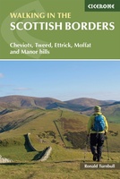 Wandelgids Walking in the Scottish Borders | Cicerone
This guidebook provides 45 day walks in the Scottish Borders. Separated into six sections, these walks are divided between the north and south Cheviots, Tweed, Ettrick, Moffat and Manor hills …
 Wandelgids Walking The End to End Trail | Cicerone
Een droomroute voor velen: helemaal van het zuidelijkste puntje van Engeland naar het noordelijkste puntje van Schotland, zo'n slordige 1956 km door fabelachtig mooie afwisselende landschappen. Zeer gedetailleerd beschreven met …
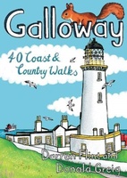 Wandelgids Galloway | Pocket Mountains
Handige compacte wandelgids met 40 dagwandelingen. Deze gids bevat kleine kaartjes en leuke uitgebreide informatie over wat er langs de route te zien is. Goede wandelkaarten zijn echter we noodzakelijk …
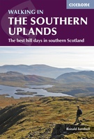 Wandelgids Walking in the Southern Uplands | Cicerone
This guidebook describes 44 routes and over 100 summits stretching across the Southern Uplands of Scotland, stretching south-west from Edinburgh to the English border, including the Galloway and Pentland Hills. …
 Wandelgids Walking Ben Lawers, Rannoch and Atholl | Cicerone
Wandelgids met 80 wandelingen van verschillende niveaus in het gebied van de Perthshire Highlands. The south-eastern Grampians of the former county of Perthshire may be grassier and less rugged than …
 Wandelgids The Tweed | Pocket Mountains
Handige compacte wandelgids met 40 dagwandelingen. Deze gids bevat kleine kaartjes en leuke uitgebreide informatie over wat er langs de route te zien is. Goede wandelkaarten zijn echter we noodzakelijk …
 Wandelgids The Clyde | Pocket Mountains
Handige compacte wandelgids met 40 dagwandelingen. Deze gids bevat kleine kaartjes en leuke uitgebreide informatie over wat er langs de route te zien is. Goede wandelkaarten zijn echter we noodzakelijk …
 Wandelgids The Dumfriesshire Dales | Pocket Mountains
Handige compacte wandelgids met 40 dagwandelingen. Deze gids bevat kleine kaartjes en leuke uitgebreide informatie over wat er langs de route te zien is. Goede wandelkaarten zijn echter we noodzakelijk …
 Wandelgids 1 Walking the Corbetts: Volume 1 | Cicerone
Uitstekende wandelgids, goed beschreven met veel praktische informatie om de route te kunnen lopen, inclusief redelijke kaarten. This guide describes routes up all 112 Corbetts south of the Great Glen. …
 Wandelgids West Lothian | Pocket Mountains
Handige compacte wandelgids met 40 dagwandelingen. Deze gids bevat kleine kaartjes en leuke uitgebreide informatie over wat er langs de route te zien is. Goede wandelkaarten zijn echter we noodzakelijk …
 Reisgids Slow Travel Dumfries and Galloway | Bradt Travel Guides
Reisgids over een specifiek deel van Schotland met veel cultuur en geschiedenis, maar zeker ook praktische tips zoals je van uitgever Bradt mag verwachten. Written by resident experts, this new, …
Laatste reviews

Kan de huidige ontstuimige ontwikkelingen wereldwijd, nu ook geografisch plaatsen en daarmee beter volgen.
★★★★★ door Leo Janssen 20 december 2024 | Heeft dit artikel gekocht
We hadden Piëmonte al eens bezocht en voor onze komende reis werd ons door kennissen deze gids aanbevolen. Inderdaad is dit een heel goede gids. …
★★★★★ door DWKdB 19 december 2024 | Heeft dit artikel gekocht
Mijn bestellingen zijn altijd goed en worden altijd op tijd geleverd. Komen afspraken goed na. Erg tevreden.
★★★★★ door Ben Wegdam 19 december 2024 | Heeft dit artikel gekocht
Zeer gedetailleerde kaart van het zuidelijke deel van het douaniers pad
★★★★★ door Marian 18 december 2024 | Heeft dit artikel gekocht