
Collins
Maak je reis compleet met de handige reisgidsen en wegenkaarten van Collins
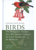 Vogelgids Birds of the Philippines, Sumatra, Java, Bali, Borneo, Sulawesi, the Lesser Sundas and the Moluccas | Collins
This comprehensive new field guide is an excellent addition to the world-renowned series – the ultimate reference book for travelling birdwatchers. Every species of bird you might encounter in …
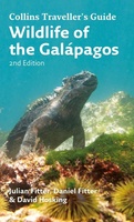 Natuurgids Wildlife of the Galapagos | Collins
Since its first publication more than a decade ago, Wildlife of the Galápagos has become the definitive, classic field guide to the natural splendors of this amazing part of the …
★★★★★ Wegenkaart - landkaart Touring Maps Ireland | Collins
 Atlas The Times Mini Atlas of the World | Collins
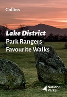 Wandelgids Park Rangers Favourite Walks Lake District | Collins
Walking guide to the Lake District National Park, with 20 best routes chosen by the park rangers. Each walk varies in length from 2 to 10 km and can be …
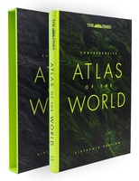 Atlas The Times Comprehensive Atlas of the World | Collins
De moeder aller atlassen in een nieuwe druk. Als je al een atlas wilt kopen, bezuinig dan niet en doe deze: veruit de beste meest complete atlas in een prachtige …
★★★★★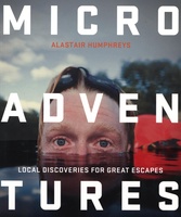 Reisgids Microadventures | Collins
Deze praktische gids staat vol met ideeën voor microadventures - om zelf of met vrienden en familie te beleven - en meer dan 150 verbluffende foto's, plus tips en advies …
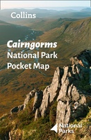 Wegenkaart - landkaart National Park Pocket Map Cairngorms | Collins
Handige kleine kaart van dit Nationaal Park. De kaart geeft een goed en helder overzicht van het gebied met alle plaatsen, doorgaande wandelpaden (alhoewel grof van schaal), bezienswaardigheden etc. Met …
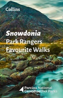 Wandelgids Park Rangers Favourite Walks Snowdonia | Collins
Compacte wandelgids met 20 wandelingen geselecteerd door park rangers en met duidelijke beschrijvingen en routekaartjes. Walking guide to the Snowdonia National Park, with 20 best routes chosen by the …
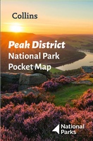 Wegenkaart - landkaart National Park Pocket Map Peak District | Collins
Handige kleine kaart van dit Nationaal Park. De kaart geeft een goed en helder overzicht van het gebied met alle plaatsen, doorgaande wandelpaden (alhoewel grof van schaal), bezienswaardigheden etc. Met …
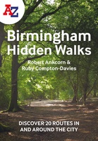 Wandelgids Birmingham | Collins
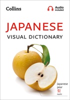 Woordenboek Visual Dictionary Japanese - Japans taalgids | Collins
Super handig! Een taalgids waarbij naast de gewone vertaling en een fonetische poging daartoe ook een plaatje staat weergegeven. Ideaal voor een moeizame conversatie in een taal die je echt …
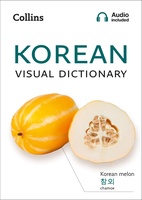 Woordenboek Visual Dictionary Korean - Koreaans taalgids | Collins
Super handig! Een taalgids waarbij naast de gewone vertaling en een fonetische poging daartoe ook een plaatje staat weergegeven. Ideaal voor een moeizame conversatie in een taal die je echt …
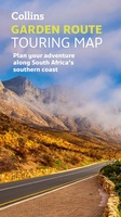 Wegenkaart - landkaart Touring Maps Garden Route | Collins
Full color, informative map of South Africa’s popular Garden Route. With detailed mapping and tourist information, this map is a perfect guide to traveling along the southern coast of South …
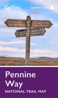 Wandelkaart National Trail Map Pennine Way | Collins
Overzichtskaart op vrij grove schaal van deze LAW Lange Afstands Wandeling in Engeland. Let op: je kunt er niet op lopen. Wel met veel informatie op de kaart, goed ingetekend, …
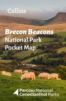 Wegenkaart - landkaart National Park Pocket Map Brecon Beacons | Collins
Handige kleine kaart van dit Nationaal Park. De kaart geeft een goed en helder overzicht van het gebied met alle plaatsen, doorgaande wandelpaden (alhoewel grof van schaal), bezienswaardigheden etc. Met …
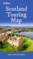 Wegenkaart - landkaart Touring Map of Scotland - Schotland | Collins
Best-selling map of Scotland. More than 1,000 places of tourist interest plotted and named on the map. The features have been plotted onto an up-to-date and attractive Collins map of …
★★★★★★★★★★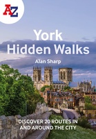 Wandelgids York | Collins
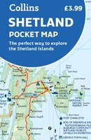 Wegenkaart - landkaart Pocket Map Shetland | Collins
Handy little full colour map of Shetland. Main features of this map include: • Clear mapping • Main tourist attractions located and described • Ideal for touring with sights, …
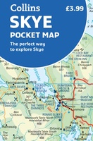 Wegenkaart - landkaart Pocket Map Skye | Collins
Handy little full colour Collins map of Skye with a high level of detail. Clear mapping of the Isle of Skye showing the road network, ferries and places of interest. …
★★★★★
- 1
- 2
- 3
- Volgende >>
- 6
Laatste reviews

De kaart van Kirgystan is prachtig, zeer gedetailleerd. Kan niet wachten tot de we echt op reis hmgaan die kant op.
★★★★★ door Marijke Eering 21 november 2024 | Heeft dit artikel gekocht
Super handig fiets boekje en mooi water bestendig. En handig om op de kaarten te kijken heel duidelijk beschrijving. Wij fietsen al jaren in Duitsland …
★★★★★ door Jenneke holterman 19 november 2024 | Heeft dit artikel gekocht
prima kaart levering en betaling allemaal vlot verlopen
★★★★★ door Marc Buts 19 november 2024 | Heeft dit artikel gekocht
Ik heb een uitklapbare kaart van Londen gekocht voor toeristische doeleinden. Snel geleverd en een product die volledig voldoet aan de behoeften. Chapeau!
★★★★★ door Cees Lindenberg 18 november 2024 | Heeft dit artikel gekocht