
Collins
Maak je reis compleet met de handige reisgidsen en wegenkaarten van Collins
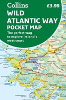 Wegenkaart - landkaart Pocket Map Wild Atlantic Way | Collins
Handy full-colour map of Ireland’s Wild Atlantic Way with a high level of detail. Clear mapping of the full 2500 km (over 1500 miles) route, showing the road network and …
★★★★★★★★★★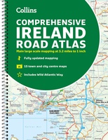 Wegenatlas Ireland Comprehensive Road Atlas - Ierland | Collins
Duidelijke en gedetailleerde atlas voor Ierland in A4-formaat met ringband. Clear, detailed road atlas of Ireland in a handy A4 spiral-bound format. This comprehensive, general purpose road atlas of …
★★★★★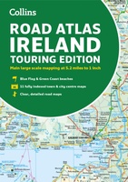 Wegenatlas Road Atlas Ireland | Collins
Explore Ireland with this accurate and fully updated road atlas. This road atlas is at A4 size, covering the whole of Ireland and features clear and detailed Collins colour mapping …
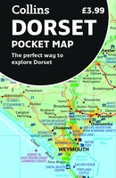 Wegenkaart - landkaart Pocket Map Dorset pocket map (r) | Collins
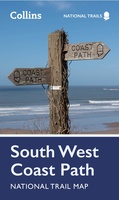 Wandelkaart National Trail Map South West Coast Path | Collins
Overzichtskaart op vrij grove schaal van deze LAW Lange Afstands Wandeling in Engeland. Let op: je kunt er niet op lopen. Wel met veel informatie op de kaart, goed ingetekend, …
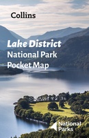 Wegenkaart - landkaart National Park Pocket Map Lake District | Collins
Handige kleine kaart van dit Nationaal Park. De kaart geeft een goed en helder overzicht van het gebied met alle plaatsen, doorgaande wandelpaden (alhoewel grof van schaal), bezienswaardigheden etc. Met …
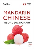 Woordenboek Visual Dictionary Mandarin Chinese - Mandarijn Chinees taalgids | Collins
Super handig! Een taalgids waarbij naast de gewone vertaling en een fonetische poging daartoe ook een plaatje staat weergegeven. Ideaal voor een moeizame conversatie in een taal die je echt …
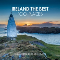 Reisgids Ireland The Best 100 Places | Collins
Sally and John McKenna, travel and food writers and authors of IRELAND THE BEST, have selected 100 extraordinary places that epitomise what is truly great about Ireland. This personal and …
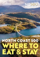 Reisgids - Accommodatiegids North Coast 500 | Collins
A guide to the best places to enjoy the local Scottish cuisine and where to rest for the night along the famous North Coast 500. Elemental, enchanting and inspiring, the …
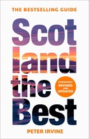 Reisgids Scotland the Best | Collins
The true Scot's insider's guide to the very best Scotland has to offer. Fully revised and updated in Peter Irvine’s own unique style, the 14th edition includes more than 2,000 …
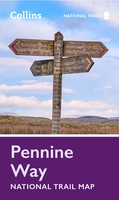 Wandelkaart National Trail Map Pennine Way | Collins
Overzichtskaart op vrij grove schaal van deze LAW Lange Afstands Wandeling in Engeland. Let op: je kunt er niet op lopen. Wel met veel informatie op de kaart, goed ingetekend, …
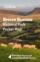 Wegenkaart - landkaart National Park Pocket Map Brecon Beacons | Collins
Handige kleine kaart van dit Nationaal Park. De kaart geeft een goed en helder overzicht van het gebied met alle plaatsen, doorgaande wandelpaden (alhoewel grof van schaal), bezienswaardigheden etc. Met …
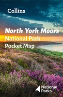 Wegenkaart - landkaart National Park Pocket Map North York Moors | Collins
Handige kleine kaart van dit Nationaal Park. De kaart geeft een goed en helder overzicht van het gebied met alle plaatsen, doorgaande wandelpaden (alhoewel grof van schaal), bezienswaardigheden etc. Met …
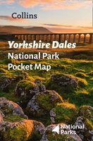 Wegenkaart - landkaart National Park Pocket Map Yorkshire Dales | Collins
Handige kleine kaart van dit Nationaal Park. De kaart geeft een goed en helder overzicht van het gebied met alle plaatsen, doorgaande wandelpaden (alhoewel grof van schaal), bezienswaardigheden etc. Met …
★★★★★ Wandelgids Bristol & Bath Hidden Walks | Collins
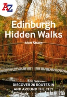 Wandelgids Edinburgh Hidden Walks | Collins
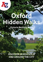 Wandelgids Oxford | Collins
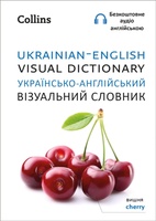 Woordenboek Visual Dictionary Ukrainian - English, Ukrains taalgids | Collins
A photographic guide to 3000 key words and phrases in Ukrainian with English translations. Фотографічний довідник близько 3000 опорних слів і фраз. This attractive pocket-sized book is a perfect English …
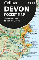 Wegenkaart - landkaart Pocket Map Devon | Collins
Handy little full colour map of Devon. Main features of this map include: • Clear mapping • Main tourist attractions located and described • Ideal for touring with sights, …
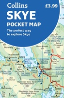 Wegenkaart - landkaart Pocket Map Skye | Collins
Handy little full colour Collins map of Skye with a high level of detail. Clear mapping of the Isle of Skye showing the road network, ferries and places of interest. …
★★★★★
Laatste reviews

Super handig fiets boekje en mooi water bestendig. En handig om op de kaarten te kijken heel duidelijk beschrijving. Wij fietsen al jaren in Duitsland …
★★★★★ door Jenneke holterman 19 november 2024 | Heeft dit artikel gekocht
prima kaart levering en betaling allemaal vlot verlopen
★★★★★ door Marc Buts 19 november 2024 | Heeft dit artikel gekocht
Ik heb een uitklapbare kaart van Londen gekocht voor toeristische doeleinden. Snel geleverd en een product die volledig voldoet aan de behoeften. Chapeau!
★★★★★ door Cees Lindenberg 18 november 2024 | Heeft dit artikel gekocht
Mooi stevig, klein koffertje. Ik had eerst de 'middenmaat' besteld maar die was helaas niet meer leverbaar. Snelle en goede communicatie hierover. Het kleinste formaat …
★★★★★ door Marieke 17 november 2024 | Heeft dit artikel gekocht