
Engeland
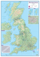 Wandkaart Engeland - British Isles roadplanning wall map, 84 X 119 cm | Maps International
Routeplanner map from Maps International's selection of British Isles maps. Routeplanning map details: British Isles routeplanning map shows the motorways, major roads and transport hubs such as airports and …
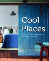 Accommodatiegids Cool Places | Punk Publishing
A lavish full-colour guide to the very best places to stay in the UK: everything from boutique hotels and designer B&Bs to chic country cottages and luxury glampsites. Inspired by …
 Wegenkaart - landkaart Südengland & Wales – Zuid-Engeland & Wales | Reise Know-How Verlag
Tweetalige kaart (Engels en Duits). Door ingetekende lengte- en breedtegraden is het gebruik van GPS mogelijk. Met hoogtelijnen en uitgebreid wegennetwerk: daarnaast worden ook de afstanden tussen belangrijke plaatsen duidelijk …
★★★★★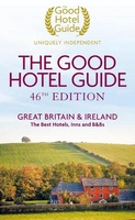 Accommodatiegids - Bed and Breakfast Gids The Good Hotel Guide Great Britain & Ireland | Good hotel guide
The Good Hotel Guide is the leading independent guide to hotels in Great Britain and Ireland. It is written for the reader seeking impartial advice on finding a good place …
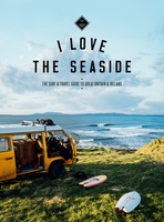 Reisgids I love the seaside Great Britain - Ireland, Groot Brittannie en Ierland | Mo'Media | Momedia
The I Love the Seaside Surf & Travel Guide to Great Britain & Ireland is a 464-page printed book (English language) exploring the (surf) coast of Britain and Ireland. From …
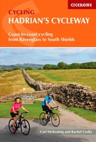 Fietsgids Hadrian's Cycleway | Cicerone
Hadrian's Cycleway is a 174 mile route from Ravenglass in Cumbria to South Shields. Also known as Route 72, this coast-to-coast route heads north up the Cumbrian coast to reach …
★★★★★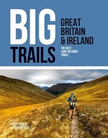 Wandelgids Great Britain & Ireland | Vertebrate Publishing
Big Trails: Great Britain & Ireland is an inspirational guide to the most iconic, spectacular and popular long-distance trails in England, Scotland, Wales, Northern Ireland, Ireland and the Isle of …
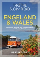 Campergids Take the Slow Road Engeland en Wales | Spectrum
Snel rijden? Echt niet! Met je voet op het gaspedaal door het landschap racen is niet meer van deze tijd. Vergeet het gehaaste leven, rustig rondtrekken is de nieuwe manier …
★★★★★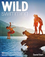 Reisgids Wild Swimming Britain | Wild Things Publishing
The all-new bumper second edition of the best-selling Wild Swimming photo guide is now fully revised and expanded to include 150 NEW amazing wild swimming locations (almost 400 in total), …
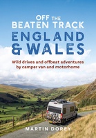 Campergids Off the Beaten Track: England and Wales | Bloomsbury
England and Wales might feel familiar to many, but there are countless hidden idylls and remote wildernesses to discover amongst the soaring passes, spectacular coastlines and boundless moorlands. For many, …
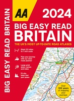 Wegenatlas Big Easy Read Britain 2024 | A3 | Ringband | AA Publishing
AA Publishing brings you the UK’s most up-to-date road atlases Over 100 years of mapping your journeys • Giant scale mapping at 2.5 miles to 1 inch = 1:25,000 • …
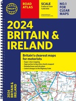 Wegenatlas Road Atlas Britain and Ireland 2024 | Philip's Maps
Let op! Ierland en een gedeelte van Schotland hebben een andere schaal dan de rest van de atlas. PHILIP'S - Market leaders and No. 1 in the UK for …
★★★★★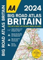 Wegenatlas Big Road Atlas Britain 2025 - A3 | Ringband | AA Publishing
This best-selling A3 format atlas is available in two binding styles; paperback and spiral bound. Up-to-date mapping from the experts at the AA this atlas has large 3 miles to …
★★★★★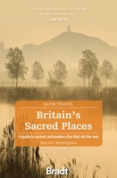 Reisgids Slow Travel Britain's Sacred Places | Bradt Travel Guides
Een bijzondere serie van Bradt guides, waarin een gedeelte van Engeland uitgebreid beschreven wordt. Met veelv aandacht voor kleine details die je niet ao gauw elders zult vinden. Naast de …
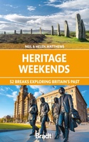 Reisgids Heritage Weekends | Bradt Travel Guides
History and heritage are among Britain’s greatest passions. Travel writers and historians Helen and Neil Matthews have selected 52 places that are wonderful examples of natural, architectural, industrial or cultural …
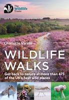 Wandelgids Wildlife Walks | Bloomsbury
The definitive guide to Britain's stunning wildlife heritage, showcasing more than 475 walks through the Wildlife Trust's forest, heaths, moors and woods. Published in conjunction with the Wildlife Trusts, …
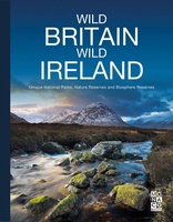 Fotoboek Wild Britain - Wild Ireland | Monaco Books
* Atmospheric mountain photography and panoramic fold-out pages* Special features on flora and fauna* Information and web addresses on protected areas and regions Britain and Ireland have so much to …
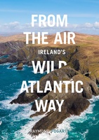 Fotoboek From the Air - Ireland's Wild Atlantic Way | O'Brien Press
The Wild Atlantic Way covers 2500km, passing through an incredible variety of landscapes - from the verdant forests of Cork to the lunar landscape of the Burren, from rugged headlands …
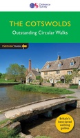 Wandelgids 006 Pathfinder Guides Cotswolds | Ordnance Survey
180 miles of wonderful walking in idyllic, limestone countryside . . . Take a journey on 28 beautiful walks across the Cotswolds with the OS Pathfinder Guidebooks, graded by …
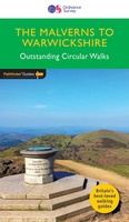 Wandelgids 074 Pathfinder Guides The Malverns to Warwickshire | Ordnance Survey
Discover 28 beautiful walks across The Malverns to Warwickshire with the OS Pathfinder Guidebooks, graded by length and ranging from 3 to 9 miles - ideal for both holidaymakers and …
Laatste reviews

Aan twee kanten bedrukt met hetzelfde gebied, de ene kant gaf wandelingen weer, de andere kant mountainbikeroutes. Ruim een week vóór de wandelvakantie gekocht, een …
★★★★★ door elly stolwijk 04 december 2024 | Heeft dit artikel gekocht
Deze kaarten gebruik ik om mooie wandelingen uit te zetten, die ik dan met mijn liefste meisje beloop. Dank u wel voor de snelle adequate …
★★★★★ door Jacques Marks 03 december 2024 | Heeft dit artikel gekocht
Ook ik ben een zwerver, maar gelukkig niet dakloos. Deze kaarten gebruik ik om mooie wandelingen uit te zetten, die ik dan met mijn liefste …
★★★★★ door Jacques Marks 03 december 2024 | Heeft dit artikel gekocht
Perfect👍
★★★★★ door Wilma & Mari 03 december 2024 | Heeft dit artikel gekocht